Hiking Project
Description: The Hiking Project is a free mobile app and website that provides information on hiking trails across the United States. It includes trail maps, difficulty ratings, photos, reviews, and other details for over 100,000 trails.
Type: software
Pricing: Free
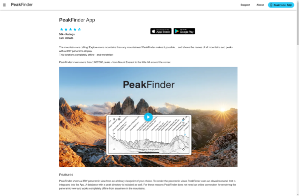
PeakFinder AR
Description: PeakFinder AR is an augmented reality mobile app that allows users to identify mountain peaks by simply pointing their phone camera. It overlays the names and heights of peaks on the camera view.
Type: software