VesselFinder
VesselFinder: Real-Time Marine Vessel Tracking
Discover the location of marine vessels in real-time using AIS data, interactive maps and tools for tracking ships, port calls and destinations.
What is VesselFinder?
VesselFinder is an online ship tracking service that uses real-time Automatic Identification System (AIS) data to provide information on the location and movements of ships and boats around the world. The service was launched in 2009 and has become one of the largest providers of ship tracking and maritime intelligence online.
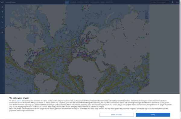
VesselFinder provides interactive maps that show live and historical positional information for thousands of vessels across the globe. Users can zoom in and out of the maps to view ship traffic in different ports and waterways. Clicking on an individual ship icon reveals details like the vessel name, MMSI number, position, course, speed, destination, dimensions, tonnage, and photos.
Key features of VesselFinder include:
- Global vessel tracking maps updated every few minutes
- Database with information and photos for over 200,000 ships
- Port and vessel databases detailing port characteristics, berths, arrivals/departures
- Search tools to lookup ships by name, IMO number, MMSI number, call sign and flag state
- Alarms and notifications for user-defined areas and ports
- Mobile apps for iOS, Android and Windows Phone
- API access for commercial users to integrate ship tracking data
VesselFinder provides both free access for casual users as well as premium accounts with additional features targeted at commercial maritime professionals. The service can be useful for tracking individual ships, studying shipping patterns and traffic, researching ports, and gathering intelligence on ship movements globally.
VesselFinder Features
Features
- Interactive map showing real-time locations of vessels
- Ability to track and get details on individual ships
- View port calls, destinations and routes for vessels
- Filter vessels by type, flag, speed and other attributes
- Receive alerts for vessels arriving or departing specific ports
- View AIS data transmitted directly from ships
- Access historical vessel positions and port calls
- Mobile app available for iOS and Android
Pricing
- Freemium
Pros
Cons
Official Links
Reviews & Ratings
Login to ReviewThe Best VesselFinder Alternatives
View all VesselFinder alternatives with detailed comparison →
Top Travel & Location and Marine Tracking and other similar apps like VesselFinder
Here are some alternatives to VesselFinder:
Suggest an alternative ❐MarineTraffic

My Ship Tracking
Lloyd’s List Intelligence: Seasearcher