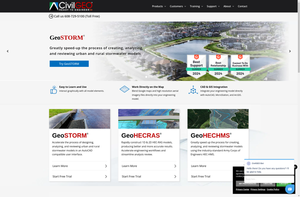
MIKE Flood vs GeoHECRAS

Professional comparison and analysis to help you choose the right software solution for your needs. Compare features, pricing, pros & cons, and make an informed decision.

MIKE Flood icon
MIKE Flood
GeoHECRAS icon
GeoHECRAS

Expert Analysis & Comparison

Struggling to choose between MIKE Flood and GeoHECRAS? Both products offer unique advantages, making it a tough decision.

MIKE Flood is a Science & Engineering solution with tags like flood-modeling, river-flooding, coastal-flooding, urban-flooding, leveedam-breach, mesh-technology.

It boasts features such as 1D and 2D flood modeling, River, coastal, urban and dam break flooding, Flexible mesh technology, Flood mapping, Flood forecasting, Risk assessment and pros including Comprehensive flooding capabilities, Flexible mesh allows complex modeling, Integrates with other DHI products.

On the other hand, GeoHECRAS is a Science & Engineering product tagged with gis, hydrology, hydraulics, modeling, river-systems.

Its standout features include Integrates HEC-RAS hydraulic modeling with ArcGIS, Allows viewing and editing of HEC-RAS geometric data, Performs steady and unsteady flow simulations, Visualizes simulation results on floodplain maps, Analyzes flood risks and damage assessments, Models levee overtopping and breaching, Optimizes flood control structures, and it shines with pros like Seamless integration of GIS and hydraulic modeling, Powerful spatial analysis capabilities, Advanced 2D modeling features, Automates repetitive tasks, Saves time compared to manual Workflows, Improves accuracy of floodplain mapping.

To help you make an informed decision, we've compiled a comprehensive comparison of these two products, delving into their features, pros, cons, pricing, and more. Get ready to explore the nuances that set them apart and determine which one is the perfect fit for your requirements.

Why Compare MIKE Flood and GeoHECRAS?

When evaluating MIKE Flood versus GeoHECRAS, both solutions serve different needs within the science & engineering ecosystem. This comparison helps determine which solution aligns with your specific requirements and technical approach.

Market Position & Industry Recognition

MIKE Flood and GeoHECRAS have established themselves in the science & engineering market. Key areas include flood-modeling, river-flooding, coastal-flooding.

Technical Architecture & Implementation

The architectural differences between MIKE Flood and GeoHECRAS significantly impact implementation and maintenance approaches. Related technologies include flood-modeling, river-flooding, coastal-flooding, urban-flooding.

Integration & Ecosystem

Both solutions integrate with various tools and platforms. Common integration points include flood-modeling, river-flooding and gis, hydrology.

Decision Framework

Consider your technical requirements, team expertise, and integration needs when choosing between MIKE Flood and GeoHECRAS. You might also explore flood-modeling, river-flooding, coastal-flooding for alternative approaches.

Feature MIKE Flood GeoHECRAS
Overall Score N/A N/A
Primary Category Science & Engineering Science & Engineering
Target Users Developers, QA Engineers QA Teams, Non-technical Users
Deployment Self-hosted, Cloud Cloud-based, SaaS
Learning Curve Moderate to Steep Easy to Moderate

Product Overview

MIKE Flood
MIKE Flood

Description: MIKE Flood is a software for comprehensive 1D and 2D flood modeling and mapping. It can model river flooding, coastal flooding, urban flooding, and levee/dam breach flooding using flexible mesh technology.

Type: Open Source Test Automation Framework

Founded: 2011

Primary Use: Mobile app testing automation

Supported Platforms: iOS, Android, Windows

GeoHECRAS
GeoHECRAS

Description: GeoHECRAS is a geographic information system (GIS) integrated with HEC-RAS hydraulic modeling software. It allows users to display, manage, analyze and visualize spatial data related to river systems and run hydraulic simulations.

Type: Cloud-based Test Automation Platform

Founded: 2015

Primary Use: Web, mobile, and API testing

Supported Platforms: Web, iOS, Android, API

Key Features Comparison

MIKE Flood
MIKE Flood Features
  • 1D and 2D flood modeling
  • River, coastal, urban and dam break flooding
  • Flexible mesh technology
  • Flood mapping
  • Flood forecasting
  • Risk assessment
GeoHECRAS
GeoHECRAS Features
  • Integrates HEC-RAS hydraulic modeling with ArcGIS
  • Allows viewing and editing of HEC-RAS geometric data
  • Performs steady and unsteady flow simulations
  • Visualizes simulation results on floodplain maps
  • Analyzes flood risks and damage assessments
  • Models levee overtopping and breaching
  • Optimizes flood control structures

Pros & Cons Analysis

MIKE Flood
MIKE Flood
Pros
  • Comprehensive flooding capabilities
  • Flexible mesh allows complex modeling
  • Integrates with other DHI products
Cons
  • Steep learning curve
  • Requires extensive data for setup
  • Can be computationally intensive
GeoHECRAS
GeoHECRAS
Pros
  • Seamless integration of GIS and hydraulic modeling
  • Powerful spatial analysis capabilities
  • Advanced 2D modeling features
  • Automates repetitive tasks
  • Saves time compared to manual Workflows
  • Improves accuracy of floodplain mapping
Cons
  • Steep learning curve
  • Requires expertise in both GIS and hydraulic modeling
  • Relatively expensive for smaller organizations
  • Limited to HEC-RAS engine, not compatible with other software
  • Requires maintenance of two separate software systems

Pricing Comparison

MIKE Flood
MIKE Flood
  • Subscription-Based
GeoHECRAS
GeoHECRAS
  • One-time Purchase
  • Subscription-Based

Get More Information

Ready to Make Your Decision?

Explore more software comparisons and find the perfect solution for your needs