OsmAnd
Description: OsmAnd is an open-source mobile map and navigation app for Android and iOS devices. It uses OpenStreetMap data and allows offline access to maps. Key features include turn-by-turn voice guided navigation, public transport routing, cycling and walking routing, Wikipedia integration, and more.
Type: software
Pricing: Open Source
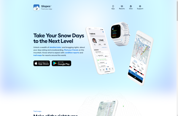
Slopes
Description: Slopes is a popular ski and snowboard tracking app for iPhone and Apple Watch. It uses GPS to record details like distance, vertical drop, speed, and more for each run. Slopes has vibrant graphics and allows users to view run history, track stats over time, set race laps, and share their activity.
Type: software