OsmAnd is an open-source mobile map and navigation app for Android and iOS devices. It uses OpenStreetMap data and allows offline access to maps. Key features include turn-by-turn voice guided navigation, public transport routing, cycling and walking routing, Wikipedia integratio
Open-source map and navigation app for Android and iOS, using OpenStreetMap data, offline access, and turn-by-turn voice guided navigation
What is OsmAnd?
OsmAnd (OpenStreetMap Automated Navigation Directions) is a free and open-source mobile map and navigation application developed for Android and iOS devices. It relies entirely on detailed, community-driven maps from the OpenStreetMap project and allows accessing them offline without an internet connection.
Some of the key features and capabilities of OsmAnd include:
Turn-by-turn voice guided car, bike and pedestrian navigation with rich POI data
Public transport routing and navigation for buses, trains, trams etc
Support for online and offline OpenStreetMap vector maps
Wikipedia integration to provide information on points of interest
Contours, hill-shading and slope maps for terrain orientation
Tracking capability with saving tracks as GPX files
Highly customizable map display with multiple map styles and themes
Support for multiple map sources like Mapillary and other XYZ/TMS based tile sources
POI search with filtering by amenity type
In-app purchases for additional pro features like nautical charts
With its extensive feature set focused on navigation and rich mapping capabilities, OsmAnd makes for a handy open-source alternative to commercial solutions from Google, Apple and TomTom.
Google Maps is a web mapping platform and consumer application offered by Google. It offers satellite imagery, aerial photography, street maps, 360° interactive panoramic views of streets, real-time traffic conditions, and route planning for traveling by foot, car, bicycle and air, or public transportation.Key features of Google Maps include:Interactive street...
Waze is a crowd-sourced GPS navigation and traffic app launched in 2008. It provides turn-by-turn navigation along with real-time traffic updates, road hazard reports, and user-submitted edits of roads and addresses.Key features of Waze include:Real-time traffic updates - Users can report accidents, traffic jams, police traps, etc. to alert other...
What Is MAPS.ME?MAPS.ME is a mobile maps and navigation app that provides detailed offline maps for over 200 countries. Originally open source, it was one of the first apps to make OpenStreetMap data accessible on mobile with a polished interface.Key FeaturesUsers download maps by country or region for fully offline...
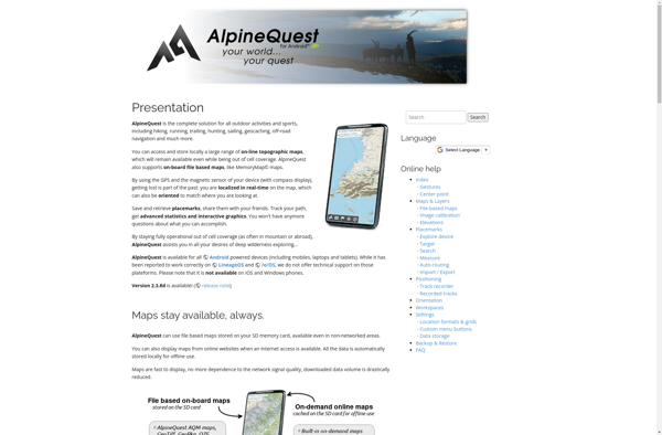
AlpineQuest is a feature-rich mobile app designed specifically for outdoor enthusiasts who enjoy activities like hiking, trail running, mountain biking, and backcountry skiing. It combines detailed topographic maps with GPS tracking and routing capabilities to help users safely plan and navigate routes in mountainous areas.Key features of AlpineQuest include:Detailed topographic...
OpenStreetMap (OSM) is a collaborative project to create a free and editable map of the world. Unlike proprietary map data from companies like Google or Apple, OSM map data is open and licensed under the Open Database License (ODbL), which allows anyone to use, modify, and distribute the data freely.The...
OruxMaps is a feature-rich Android app designed specifically for outdoor activities like hiking, mountain biking, road cycling, trail running, geocaching, and more. Some key features include:Offline maps - Download detailed topographic, outdoor, cycling, and hiking maps for offline use.Route planning - Plan routes and courses on the map, including waypoints...
HERE WeGo is a free map and navigation app developed by HERE Technologies for iOS and Android devices. It allows users to navigate by car, public transportation, foot or bike using turn-by-turn voice guided directions. Key features of HERE WeGo include:Offline maps - Download maps to your device so you...
Moovit is a popular free app that helps users navigate public transport systems in cities around the world. It provides real-time transit information, schedules, route planning, and step-by-step directions all in one place.Some key features of Moovit include:Real-time arrival info for buses, trains, subways, and other transit options in over...
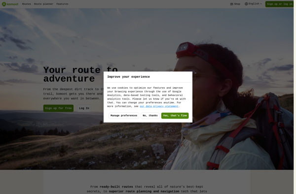
Komoot is a popular route planning and navigation app designed specifically for outdoor activities like cycling, hiking, and mountain biking. Its key features include:Detailed topographic maps with terrain info, trail conditions, and points of interestTurn-by-turn voice navigation that works offlinePlanning routes by choosing destinations or dragging routesElevation profiles and gradients...
Modest Maps is an open source JavaScript mapping library designed for easily embedding interactive maps into web pages. Some key features of Modest Maps include:Lightweight and customizable - Only about 6KB when minified and gzippedSupports various map tile sources including OpenStreetMap, MapQuest, and CloudMadeProvides API for basic interactions like panning,...
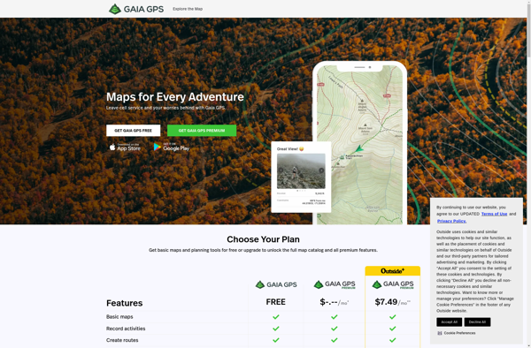
Gaia GPS is a popular mobile app designed specifically for backcountry exploration and offline navigation. It provides detailed topographic maps, aerial imagery, navigation tools, and information on public lands across the world to help users plan trips and navigate in remote areas.Key features of Gaia GPS include:Downloadable offline maps -...
What Is Organic Maps?Organic Maps is a free, open-source maps and navigation app for Android and iOS. It uses OpenStreetMap data and works entirely offline — no internet connection needed for navigation, search, or route planning.Key FeaturesThe app provides turn-by-turn navigation for driving, cycling, and walking with voice guidance. Maps...
Google Maps Navigation is a free GPS navigation app developed by Google for Android and iOS devices. It utilizes Google Maps and crowd-sourced traffic data to provide turn-by-turn voice guided navigation and real-time traffic updates.Key features include:Turn-by-turn voice guided navigation with automatic reroutingReal-time traffic updates using crowdsourced dataLane guidance and...
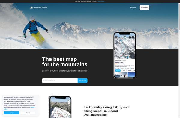
FATMAP is an outdoor navigation app and website designed specifically for adventure sports enthusiasts like hikers, trail runners, mountain bikers, and backcountry skiers. It provides interactive 3D mapping with detailed topographic data to help users safely plan and navigate routes in mountainous and backcountry areas.Key features of FATMAP include:Accurate, hike-specific...
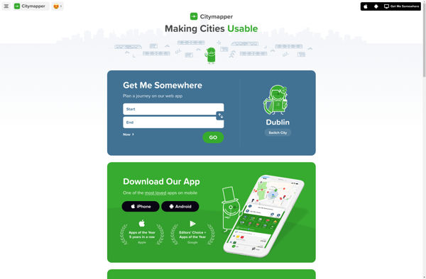
Citymapper is a mobile app and website that provides public transit information and directions for major cities around the world. First launched in 2011 for London's complex transit system, Citymapper has since expanded to over 80 cities globally.The app shows users comprehensive transit options combining subway, bus, rail, ferry, bike...
Arcane Maps is a feature-rich yet easy-to-use fantasy map creation tool designed specifically for tabletop roleplaying games like Dungeons & Dragons. With an intuitive interface, users can quickly sketch out custom maps with a variety of terrains, landmarks, borders, text labels, and other cartography elements.The software provides numerous brush styles...
Apple Maps is a web mapping service developed by Apple Inc. It was introduced in 2012 with iOS 6 as a replacement for Google Maps on Apple devices. Apple Maps offers turn-by-turn navigation, interactive panoramic street views, Flyover mode for photorealistic 3D views of certain cities, support for transit routing...
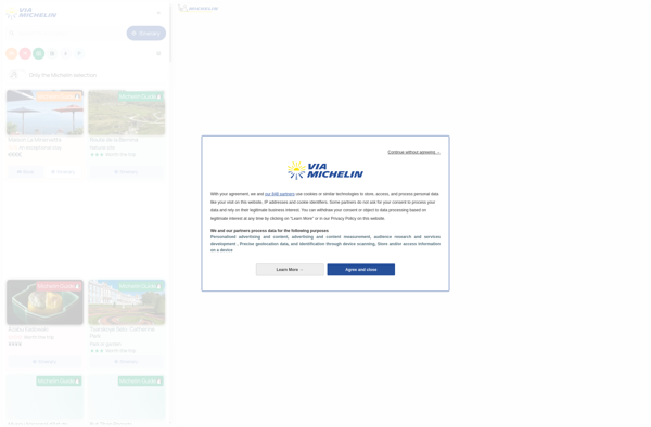
ViaMichelin is a popular travel website and mobile app focused on providing information and services for driving in Europe. It was launched in 2001 by Michelin, the French tire company.Some key features of ViaMichelin include:Interactive maps of European countries with the option to plan routes and get turn-by-turn GPS navigation.Tourist...
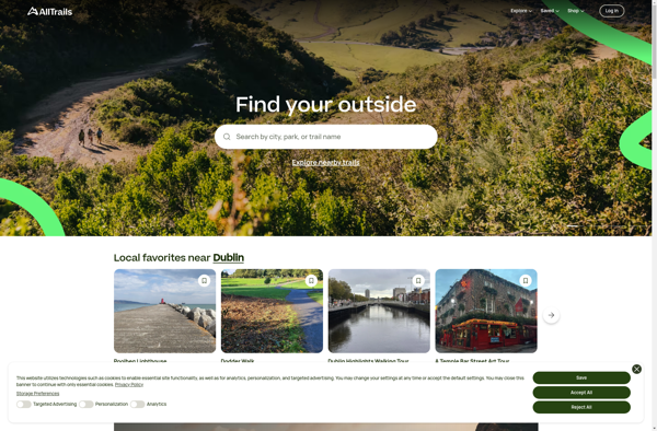
AllTrails is a digital guide to the outdoors, helping people explore and share information on hiking, biking, and trail running routes worldwide. The AllTrails website and mobile apps provide detailed topographic trail maps, directions to trailheads, photos and reviews of tens of thousands of trails across North America, Europe, Australia...
TransforMap is a free, open-source mind mapping and brainstorming software. It allows users to visually organize ideas, tasks, projects, and other information with the flexibility of a mind map interface.With TransforMap, users can:Create branching mind maps to break down large concepts and projects into an organized structureConnect related topics, ideas,...
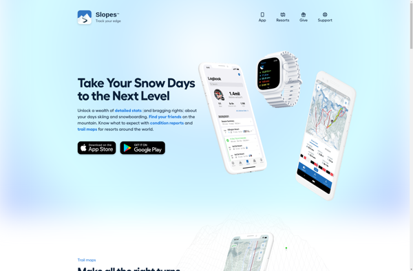
Slopes is a feature-rich app for tracking skiing and snowboarding activity using iPhone and Apple Watch. It uses the device's GPS and motion sensors to precisely record metrics like distance, vertical drop, maximum and average speeds, time on lifts vs slopes, and more for every run.Slopes stands out for its...
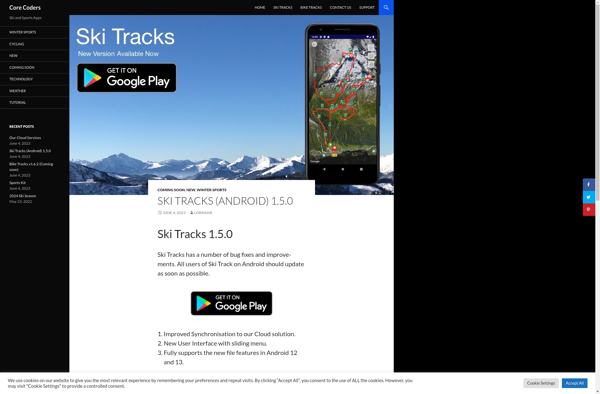
Ski Tracks is a popular mobile application for skiers and snowboarders to track their activity on the slopes. It is available on both iPhone and Android devices and uses the phone's built-in GPS to map out each run down the mountain.Some of the key features Ski Tracks offers include:Real-time speed...
Endomondo is a fitness tracking application mainly focused on outdoor sports like running, walking, cycling, and hiking. It utilizes a phone or watch's GPS sensors to accurately track metrics during workouts including distance, pace/speed, duration, route, elevation gain, and calories burned.Some key features that make Endomondo a popular choice for...
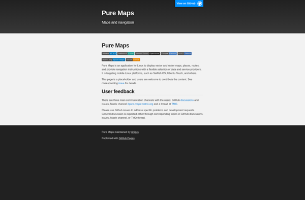
Pure Maps is an open-source mapping platform developed as an alternative to Google Maps that focuses on user privacy. Unlike Google Maps, Pure Maps does not collect or store any personal user data.Some key features of Pure Maps include:Open-source codebase that allows anyone to contribute and audit the projectVector-based map...
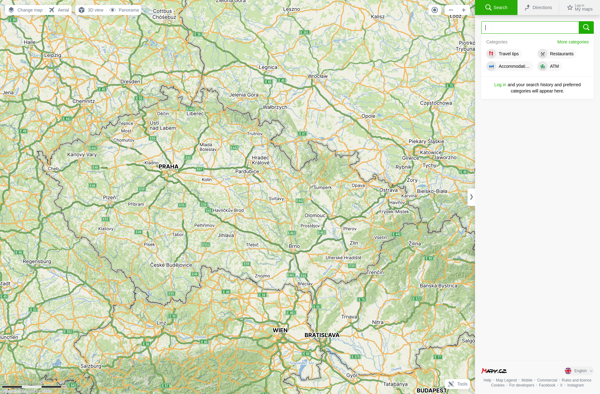
Mapy.cz is a comprehensive online map service based in the Czech Republic. It was launched in 2005 and is one of the most widely used map services for the Czech Republic and Slovakia.Mapy.cz provides detailed street maps, topographic maps, satellite and aerial imagery of the Czech Republic and Slovakia. It...
Planet Labs is an earth imaging company founded in 2010 and based in San Francisco, California. They operate the world's largest commercial satellite constellation with over 200 satellites in orbit, collecting imagery of the entire land mass of the Earth every day.Their high revisit rate and global coverage allows them...
Marble is a free and open source note taking application designed specifically for Linux desktop environments like KDE Plasma and GNOME. It provides a simple yet effective way to create rich text notes, tackle checklists, set reminders, and organize your notes into notebooks.Some of the key features of Marble include:Rich...
Universal Maps Downloader is a free and open source software application that provides the ability to download map images from various popular online map services, including Google Maps, Bing Maps, OpenStreetMap, MapQuest, Yandex Maps, and more.Some key features of Universal Maps Downloader:Supports downloading map images at various zoom levels ranging...
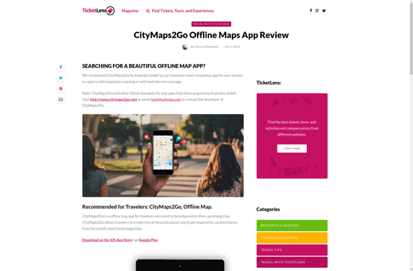
CityMaps2Go is an essential app for travelers who want access to detailed offline maps. With CityMaps2Go, you can download maps and points of interest for over 300 destinations worldwide so you can navigate confidently without using cell data or paying expensive roaming charges.Once the maps are downloaded, you have unlimited...
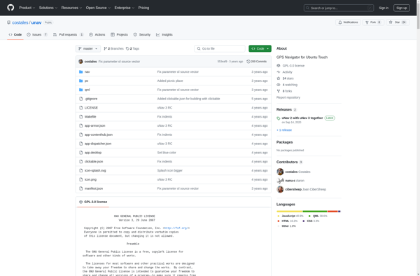
uNav is an open-source web browser developed by a non-profit organization dedicated to giving users control over their online privacy and security. Unlike other major browsers, uNav blocks ads, trackers, and malicious websites by default to protect users from surveillance, malware, and annoying ads.Despite its privacy focus, uNav does not...
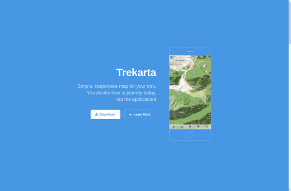
Trekarta is a popular software suite built specifically for trekking, hiking, nature exploration and outdoor adventure trips. It comes packed with a wide range of features to plan, record, organize and share wilderness adventures.Key features include:Interactive route planning on zoomable topographic mapsExtensive offline map data for most countries and regionsComprehensive...
TomTom MyDrive is a free desktop and mobile app that interfaces with TomTom GPS navigation devices to provide expanded features and functionality. With MyDrive, users can plan routes and destinations on their computer, tablet, or phone and seamlessly send that information to their TomTom device.Key features of TomTom MyDrive include:Updated...
Guru Maps is an online mind mapping and brainstorming application designed to help users organize ideas and information visually. As an intuitive tool for project planning, brainstorming sessions, and task management, Guru Maps enables users to create colorful nonlinear maps to connect ideas, notes, files, links, and more.Key features of...
Windows Maps is a mapping service developed by Microsoft as part of the company's Windows services. It provides users with interactive road maps, aerial and streetside imagery, walking and driving directions, traffic information, location search, and the ability to save and sync collections like favorite places and routes across devices.Key...
Garmin StreetPilot Onboard is an in-vehicle GPS navigation system made by Garmin. It comes preloaded with detailed maps that provide turn-by-turn directions and voice guidance to help drivers navigate to their destinations.Key features of StreetPilot Onboard include:Millions of points of interest like gas stations, restaurants, hotels, ATMs, etc.Lane assist with...
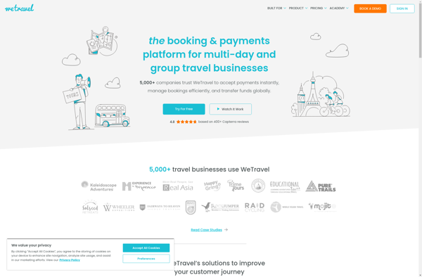
WeTravel is an innovative online travel platform launched in 2015 that is revolutionizing the way people research, plan, and book travel. With its easy-to-use interface and industry-leading search functionalities, WeTravel has become a go-to site for travelers looking to streamline trip planning and booking.At the core of WeTravel's offerings is...
Magic Earth is an open-source, free mobile map application developed for Android and iOS devices. It can be used as a fully-functional GPS navigation software both online and offline. Some of the key features include:Downloads offline vector maps worldwide for using the app without internet connection.Supports turn-by-turn voice navigation and...
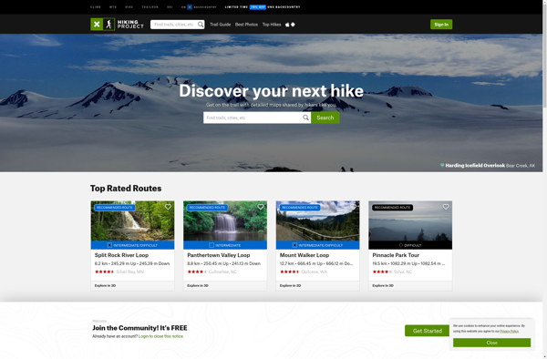
The Hiking Project is a free platform that helps people explore and share information on hiking trails across the United States. It is available as both a mobile app (for iOS and Android devices) and a website.The Hiking Project contains details on over 100,000 hiking trails, making it one of...
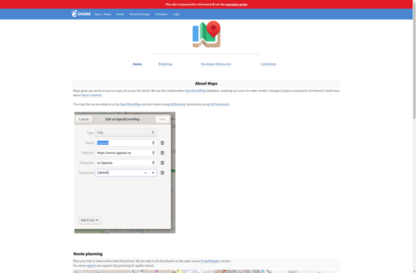
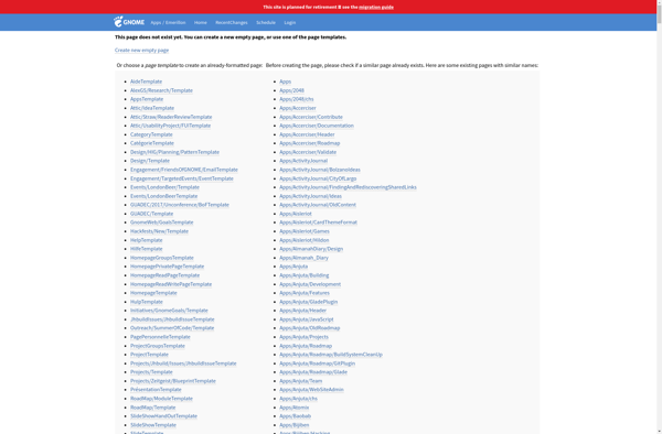
GNOME Maps is a mapping and navigation application built for the Linux GNOME desktop environment. Developed as part of the GNOME project, it is free and open source software.GNOME Maps allows users to view different map layers, including street maps, satellite imagery, and terrain. It has basic functionality like panning...
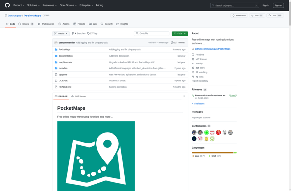
PocketMaps is an open source, offline GPS navigation app for Android devices. It allows users to download OpenStreetMap maps for offline use so navigation is possible without an internet connection. Some key features of PocketMaps include:Completely offline maps - no data connection needed once maps are downloadedTurn-by-turn voice guided GPS...
GeoNET is an open-source desktop application for geographic network analysis. Developed by CHAMP (Center for Health Assessment, Monitoring, and Policy), GeoNET provides tools for modeling, visualizing, and analyzing spatial networks such as transportation, infrastructure, and utility systems.With GeoNET, users can import existing GIS network datasets, or create new network models...
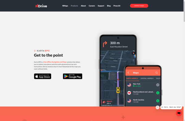
Karta GPS is a mapping, navigation, and GPS tracking app designed specifically for outdoor adventures like hiking, backpacking, cycling, and more. It provides topographic and terrain maps that work offline so you can navigate trails and rural areas without cell service.Some key features of Karta GPS include:Detailed topographic maps with...
Transportr is an open-source public transportation app for Android devices. It is designed to help users search, plan, and navigate public transit systems in cities around the world.Some key features of Transportr include:Intuitive user interface for searching routes, planning trips, and viewing schedules and maps.Support for public transit systems in...
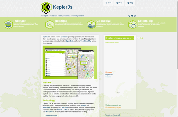
KeplerJs is an open-source web application framework for Node.js focused on scalability and high performance. It uses an asynchronous, non-blocking architecture optimized for handling a high volume of concurrent requests with low latency.Some key features of KeplerJs include:Built-in support for horizontal scaling across multiple CPU cores/serversFirst-class support for real-time features...
OpenMaps is an open source web mapping platform built on top of OpenStreetMap data. It allows users to create custom maps by drawing on top of existing maps and adding their own annotations, text labels, and lines/shapes. These custom maps can then be exported, embedded on websites, or shared publicly...
GPS Navigator is a feature-rich navigation and maps app for Android and iOS that is focused on providing accurate turn-by-turn directions even when offline. It sets itself apart by offering free offline map downloads for over 200 countries and territories worldwide, meaning you can navigate unfamiliar areas without racking up...
Google Maps Go is a streamlined version of the Google Maps app designed for Android Go edition devices. Android Go edition is a configuration of Android optimized for devices with less than 2GB of RAM, aimed at improving performance and accessibility in emerging markets.Some key features of Google Maps Go...
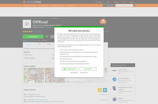
OffRoad OSM is an open source GPS navigation app designed specifically for off-road use. It works offline using downloaded OpenStreetMap maps so you can navigate trails and rural roads even without cell service or wifi.Some key features of OffRoad OSM include:Works completely offline for navigation in remote areasUses OpenStreetMap data...
Emerillon is a free, open source photo geotagging program for Linux operating systems. It provides an intuitive interface that allows users to easily geotag their collection of photos by plotting points on a map or entering GPS coordinates.Some key features of Emerillon include:Drag-and-drop interface for quickly importing photos.Ability to manually...
Wisepilot is a comprehensive yet intuitive project management software designed specifically for creative agencies, marketing and production teams. It provides a complete set of features to help you plan projects, break down complex tasks, assign work to team members, track time and collaborate smoothly at every stage.Key features of Wisepilot...
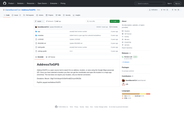
AddressToGPS is a Windows-based geocoding software used to convert street addresses into geographic coordinates like latitude and longitude. It has an easy-to-use interface where users can enter addresses, which are then converted into GPS coordinates that can be used in mapping software and GPS devices.Some key features of AddressToGPS include:Works...
Mobile GMaps is a mobile app developed by Google that brings the capabilities of Google Maps to your smartphone or tablet. It allows you to access many of the popular features of Google Maps on the go.Some of the key things you can do with Mobile GMaps include:View interactive maps...
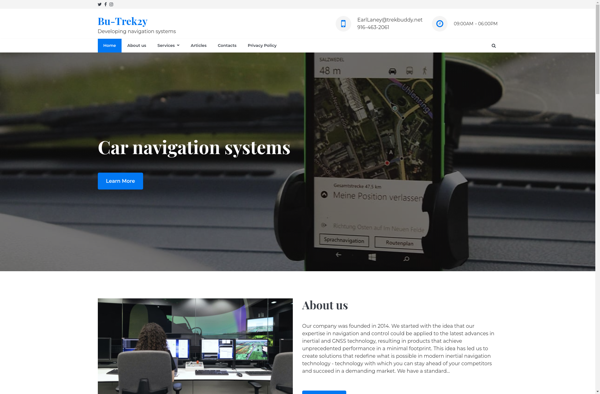
TrekBuddy is a versatile backpacking and hiking app that aids outdoor enthusiasts in planning and documenting their adventures in nature. Whether heading out for a long-distance thru hike, a multi-day loop, or just a quick overnight trip, TrekBuddy streamlines the process of organizing gear lists, dialing in routes, booking campsites,...
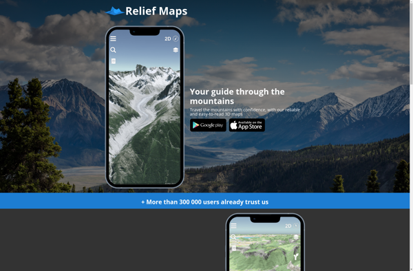
Relief Maps is a desktop software application designed specifically for visualizing and working with digital elevation models (DEMs). It enables users to import raw elevation datasets such as Lidar scans or SRTM data and transform them into interactive 3D maps and terrain models.Key features of Relief Maps include:Support for all...
AutoMapa is an open source desktop application designed specifically for creating interactive and zoomable maps. It provides a user-friendly graphical interface that allows users to easily import a variety of spatial data sets including shapefiles, geoJSON files, KML files, and more.Once data sets are imported, AutoMapa provides extensive styling and...
MapDroyd is a free, open-source map viewing and editing app for Android. It allows users to download map data for offline use and view, create, and edit maps when internet connectivity is limited.Key features of MapDroyd include:Ability to download OpenStreetMap data for offline map viewingSupport for standard mapping features like...
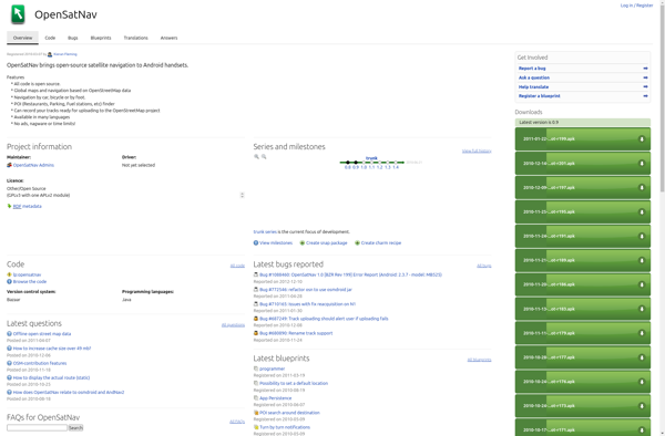
OpenSatNav is an open source navigation software that provides turn-by-turn GPS navigation and route planning for personal use. It can be installed on Windows, Linux, and Android devices and used completely offline thanks to its support for offline map downloads.Key features of OpenSatNav include:Turn-by-turn voice guided GPS navigationSupport for offline...
ShareNav is a browser extension and web application designed to help users organize, discover, and share links for research and reference. It serves as a central platform to capture and access references encountered during Web browsing and reading.Some of the key features of ShareNav include:Save links, PDFs, images, and snippets...
MapQuery is an open-source desktop geographic information system (GIS) software application used for viewing, editing, and analyzing spatial data. Developed by the Oregon Department of Transportation, MapQuery provides a user-friendly interface and tools for working with maps and geographic information.Key features of MapQuery include:Interactive map display with zooming, panning, and...
Ski Blackbox is an activity and sports tracker mobile app designed specifically for skiers and snowboarders. Using the built-in GPS sensor on your phone or smartwatch, Ski Blackbox precisely tracks all the key statistics for your time spent skiing or snowboarding on the mountain.As you make your runs, Ski Blackbox...
Velotton is a note-taking and simple task management application designed to help users focus without getting distracted. Its minimalist design provides a clean, ad-free interface for jotting down ideas, thoughts, to-do lists, and more.Some key features of Velotton include:Create notes - Simple rich text notes with formatting options for rapid...
Mappy is an online and mobile map service mainly focused on Europe. It provides detailed street-level maps for over 40 European countries, covering popular travel destinations like France, Germany, Italy, Spain, and the UK as well as smaller countries across the region.Key features of Mappy include:Interactive maps with zoom, pan,...
Doko Maps is an open-source, privacy-focused alternative to Google Maps. Developed by a non-profit organization, Doko Maps aims to provide an ethical mapping service that respects user privacy.Like Google Maps, Doko Maps offers features like turn-by-turn navigation for driving, walking, biking and public transit. It allows users to search for...
Skied Demon is a ski resort management and construction simulation game. Players take on the role of a resort owner tasked with building their dreamed ski resort in the mountains. Starting with an empty plot of land, players must carefully construct ski slopes, lifts, lodges, amenities and manage the business...
Gokivo Navigator is a free, open-source web browser developed as an alternative to more complex browsers. It was created with simplicity, speed, and ease-of-use as the main priorities.The interface has been designed to be clean and minimal, allowing users to focus on the web content rather than the browser itself....
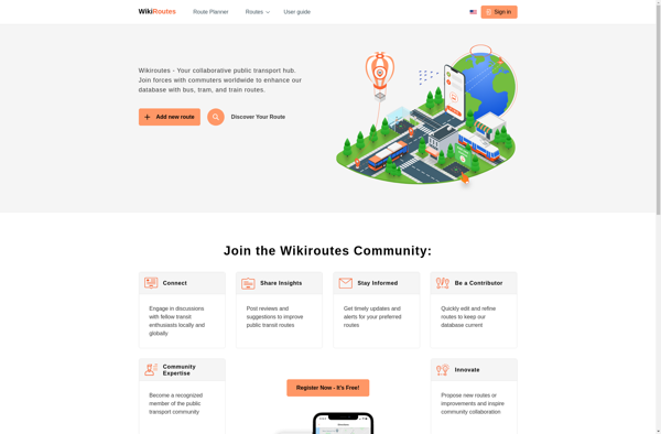
Wikiroutes is an open-source web application designed to help travelers plan and organize trips. It works by tapping into the vast amounts of up-to-date travel information on Wikipedia to provide users with curated guides and customizable itineraries.Some key features of Wikiroutes include:Destination explorer - Browse through popular destinations and dig...
GPS voice navigation software is designed to provide turn-by-turn voice guided directions while driving to help drivers navigate to their desired destinations. It works by accessing GPS satellite signals to accurately track the vehicle's location, then using embedded street-level mapping data to calculate optimal routes to the specified destination.As the...
AlpineReplay is a video editing application targeted at action sports enthusiasts. It is optimized to work with point-of-view camera footage from devices like GoPro so users can easily import, view, edit, and share their adventures.Some key features of AlpineReplay include:Multi-angle syncing - Sync footage from multiple cameras for a multi-angle...
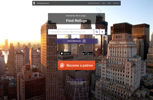
Refuge Restrooms is a free website and mobile app launched in 2010 that crowdsources and shares the locations of gender-neutral and accessible public restrooms. Its goal is to provide safe restroom access for transgender, intersex, and gender nonconforming individuals who often face discrimination, hostility, and safety issues when using gender-segregated...
GpsMid is a feature-rich Windows desktop application designed specifically for GPS tracking, route planning, and trip sharing. Some key features include:Import/export GPX, KML, CSV files from GPS devices or apps like Gaia GPS, AllTrails, etc.Create routes and waypoints, view elevation profilesRecord tracks in real-time, show speed and elevation as you...