FATMAP is an outdoor mapping app and website that provides detailed topographic maps for hiking, skiing, and other outdoor activities. It includes trail information, 3D terrain view, route planning tools, and offline maps.
FATMAP is an outdoor mapping app and website providing detailed topographic maps for hiking, skiing, and other outdoor activities, including trail information, 3D terrain view, route planning tools, and offline maps.
What is FATMAP?
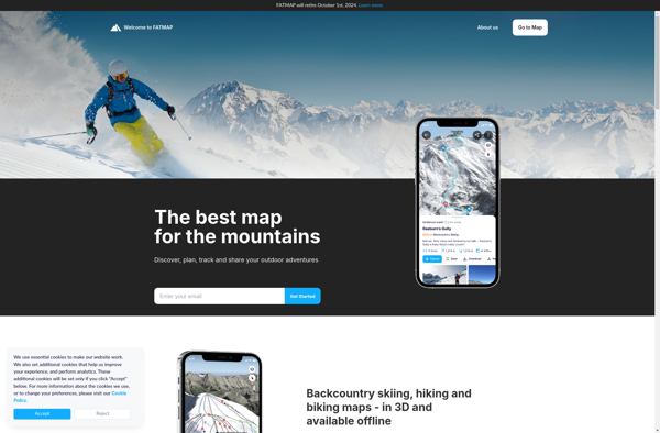
FATMAP is an outdoor navigation app and website designed specifically for adventure sports enthusiasts like hikers, trail runners, mountain bikers, and backcountry skiers. It provides interactive 3D mapping with detailed topographic data to help users safely plan and navigate routes in mountainous and backcountry areas.
Key features of FATMAP include:
Accurate, hike-specific topo maps with critical information like slope gradients, terrain classification, and elevation profiles
3D map view that clearly visualizes complex mountain landscapes and terrain
Offline downloadable maps that work without cell or wifi coverage
Route planning and recording tools with stats like distance, time, ascent/descent
Curated trail guides and descriptions crowd-sourced from the FATMAP user community
Different map layers like satellite view or snow depth for ski touring
Unlike apps made for driving directions, FATMAP is designed specifically for hiking, skiing and mountaineering. It works like a detailed topographic map in your pocket, helping both recreational users and seasoned backcountry explorers better understand 3D terrain, plan safer routes, and navigate precisely even without service. Advanced features cater to specialized users like skiers while the app overall aims to make off-trail navigation more accessible to outdoor enthusiasts of all levels.
Google Earth is a geobrowser that accesses satellite and aerial imagery, ocean bathymetry, and other geographic data over the internet to represent the Earth as a three-dimensional globe. It was originally developed by Keyhole, Inc., a company acquired by Google in 2004.Google Earth allows users to search for addresses and...
OsmAnd (OpenStreetMap Automated Navigation Directions) is a free and open-source mobile map and navigation application developed for Android and iOS devices. It relies entirely on detailed, community-driven maps from the OpenStreetMap project and allows accessing them offline without an internet connection.Some of the key features and capabilities of OsmAnd include:Turn-by-turn...
HERE WeGo is a free map and navigation app developed by HERE Technologies for iOS and Android devices. It allows users to navigate by car, public transportation, foot or bike using turn-by-turn voice guided directions. Key features of HERE WeGo include:Offline maps - Download maps to your device so you...
What Is Organic Maps?Organic Maps is a free, open-source maps and navigation app for Android and iOS. It uses OpenStreetMap data and works entirely offline — no internet connection needed for navigation, search, or route planning.Key FeaturesThe app provides turn-by-turn navigation for driving, cycling, and walking with voice guidance. Maps...
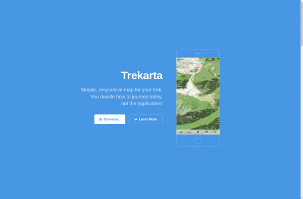
Trekarta is a popular software suite built specifically for trekking, hiking, nature exploration and outdoor adventure trips. It comes packed with a wide range of features to plan, record, organize and share wilderness adventures.Key features include:Interactive route planning on zoomable topographic mapsExtensive offline map data for most countries and regionsComprehensive...
Transportr is an open-source public transportation app for Android devices. It is designed to help users search, plan, and navigate public transit systems in cities around the world.Some key features of Transportr include:Intuitive user interface for searching routes, planning trips, and viewing schedules and maps.Support for public transit systems in...
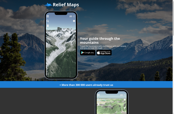
Relief Maps is a desktop software application designed specifically for visualizing and working with digital elevation models (DEMs). It enables users to import raw elevation datasets such as Lidar scans or SRTM data and transform them into interactive 3D maps and terrain models.Key features of Relief Maps include:Support for all...