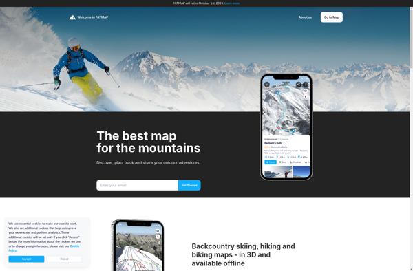
Struggling to choose between Transportr and FATMAP? Both products offer unique advantages, making it a tough decision.
Transportr is a Travel & Location solution with tags like transport, transit, travel, navigation.
It boasts features such as Search for public transit routes, Get accurate real-time departure info, View routes on a map, Set reminders and get notifications about your trip, Save favorite routes and stations, Works offline, Open-source and free and pros including Intuitive and easy to use interface, Comprehensive worldwide public transit data, Real-time departure and delay info, Offline capability is useful when no data connection, Completely free with no ads or paid tiers.
On the other hand, FATMAP is a Travel & Location product tagged with maps, hiking, skiing, outdoors, trails, 3d-terrain, route-planning, offline-maps.
Its standout features include Detailed topographic maps, 3D terrain view, Trail information and guides, Route planning tools, Offline downloadable maps, Elevation profiles, Weather forecasts, and it shines with pros like Very detailed and accurate maps, Useful 3D view of terrain, Lots of trail data and guides, Good route planning features, Can download maps for offline use, Elevation data for hikes and climbs.
To help you make an informed decision, we've compiled a comprehensive comparison of these two products, delving into their features, pros, cons, pricing, and more. Get ready to explore the nuances that set them apart and determine which one is the perfect fit for your requirements.
Transportr is an open-source public transport app for Android. It allows users to search for and plan trips using public transportation, with route planning, reminders, and notifications. The app has an intuitive interface and supports cities worldwide.
FATMAP is an outdoor mapping app and website that provides detailed topographic maps for hiking, skiing, and other outdoor activities. It includes trail information, 3D terrain view, route planning tools, and offline maps.