Waze is a community-based GPS navigation app that provides real-time traffic and road info based on crowd sourced data. Users report accidents, police, hazards, etc. to alert other drivers.
Real-time traffic and road info for a safer commute, powered by user reports of accidents, police, hazards, and more.
What is Waze?
Waze is a crowd-sourced GPS navigation and traffic app launched in 2008. It provides turn-by-turn navigation along with real-time traffic updates, road hazard reports, and user-submitted edits of roads and addresses.
Key features of Waze include:
Real-time traffic updates - Users can report accidents, traffic jams, police traps, etc. to alert other drivers in the area.
Crowdsourced mapping - Users can make map edits like adding, confirming or changing roads, addresses, landmarks.
Social networking integration - Users can share their drives and connect with friends on Waze.
Free to use - Waze generates revenue from location-based ads displayed on the map.
Originally started in Israel, Waze was acquired by Google in 2013 for $1.1 billion. It has over 100 million users as of 2022.
Compared to standalone GPS navigation from the likes of TomTom or Garmin, Waze provides a more social, interactive navigation experience focused on routing drivers along the optimum route based on live traffic conditions.
Google Maps is a web mapping platform and consumer application offered by Google. It offers satellite imagery, aerial photography, street maps, 360° interactive panoramic views of streets, real-time traffic conditions, and route planning for traveling by foot, car, bicycle and air, or public transportation.Key features of Google Maps include:Interactive street...
What Is MAPS.ME?MAPS.ME is a mobile maps and navigation app that provides detailed offline maps for over 200 countries. Originally open source, it was one of the first apps to make OpenStreetMap data accessible on mobile with a polished interface.Key FeaturesUsers download maps by country or region for fully offline...
OsmAnd (OpenStreetMap Automated Navigation Directions) is a free and open-source mobile map and navigation application developed for Android and iOS devices. It relies entirely on detailed, community-driven maps from the OpenStreetMap project and allows accessing them offline without an internet connection.Some of the key features and capabilities of OsmAnd include:Turn-by-turn...
OpenStreetMap (OSM) is a collaborative project to create a free and editable map of the world. Unlike proprietary map data from companies like Google or Apple, OSM map data is open and licensed under the Open Database License (ODbL), which allows anyone to use, modify, and distribute the data freely.The...
HERE WeGo is a free map and navigation app developed by HERE Technologies for iOS and Android devices. It allows users to navigate by car, public transportation, foot or bike using turn-by-turn voice guided directions. Key features of HERE WeGo include:Offline maps - Download maps to your device so you...
What Is Organic Maps?Organic Maps is a free, open-source maps and navigation app for Android and iOS. It uses OpenStreetMap data and works entirely offline — no internet connection needed for navigation, search, or route planning.Key FeaturesThe app provides turn-by-turn navigation for driving, cycling, and walking with voice guidance. Maps...
Google Maps Navigation is a free GPS navigation app developed by Google for Android and iOS devices. It utilizes Google Maps and crowd-sourced traffic data to provide turn-by-turn voice guided navigation and real-time traffic updates.Key features include:Turn-by-turn voice guided navigation with automatic reroutingReal-time traffic updates using crowdsourced dataLane guidance and...
Arcane Maps is a feature-rich yet easy-to-use fantasy map creation tool designed specifically for tabletop roleplaying games like Dungeons & Dragons. With an intuitive interface, users can quickly sketch out custom maps with a variety of terrains, landmarks, borders, text labels, and other cartography elements.The software provides numerous brush styles...
Apple Maps is a web mapping service developed by Apple Inc. It was introduced in 2012 with iOS 6 as a replacement for Google Maps on Apple devices. Apple Maps offers turn-by-turn navigation, interactive panoramic street views, Flyover mode for photorealistic 3D views of certain cities, support for transit routing...
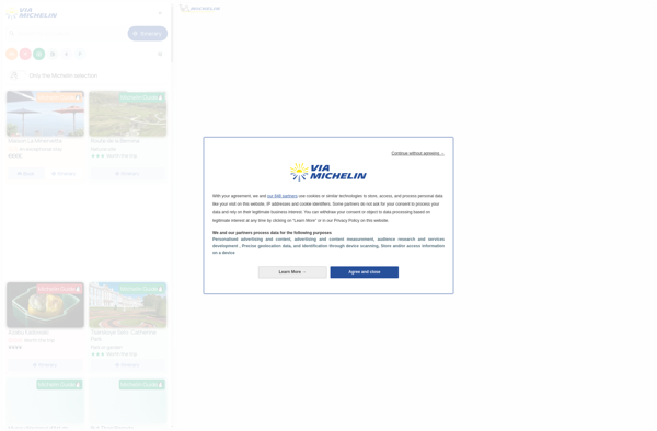
ViaMichelin is a popular travel website and mobile app focused on providing information and services for driving in Europe. It was launched in 2001 by Michelin, the French tire company.Some key features of ViaMichelin include:Interactive maps of European countries with the option to plan routes and get turn-by-turn GPS navigation.Tourist...
MapQuest is a free online mapping service launched in 1996 that provides users with driving directions, traffic conditions, route planning, and interactive maps. It was one of the first and most popular online mapping sites before the rise of Google Maps and Bing Maps.Key features of MapQuest include:Driving directions for...
JBV1 is a free, open-source vector graphics editor for Windows, macOS and Linux operating systems. Originally created as a fork of Inkscape in 2021, JBV1 focuses on improving stability and usability for all platforms.With JBV1, users can create various types of vector imagery such as logos, icons, diagrams, charts, illustrations...
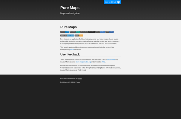
Pure Maps is an open-source mapping platform developed as an alternative to Google Maps that focuses on user privacy. Unlike Google Maps, Pure Maps does not collect or store any personal user data.Some key features of Pure Maps include:Open-source codebase that allows anyone to contribute and audit the projectVector-based map...
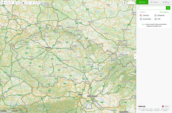
Mapy.cz is a comprehensive online map service based in the Czech Republic. It was launched in 2005 and is one of the most widely used map services for the Czech Republic and Slovakia.Mapy.cz provides detailed street maps, topographic maps, satellite and aerial imagery of the Czech Republic and Slovakia. It...
Planet Labs is an earth imaging company founded in 2010 and based in San Francisco, California. They operate the world's largest commercial satellite constellation with over 200 satellites in orbit, collecting imagery of the entire land mass of the Earth every day.Their high revisit rate and global coverage allows them...
Yandex.Navigator is a popular free turn-by-turn navigation app developed by Yandex for Android and iOS devices. It provides real-time traffic information, speed limit warnings, lane assistance and offline maps for over 190 countries.Some key features of Yandex.Navigator include:Turn-by-turn voice guided navigation with offline maps so you can navigate without an...
BlackBerry Maps is a mobile map application developed by BlackBerry Limited specifically for BlackBerry 10 devices. It comes pre-installed on most BlackBerry 10 smartphones and provides a variety of mapping and navigation features.Some of the key capabilities of BlackBerry Maps include:Turn-by-turn GPS navigation with voice guidanceTraffic information with automatic rerouting...
Universal Maps Downloader is a free and open source software application that provides the ability to download map images from various popular online map services, including Google Maps, Bing Maps, OpenStreetMap, MapQuest, Yandex Maps, and more.Some key features of Universal Maps Downloader:Supports downloading map images at various zoom levels ranging...
iCoyote is a popular GPS-based app that alerts drivers in real-time to upcoming speed traps, speed limits, red light cameras, and more. Its key goal is to help drivers avoid speeding tickets and stay safe on the road.The app uses crowd-sourced user reports and publicly available data to identify the...
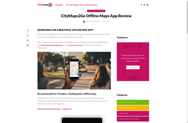
CityMaps2Go is an essential app for travelers who want access to detailed offline maps. With CityMaps2Go, you can download maps and points of interest for over 300 destinations worldwide so you can navigate confidently without using cell data or paying expensive roaming charges.Once the maps are downloaded, you have unlimited...
uNav is an open-source web browser developed by a non-profit organization dedicated to giving users control over their online privacy and security. Unlike other major browsers, uNav blocks ads, trackers, and malicious websites by default to protect users from surveillance, malware, and annoying ads.Despite its privacy focus, uNav does not...
Yandex Maps is a free online map service developed by Yandex, a Russian multinational technology company specializing in Internet-related services and products. Yandex Maps offers highly detailed and searchable maps, turn-by-turn navigation, public transit information, traffic data, and 360-degree panoramic street view images for over 220 countries around the world.The...
INRIX Traffic is a leading provider of real-time traffic information and connected car services. It processes data from hundreds of millions of cars, devices, and road sensors to deliver real-time and predictive traffic flow information across urban, suburban, and highway road networks.INRIX leverages advanced algorithms and artificial intelligence to turn...
TomTom MyDrive is a free desktop and mobile app that interfaces with TomTom GPS navigation devices to provide expanded features and functionality. With MyDrive, users can plan routes and destinations on their computer, tablet, or phone and seamlessly send that information to their TomTom device.Key features of TomTom MyDrive include:Updated...
Guru Maps is an online mind mapping and brainstorming application designed to help users organize ideas and information visually. As an intuitive tool for project planning, brainstorming sessions, and task management, Guru Maps enables users to create colorful nonlinear maps to connect ideas, notes, files, links, and more.Key features of...
2GIS is a popular free map, local search and business directory mobile app and website operating in over 1800 cities across Russia, CIS, Europe, Asia and other countries. It offers detailed interactive maps, local business listings, navigation, reviews and other local information.Some key features of 2GIS include:Detailed vector maps for...
Windows Maps is a mapping service developed by Microsoft as part of the company's Windows services. It provides users with interactive road maps, aerial and streetside imagery, walking and driving directions, traffic information, location search, and the ability to save and sync collections like favorite places and routes across devices.Key...
Garmin StreetPilot Onboard is an in-vehicle GPS navigation system made by Garmin. It comes preloaded with detailed maps that provide turn-by-turn directions and voice guidance to help drivers navigate to their destinations.Key features of StreetPilot Onboard include:Millions of points of interest like gas stations, restaurants, hotels, ATMs, etc.Lane assist with...
Calimoto is a route planning and navigation smartphone app designed specifically for motorcyclists. It sets itself apart from traditional navigation apps by focusing on finding the most enjoyable, exciting motorcycle routes rather than just the fastest or shortest routes.Here are some key features of Calimoto:Route recommendations are tailored to your...
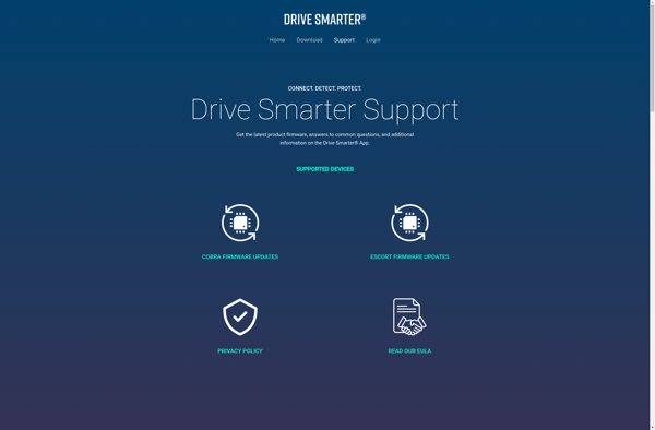
Drive Smarter is a mobile application designed to make people better, safer drivers. It uses sensor data from smartphones to monitor driving patterns and habits, providing users with real-time feedback and coaching to improve their skills.Some key features of Drive Smarter include:Tracking of metrics like speeding, acceleration, braking, cornering, phone...
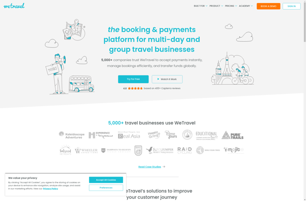
WeTravel is an innovative online travel platform launched in 2015 that is revolutionizing the way people research, plan, and book travel. With its easy-to-use interface and industry-leading search functionalities, WeTravel has become a go-to site for travelers looking to streamline trip planning and booking.At the core of WeTravel's offerings is...
Magic Earth is an open-source, free mobile map application developed for Android and iOS devices. It can be used as a fully-functional GPS navigation software both online and offline. Some of the key features include:Downloads offline vector maps worldwide for using the app without internet connection.Supports turn-by-turn voice navigation and...
GeoNET is an open-source desktop application for geographic network analysis. Developed by CHAMP (Center for Health Assessment, Monitoring, and Policy), GeoNET provides tools for modeling, visualizing, and analyzing spatial networks such as transportation, infrastructure, and utility systems.With GeoNET, users can import existing GIS network datasets, or create new network models...
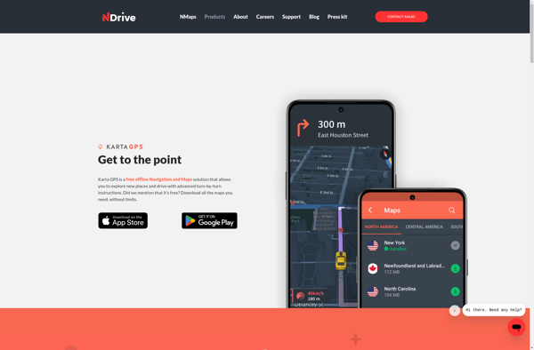
Karta GPS is a mapping, navigation, and GPS tracking app designed specifically for outdoor adventures like hiking, backpacking, cycling, and more. It provides topographic and terrain maps that work offline so you can navigate trails and rural areas without cell service.Some key features of Karta GPS include:Detailed topographic maps with...
Transportr is an open-source public transportation app for Android devices. It is designed to help users search, plan, and navigate public transit systems in cities around the world.Some key features of Transportr include:Intuitive user interface for searching routes, planning trips, and viewing schedules and maps.Support for public transit systems in...
WalkWay Navi is a pedestrian navigation and route planning app for Android and iOS devices. It is designed specifically for walking and public transit navigation in cities and urban areas.Key features of WalkWay Navi include:Turn-by-turn walking directions with voice guidanceOffline vector maps that work without an internet connectionLocal search for...
GPS Navigator is a feature-rich navigation and maps app for Android and iOS that is focused on providing accurate turn-by-turn directions even when offline. It sets itself apart by offering free offline map downloads for over 200 countries and territories worldwide, meaning you can navigate unfamiliar areas without racking up...
Google Maps Go is a streamlined version of the Google Maps app designed for Android Go edition devices. Android Go edition is a configuration of Android optimized for devices with less than 2GB of RAM, aimed at improving performance and accessibility in emerging markets.Some key features of Google Maps Go...
Acastus Photon is an open-source web application that serves as a self-hosted alternative to Pinterest. Like Pinterest, it allows users to create visual inspiration boards to collect, organize, and share images, links, notes, and other content.Some key features of Acastus Photon include:Creating public and private boards to organize contentFollowing other...
BlackBerry Traffic is a mobile application developed by BlackBerry Limited to provide users with real-time traffic information and routing assistance. The app is available for BlackBerry 10 and Android devices.Key features of BlackBerry Traffic include:Real-time traffic flow data - the app shows current traffic conditions on roads using colored lines...
Yahoo! Maps is a free online map service owned and operated by Yahoo!. It offers interactive maps and satellite/aerial imagery of locations around the world, as well as street-level photography in some areas. Users can get driving, walking, public transit and biking directions, view real-time traffic information, create customized maps,...
Wisepilot is a comprehensive yet intuitive project management software designed specifically for creative agencies, marketing and production teams. It provides a complete set of features to help you plan projects, break down complex tasks, assign work to team members, track time and collaborate smoothly at every stage.Key features of Wisepilot...
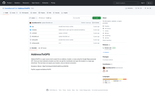
AddressToGPS is a Windows-based geocoding software used to convert street addresses into geographic coordinates like latitude and longitude. It has an easy-to-use interface where users can enter addresses, which are then converted into GPS coordinates that can be used in mapping software and GPS devices.Some key features of AddressToGPS include:Works...
AutoMapa is an open source desktop application designed specifically for creating interactive and zoomable maps. It provides a user-friendly graphical interface that allows users to easily import a variety of spatial data sets including shapefiles, geoJSON files, KML files, and more.Once data sets are imported, AutoMapa provides extensive styling and...
MapDroyd is a free, open-source map viewing and editing app for Android. It allows users to download map data for offline use and view, create, and edit maps when internet connectivity is limited.Key features of MapDroyd include:Ability to download OpenStreetMap data for offline map viewingSupport for standard mapping features like...
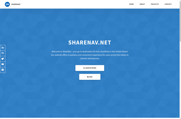
ShareNav is a browser extension and web application designed to help users organize, discover, and share links for research and reference. It serves as a central platform to capture and access references encountered during Web browsing and reading.Some of the key features of ShareNav include:Save links, PDFs, images, and snippets...
Mappy is an online and mobile map service mainly focused on Europe. It provides detailed street-level maps for over 40 European countries, covering popular travel destinations like France, Germany, Italy, Spain, and the UK as well as smaller countries across the region.Key features of Mappy include:Interactive maps with zoom, pan,...
Chop Commute is an innovative mobile application that leverages artificial intelligence to completely transform the daily commute. Using advanced machine learning algorithms, Chop Commute provides hyper-accurate travel time predictions down to the minute, even factoring in real-time traffic conditions. This allows users to confidently plan their commute and arrive on-time.But...
Trapster is a free community-based traffic and speed trap reporting app available for iOS and Android devices. It allows drivers to work together to alert each other in real-time to police locations, speed traps, road hazards, and traffic delays.Users can report traffic incidents and view reports from other users along...
Doko Maps is an open-source, privacy-focused alternative to Google Maps. Developed by a non-profit organization, Doko Maps aims to provide an ethical mapping service that respects user privacy.Like Google Maps, Doko Maps offers features like turn-by-turn navigation for driving, walking, biking and public transit. It allows users to search for...
HUDWAY Go is a heads-up display designed for car windshields to promote safer and smarter driving. It wirelessly connects to smartphones via Bluetooth and projects an augmented reality display directly in the driver's line of sight that includes useful information like current speed, speed limits, navigation prompts, weather data, and...
Gokivo Navigator is a free, open-source web browser developed as an alternative to more complex browsers. It was created with simplicity, speed, and ease-of-use as the main priorities.The interface has been designed to be clean and minimal, allowing users to focus on the web content rather than the browser itself....
Nav4All is an open-source navigation software application designed specifically to meet the needs of people with disabilities that impact mobility and navigation. It was created by a non-profit organization focused on developing helpful technologies for the disability community.The software provides customizable verbal prompts, sounds, and haptic feedback through connected devices...
GPS voice navigation software is designed to provide turn-by-turn voice guided directions while driving to help drivers navigate to their desired destinations. It works by accessing GPS satellite signals to accurately track the vehicle's location, then using embedded street-level mapping data to calculate optimal routes to the specified destination.As the...
GpsMid is a feature-rich Windows desktop application designed specifically for GPS tracking, route planning, and trip sharing. Some key features include:Import/export GPX, KML, CSV files from GPS devices or apps like Gaia GPS, AllTrails, etc.Create routes and waypoints, view elevation profilesRecord tracks in real-time, show speed and elevation as you...