Calimoto
Calimoto: Motorcycle Route Planning App
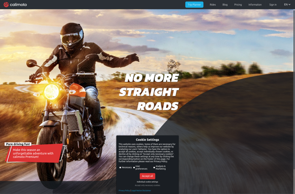
Plan your motorcycling adventures with Calimoto, a route planning and navigation app that offers curated, fun motorcycle routes and considers personal riding styles and motorcycle types.
What is Calimoto?
Calimoto is a route planning and navigation smartphone app designed specifically for motorcyclists. It sets itself apart from traditional navigation apps by focusing on finding the most enjoyable, exciting motorcycle routes rather than just the fastest or shortest routes.
Here are some key features of Calimoto:
- Route recommendations are tailored to your personal riding style preferences (e.g. twisty roads vs highways) and motorcycle type (cruiser, sportbike, etc).
- Uses a proprietary "Joy of Riding" algorithm to avoid boring roads and discover curated, entertaining motorcycle routes ideal for joyrides or tours.
- Incorporates user feedback on routes to continuously improve recommendations over time.
- Provides turn-by-turn voice guided navigation along curated motorcycle routes to enhance the riding experience.
- Global route database with over 7 million curated miles/kilometers of exciting motorcycle roads.
- Community aspect allows users to share and discover new motorcycle routes uploaded by other users.
- Available as a free subscription-based app on iOS and Android devices.
In summary, Calimoto focuses strictly on enhancing the adventure, freedom and joy of motorcycle riding through smart route recommendations tailored for bikers. Its ever-growing database combined with continuous user feedback helps motorcyclists discover the best riding routes for their style and bike.
Calimoto Features
Features
- Provides curated, fun motorcycle routes
- Avoids boring roads
- Accounts for personal riding styles
- Accounts for motorcycle types
- Suggests appropriate routes
Pricing
- Freemium
- Subscription-Based
Pros
Cons
Official Links
Reviews & Ratings
Login to ReviewThe Best Calimoto Alternatives
View all Calimoto alternatives with detailed comparison →
Top Travel & Location and Navigation and other similar apps like Calimoto
Here are some alternatives to Calimoto:
Suggest an alternative ❐Google Maps

Waze

OpenStreetMap

Apple Maps
