2GIS is a free mobile map and business directory app and website. It provides detailed maps, business listings, reviews, and navigation for over 1800 cities in Russia, CIS, Europe, Asia and America.
Detailed maps, business listings, reviews, navigation for over 1800 cities in Russia, CIS, Europe, Asia and America, a free mobile map and business directory app and website.
What is 2GIS?
2GIS is a popular free map, local search and business directory mobile app and website operating in over 1800 cities across Russia, CIS, Europe, Asia and other countries. It offers detailed interactive maps, local business listings, navigation, reviews and other local information.
Some key features of 2GIS include:
Detailed vector maps for over 1800 cities with navigation and route planning capabilities
Business directories with millions of POIs across various categories like restaurants, hotels, gas stations etc.
Information like business hours, addresses, user reviews and ratings
Augmented reality mode to easily spot nearby POIs by simply pointing the phone camera
Public transport routes and stops data for major cities
Offline maps support for usage without an internet connection
Integration with other apps like Uber, Yandex Taxi etc. to easily get rides
2GIS apps are available for Android, iOS, Windows Phone and Web platforms. The service is focused on providing the best local search and city guide experience by offering hyperlocal, relevant and updated business information and maps.
2GIS Features
Features
Detailed maps for over 1800 cities worldwide
Business directory with contact info, hours, photos
Google Maps is a web mapping platform and consumer application offered by Google. It offers satellite imagery, aerial photography, street maps, 360° interactive panoramic views of streets, real-time traffic conditions, and route planning for traveling by foot, car, bicycle and air, or public transportation.Key features of Google Maps include:Interactive street...
Google Earth is a geobrowser that accesses satellite and aerial imagery, ocean bathymetry, and other geographic data over the internet to represent the Earth as a three-dimensional globe. It was originally developed by Keyhole, Inc., a company acquired by Google in 2004.Google Earth allows users to search for addresses and...
Waze is a crowd-sourced GPS navigation and traffic app launched in 2008. It provides turn-by-turn navigation along with real-time traffic updates, road hazard reports, and user-submitted edits of roads and addresses.Key features of Waze include:Real-time traffic updates - Users can report accidents, traffic jams, police traps, etc. to alert other...
What Is MAPS.ME?MAPS.ME is a mobile maps and navigation app that provides detailed offline maps for over 200 countries. Originally open source, it was one of the first apps to make OpenStreetMap data accessible on mobile with a polished interface.Key FeaturesUsers download maps by country or region for fully offline...
OpenStreetMap (OSM) is a collaborative project to create a free and editable map of the world. Unlike proprietary map data from companies like Google or Apple, OSM map data is open and licensed under the Open Database License (ODbL), which allows anyone to use, modify, and distribute the data freely.The...
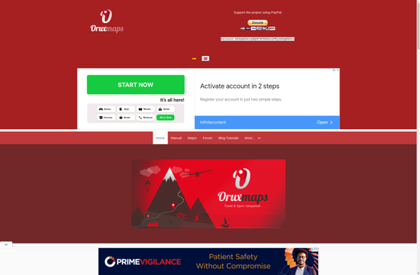
OruxMaps is a feature-rich Android app designed specifically for outdoor activities like hiking, mountain biking, road cycling, trail running, geocaching, and more. Some key features include:Offline maps - Download detailed topographic, outdoor, cycling, and hiking maps for offline use.Route planning - Plan routes and courses on the map, including waypoints...
HERE WeGo is a free map and navigation app developed by HERE Technologies for iOS and Android devices. It allows users to navigate by car, public transportation, foot or bike using turn-by-turn voice guided directions. Key features of HERE WeGo include:Offline maps - Download maps to your device so you...
Modest Maps is an open source JavaScript mapping library designed for easily embedding interactive maps into web pages. Some key features of Modest Maps include:Lightweight and customizable - Only about 6KB when minified and gzippedSupports various map tile sources including OpenStreetMap, MapQuest, and CloudMadeProvides API for basic interactions like panning,...
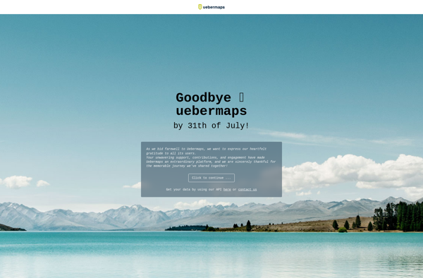
Uebermaps is an open-source web application that allows users to create fully customizable maps that can be shared online. It is self-hosted, meaning you download and install it on your own server or website.Some key features of Uebermaps include:Add custom markers, lines, polygons to a mapAnnotate points of interest with...
Arcane Maps is a feature-rich yet easy-to-use fantasy map creation tool designed specifically for tabletop roleplaying games like Dungeons & Dragons. With an intuitive interface, users can quickly sketch out custom maps with a variety of terrains, landmarks, borders, text labels, and other cartography elements.The software provides numerous brush styles...
Apple Maps is a web mapping service developed by Apple Inc. It was introduced in 2012 with iOS 6 as a replacement for Google Maps on Apple devices. Apple Maps offers turn-by-turn navigation, interactive panoramic street views, Flyover mode for photorealistic 3D views of certain cities, support for transit routing...
TransforMap is a free, open-source mind mapping and brainstorming software. It allows users to visually organize ideas, tasks, projects, and other information with the flexibility of a mind map interface.With TransforMap, users can:Create branching mind maps to break down large concepts and projects into an organized structureConnect related topics, ideas,...
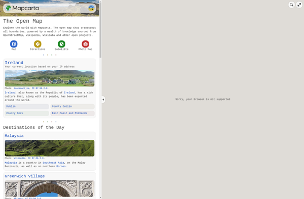
Mapcarta is an interactive online map service launched in 2009 that allows users to explore locations, cities, countries, and regions around the world. It provides detailed zoomable maps along with essential information and statistics about the places mapped. Some key features of Mapcarta include:Zoomable maps covering the entire world down...
MapQuest is a free online mapping service launched in 1996 that provides users with driving directions, traffic conditions, route planning, and interactive maps. It was one of the first and most popular online mapping sites before the rise of Google Maps and Bing Maps.Key features of MapQuest include:Driving directions for...
Planet Labs is an earth imaging company founded in 2010 and based in San Francisco, California. They operate the world's largest commercial satellite constellation with over 200 satellites in orbit, collecting imagery of the entire land mass of the Earth every day.Their high revisit rate and global coverage allows them...
Yandex.Navigator is a popular free turn-by-turn navigation app developed by Yandex for Android and iOS devices. It provides real-time traffic information, speed limit warnings, lane assistance and offline maps for over 190 countries.Some key features of Yandex.Navigator include:Turn-by-turn voice guided navigation with offline maps so you can navigate without an...
Universal Maps Downloader is a free and open source software application that provides the ability to download map images from various popular online map services, including Google Maps, Bing Maps, OpenStreetMap, MapQuest, Yandex Maps, and more.Some key features of Universal Maps Downloader:Supports downloading map images at various zoom levels ranging...
Map Pad is a free, open-source note-taking and information management software that provides an alternative to commercial options like Microsoft OneNote or Evernote. It uses an interactive and customizable map interface to help users visually organize their notes and information.With Map Pad, all your notes, documents, links and media files...
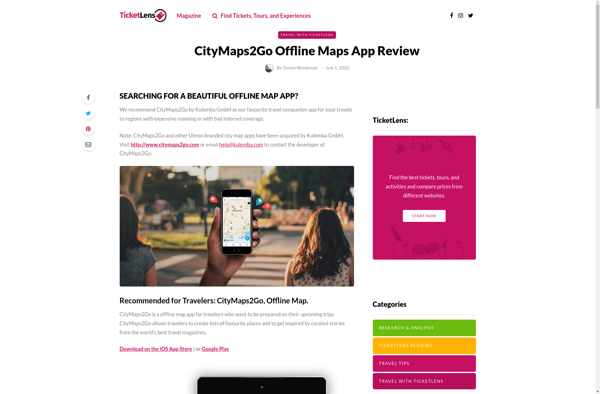
CityMaps2Go is an essential app for travelers who want access to detailed offline maps. With CityMaps2Go, you can download maps and points of interest for over 300 destinations worldwide so you can navigate confidently without using cell data or paying expensive roaming charges.Once the maps are downloaded, you have unlimited...
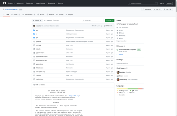
uNav is an open-source web browser developed by a non-profit organization dedicated to giving users control over their online privacy and security. Unlike other major browsers, uNav blocks ads, trackers, and malicious websites by default to protect users from surveillance, malware, and annoying ads.Despite its privacy focus, uNav does not...
Yandex Maps is a free online map service developed by Yandex, a Russian multinational technology company specializing in Internet-related services and products. Yandex Maps offers highly detailed and searchable maps, turn-by-turn navigation, public transit information, traffic data, and 360-degree panoramic street view images for over 220 countries around the world.The...
TomTom MyDrive is a free desktop and mobile app that interfaces with TomTom GPS navigation devices to provide expanded features and functionality. With MyDrive, users can plan routes and destinations on their computer, tablet, or phone and seamlessly send that information to their TomTom device.Key features of TomTom MyDrive include:Updated...
Guru Maps is an online mind mapping and brainstorming application designed to help users organize ideas and information visually. As an intuitive tool for project planning, brainstorming sessions, and task management, Guru Maps enables users to create colorful nonlinear maps to connect ideas, notes, files, links, and more.Key features of...
Qwant Maps is an open-source web mapping service developed by the French company Qwant aimed at providing privacy and protecting user data. Launched in 2019, Qwant Maps does not track user searches or collect private information the way many other mapping services do.Some key features of Qwant Maps include:Search for...
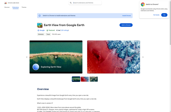
Earth View from Google Earth is a free browser extension available for Chrome, Firefox, and Edge that changes your new tab page to showcase gorgeous satellite photos of places around the world sourced from Google Earth. When you open a new tab, you'll be greeted with a breathtaking high resolution...
Mapline is an open-source, self-hosted web application that allows users to create custom maps for free. It is an alternative to proprietary services like Google My Maps.Some key features of Mapline include:Ability to add markers, lines, shapes, and text notes to your mapsSupport for multiple layers on a single mapOptions...
Windows Maps is a mapping service developed by Microsoft as part of the company's Windows services. It provides users with interactive road maps, aerial and streetside imagery, walking and driving directions, traffic information, location search, and the ability to save and sync collections like favorite places and routes across devices.Key...
Garmin StreetPilot Onboard is an in-vehicle GPS navigation system made by Garmin. It comes preloaded with detailed maps that provide turn-by-turn directions and voice guidance to help drivers navigate to their destinations.Key features of StreetPilot Onboard include:Millions of points of interest like gas stations, restaurants, hotels, ATMs, etc.Lane assist with...
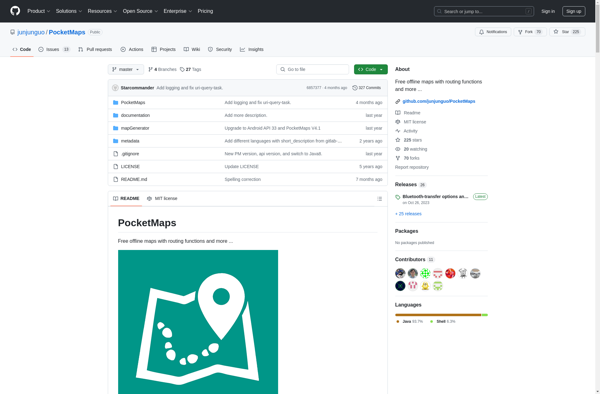
PocketMaps is an open source, offline GPS navigation app for Android devices. It allows users to download OpenStreetMap maps for offline use so navigation is possible without an internet connection. Some key features of PocketMaps include:Completely offline maps - no data connection needed once maps are downloadedTurn-by-turn voice guided GPS...
Localscope is an open-source, self-hosted alternative to Google Analytics. It provides many of the same website traffic analytics and reporting capabilities, but with a strong focus on privacy.Some key features of Localscope include:Open-source codebase that you can host on your own serversTracks standard metrics like pageviews, visits, referrers, etc.Provides real-time...
GeoNET is an open-source desktop application for geographic network analysis. Developed by CHAMP (Center for Health Assessment, Monitoring, and Policy), GeoNET provides tools for modeling, visualizing, and analyzing spatial networks such as transportation, infrastructure, and utility systems.With GeoNET, users can import existing GIS network datasets, or create new network models...
MapSphere is an open-source web mapping platform designed for creating custom interactive maps. It provides a user-friendly editor that allows users without GIS expertise to easily visualize various types of data on maps.Key features of MapSphere include:Intuitive drag-and-drop editor for adding vector and raster data layersCustom base maps using WMS,...
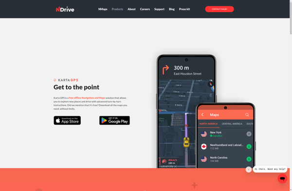
Karta GPS is a mapping, navigation, and GPS tracking app designed specifically for outdoor adventures like hiking, backpacking, cycling, and more. It provides topographic and terrain maps that work offline so you can navigate trails and rural areas without cell service.Some key features of Karta GPS include:Detailed topographic maps with...
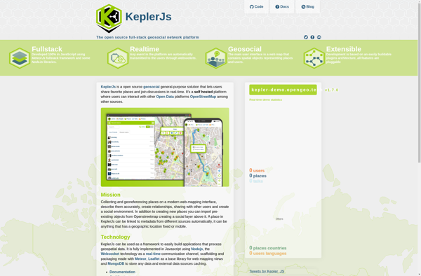
KeplerJs is an open-source web application framework for Node.js focused on scalability and high performance. It uses an asynchronous, non-blocking architecture optimized for handling a high volume of concurrent requests with low latency.Some key features of KeplerJs include:Built-in support for horizontal scaling across multiple CPU cores/serversFirst-class support for real-time features...
GMap.NET is an open source .NET control that allows embedding interactive maps from providers like Google, Bing, OpenStreetMap, WikiMapia, Yandex, ArcGIS and more into .NET applications. It was created in 2008 by Jan Mojžíš and is distributed under the LGPL license.Some key features of GMap.NET include:Support for various map providers...
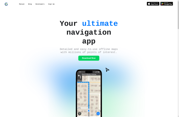
GPS Navigator is a feature-rich navigation and maps app for Android and iOS that is focused on providing accurate turn-by-turn directions even when offline. It sets itself apart by offering free offline map downloads for over 200 countries and territories worldwide, meaning you can navigate unfamiliar areas without racking up...
Google Maps Go is a streamlined version of the Google Maps app designed for Android Go edition devices. Android Go edition is a configuration of Android optimized for devices with less than 2GB of RAM, aimed at improving performance and accessibility in emerging markets.Some key features of Google Maps Go...
Yahoo! Maps is a free online map service owned and operated by Yahoo!. It offers interactive maps and satellite/aerial imagery of locations around the world, as well as street-level photography in some areas. Users can get driving, walking, public transit and biking directions, view real-time traffic information, create customized maps,...
Emerillon is a free, open source photo geotagging program for Linux operating systems. It provides an intuitive interface that allows users to easily geotag their collection of photos by plotting points on a map or entering GPS coordinates.Some key features of Emerillon include:Drag-and-drop interface for quickly importing photos.Ability to manually...
AddressToGPS is a Windows-based geocoding software used to convert street addresses into geographic coordinates like latitude and longitude. It has an easy-to-use interface where users can enter addresses, which are then converted into GPS coordinates that can be used in mapping software and GPS devices.Some key features of AddressToGPS include:Works...
Jawg Maps is an open-source, customizable mapping platform that can be used as an alternative to Google Maps. Some key features and benefits of Jawg Maps include:Global map coverage for over 200 countriesVector and raster map types with customizable stylesUser-friendly admin interface to manage maps, markers, layers, etc.Developer APIs and...
ShareNav is a browser extension and web application designed to help users organize, discover, and share links for research and reference. It serves as a central platform to capture and access references encountered during Web browsing and reading.Some of the key features of ShareNav include:Save links, PDFs, images, and snippets...
Tagzania is a productivity browser extension used to organize, tag and annotate web content you discover while browsing the internet. It works across various websites and platforms like news sites, blogs, social media, and more to help you save key information from online content.Some key features of Tagzania include:Adding custom...
MapQuery is an open-source desktop geographic information system (GIS) software application used for viewing, editing, and analyzing spatial data. Developed by the Oregon Department of Transportation, MapQuery provides a user-friendly interface and tools for working with maps and geographic information.Key features of MapQuery include:Interactive map display with zooming, panning, and...
Where To Travel Next is an AI-powered travel recommendation platform that aims to take the guesswork out of travel planning. The website prompts users with a series of questions about their budget, previous trips, interests, preferred climate, and more in order to generate a tailored list of destination ideas.Using complex...
Mappy is an online and mobile map service mainly focused on Europe. It provides detailed street-level maps for over 40 European countries, covering popular travel destinations like France, Germany, Italy, Spain, and the UK as well as smaller countries across the region.Key features of Mappy include:Interactive maps with zoom, pan,...
Doko Maps is an open-source, privacy-focused alternative to Google Maps. Developed by a non-profit organization, Doko Maps aims to provide an ethical mapping service that respects user privacy.Like Google Maps, Doko Maps offers features like turn-by-turn navigation for driving, walking, biking and public transit. It allows users to search for...
Gokivo Navigator is a free, open-source web browser developed as an alternative to more complex browsers. It was created with simplicity, speed, and ease-of-use as the main priorities.The interface has been designed to be clean and minimal, allowing users to focus on the web content rather than the browser itself....