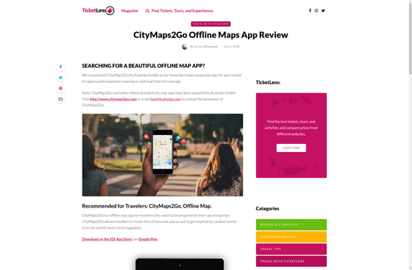
CityMaps2Go is an offline maps app for travelers. It allows you to download detailed maps to your phone or tablet so you can navigate a city without using cell data or paying roaming charges. The maps include searchable points of interest like restaurants, hotels, ATMs, etc.
Download detailed maps to your phone or tablet and navigate a city without using cell data or paying roaming charges. Find searchable points of interest like restaurants, hotels, ATMs, etc.
What is CityMaps2Go?
CityMaps2Go is an essential app for travelers who want access to detailed offline maps. With CityMaps2Go, you can download maps and points of interest for over 300 destinations worldwide so you can navigate confidently without using cell data or paying expensive roaming charges.
Once the maps are downloaded, you have unlimited access to them offline. You can search for points of interest like hotels, restaurants, museums, ATMs and more. The app provides walking, driving and transit directions to help you get anywhere in the city.
Some key features include:
Works completely offline so no cellular data or roaming charges
Detailed maps of streets, public transit lines, parks, etc.
Searchable points of interest like hotels, attractions, shops, etc.
Walking, driving and public transit directions
Bookmark favorite locations
Location sharing and trip planning tools
With detailed offline maps, directions and points of interest at your fingertips, CityMaps2Go is an essential travel companion and one of the best offline map apps available. It allows travelers to navigate confidently without incurring huge roaming charges.
CityMaps2Go Features
Features
Offline maps for cities worldwide
Searchable points of interest (restaurants, hotels, ATMs, etc.)
Turn-by-turn navigation
GPS tracking without using cellular data
Ability to save favorite locations and create custom maps
Pricing
Freemium
Pros
Allows for navigation without using cellular data or paying roaming charges
Detailed and up-to-date maps for many cities
Searchable points of interest are useful for travelers
Google Maps is a web mapping platform and consumer application offered by Google. It offers satellite imagery, aerial photography, street maps, 360° interactive panoramic views of streets, real-time traffic conditions, and route planning for traveling by foot, car, bicycle and air, or public transportation.Key features of Google Maps include:Interactive street...
Waze is a crowd-sourced GPS navigation and traffic app launched in 2008. It provides turn-by-turn navigation along with real-time traffic updates, road hazard reports, and user-submitted edits of roads and addresses.Key features of Waze include:Real-time traffic updates - Users can report accidents, traffic jams, police traps, etc. to alert other...
What Is MAPS.ME?MAPS.ME is a mobile maps and navigation app that provides detailed offline maps for over 200 countries. Originally open source, it was one of the first apps to make OpenStreetMap data accessible on mobile with a polished interface.Key FeaturesUsers download maps by country or region for fully offline...
OsmAnd (OpenStreetMap Automated Navigation Directions) is a free and open-source mobile map and navigation application developed for Android and iOS devices. It relies entirely on detailed, community-driven maps from the OpenStreetMap project and allows accessing them offline without an internet connection.Some of the key features and capabilities of OsmAnd include:Turn-by-turn...
OpenStreetMap (OSM) is a collaborative project to create a free and editable map of the world. Unlike proprietary map data from companies like Google or Apple, OSM map data is open and licensed under the Open Database License (ODbL), which allows anyone to use, modify, and distribute the data freely.The...
HERE WeGo is a free map and navigation app developed by HERE Technologies for iOS and Android devices. It allows users to navigate by car, public transportation, foot or bike using turn-by-turn voice guided directions. Key features of HERE WeGo include:Offline maps - Download maps to your device so you...
What Is Organic Maps?Organic Maps is a free, open-source maps and navigation app for Android and iOS. It uses OpenStreetMap data and works entirely offline — no internet connection needed for navigation, search, or route planning.Key FeaturesThe app provides turn-by-turn navigation for driving, cycling, and walking with voice guidance. Maps...
Apple Maps is a web mapping service developed by Apple Inc. It was introduced in 2012 with iOS 6 as a replacement for Google Maps on Apple devices. Apple Maps offers turn-by-turn navigation, interactive panoramic street views, Flyover mode for photorealistic 3D views of certain cities, support for transit routing...
Marble is a free and open source note taking application designed specifically for Linux desktop environments like KDE Plasma and GNOME. It provides a simple yet effective way to create rich text notes, tackle checklists, set reminders, and organize your notes into notebooks.Some of the key features of Marble include:Rich...
2GIS is a popular free map, local search and business directory mobile app and website operating in over 1800 cities across Russia, CIS, Europe, Asia and other countries. It offers detailed interactive maps, local business listings, navigation, reviews and other local information.Some key features of 2GIS include:Detailed vector maps for...
Transportr is an open-source public transportation app for Android devices. It is designed to help users search, plan, and navigate public transit systems in cities around the world.Some key features of Transportr include:Intuitive user interface for searching routes, planning trips, and viewing schedules and maps.Support for public transit systems in...
MAPCAT.com is an intuitive yet powerful online map creation and sharing platform. It enables anyone to quickly and easily create custom interactive maps, without needing any design or technical skills.With MAPCAT, users can add markers, lines, shapes, and custom icons to a map. Rich data can be connected to map...