MAPCAT.com is an online map creation and sharing platform that allows users to easily make custom maps by adding markers, lines, shapes, and custom icons. Users can collaborate on maps with others and publish or embed interactive maps on websites.
MAPCAT.com: Create Custom Maps with Interactive Features
MapCAT.com is an online map creation and sharing platform that allows users to easily make custom maps by adding markers, lines, shapes, and custom icons. Users can collaborate on maps with others and publish or embed interactive maps on websites.
What is MAPCAT.com?
MAPCAT.com is an intuitive yet powerful online map creation and sharing platform. It enables anyone to quickly and easily create custom interactive maps, without needing any design or technical skills.
With MAPCAT, users can add markers, lines, shapes, and custom icons to a map. Rich data can be connected to map features with custom data fields and photos. Users can collaborate together on maps by sharing and editing in real-time. Finished maps can be shared via a public link or embed code for display on websites, blogs, apps etc.
Key features include:
Intuitive drag and drop map creator
Mass import data from CSV/Excel files
Custom map icons and symbol libraries
Draw lines, shapes and add text to map
Attach photos, links and rich attributes to markers
Real-time map collaboration for teams
Generate public links or embed code to publish maps
Tons of customization and theming options
With an easy-to-master toolset and powerful capabilities, MAPCAT enables anyone to create beautiful interactive map visualizations to tell location-based stories and transport audiences anywhere in the world.
MAPCAT.com Features
Features
Online map creation and sharing platform
Add markers, lines, shapes, and custom icons to create custom maps
Collaborate with others on maps
Publish and embed interactive maps on websites
Pricing
Freemium
Subscription-Based
Pros
Easy to use interface for creating custom maps
Collaborative features for working with others
Ability to publish and embed maps on websites
Cons
Limited free plan with paid upgrades required for advanced features
May not have as many features as some desktop-based mapping software
Google Maps is a web mapping platform and consumer application offered by Google. It offers satellite imagery, aerial photography, street maps, 360° interactive panoramic views of streets, real-time traffic conditions, and route planning for traveling by foot, car, bicycle and air, or public transportation.Key features of Google Maps include:Interactive street...
Mapbox Studio is a powerful desktop application for designing custom map styles. It provides a graphical user interface that allows you to visually style vector tiles created with Mapbox tools and services.Some key features of Mapbox Studio include:Import vector tilesets created with Mapbox tools like Mapbox Streets and SatelliteStyle map...
HERE WeGo is a free map and navigation app developed by HERE Technologies for iOS and Android devices. It allows users to navigate by car, public transportation, foot or bike using turn-by-turn voice guided directions. Key features of HERE WeGo include:Offline maps - Download maps to your device so you...
Mapotic is an open-source, self-hosted alternative to Mapbox that provides developers and designers with tools for creating interactive maps. Some key features of Mapotic include:Ability to design custom base maps with Mapnik and CartoCSSSupport for overlaying vector and raster map tiles from various sourcesTools for visualizing, analyzing, and processing geospatial...
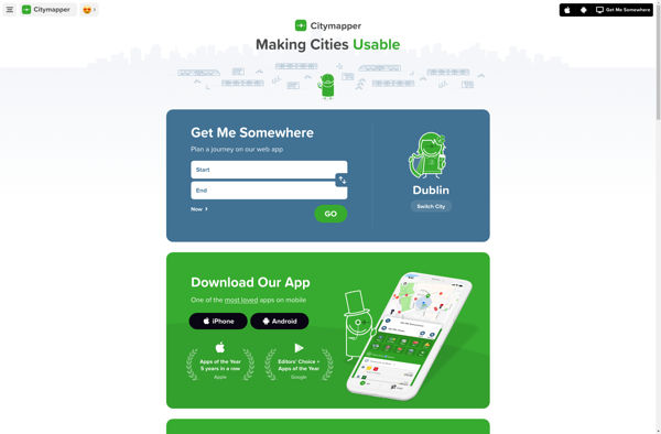
Citymapper is a mobile app and website that provides public transit information and directions for major cities around the world. First launched in 2011 for London's complex transit system, Citymapper has since expanded to over 80 cities globally.The app shows users comprehensive transit options combining subway, bus, rail, ferry, bike...
Map3 is a versatile mind mapping and brainstorming software used to visually organize ideas, concepts, notes, and tasks. With Map3, users can create flexible and free-flowing maps to connect thoughts and information.Some key features and capabilities of Map3 include:Tree, org chart, flowchart map views to structure informationTagging and searching maps...
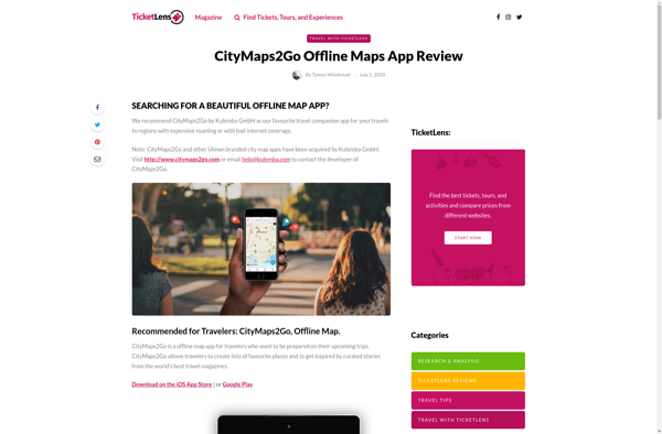
CityMaps2Go is an essential app for travelers who want access to detailed offline maps. With CityMaps2Go, you can download maps and points of interest for over 300 destinations worldwide so you can navigate confidently without using cell data or paying expensive roaming charges.Once the maps are downloaded, you have unlimited...
TomTom MyDrive is a free desktop and mobile app that interfaces with TomTom GPS navigation devices to provide expanded features and functionality. With MyDrive, users can plan routes and destinations on their computer, tablet, or phone and seamlessly send that information to their TomTom device.Key features of TomTom MyDrive include:Updated...
MapTiler Cloud is a cloud-based solution that allows users to create, style, optimize and deliver map tiles for web and mobile applications. Some key features include:Upload your own geospatial data like satellite/aerial imagery, DEMs, shapefiles, KMLs etc.Tiling engine that efficiently slices geospatial data into map tiles for zoom levelsMap styling...