MapTiler Cloud is a cloud-based raster and vector map tiling software. It allows users to upload geospatial data like satellite imagery, DEMs, shapefiles etc. and generate map tiles optimized for web and mobile apps. Key features include fast tiling, customizable styling, efficie
MapTiler Cloud: Cloud-based Raster and Vector Map Tiling Software
MapTiler Cloud is a cloud-based raster and vector map tiling software. It allows users to upload geospatial data like satellite imagery, DEMs, shapefiles etc. and generate map tiles optimized for web and mobile apps. Key features include fast tiling, customizable styling, efficient storage and bandwidth.
What is MapTiler Cloud?
MapTiler Cloud is a cloud-based solution that allows users to create, style, optimize and deliver map tiles for web and mobile applications. Some key features include:
Upload your own geospatial data like satellite/aerial imagery, DEMs, shapefiles, KMLs etc.
Tiling engine that efficiently slices geospatial data into map tiles for zoom levels
Map styling and customization tools for raster and vector data
Generate map caches for fast delivery of map tiles
Optimized tile storage to save bandwidth
Flexible cloud hosting of the map tiles
REST APIs and JavaScript libraries to display the vector/raster tiles
Secured user access controls on the data and maps
MapTiler Cloud is ideal for organizations that need to generate, host and manage large volumes of dynamic map tiles from their own geospatial big data. Use cases include basemaps, asset monitoring, planning and inspection maps for energy, government, mining, construction, agriculture etc.
MapTiler Cloud Features
Features
Upload geospatial data like satellite imagery, DEMs, shapefiles
Generate map tiles optimized for web and mobile apps
OpenStreetMap (OSM) is a collaborative project to create a free and editable map of the world. Unlike proprietary map data from companies like Google or Apple, OSM map data is open and licensed under the Open Database License (ODbL), which allows anyone to use, modify, and distribute the data freely.The...
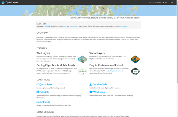
OpenLayers is an open source JavaScript library for displaying map data in web browsers. It provides an API for building rich web-based geographic applications.Some key features of OpenLayers include:Supports displaying map tiles and vector data from any sourceIncludes zooming, panning, layer switching controls out of the boxExtensive API for programatically...
Mapbox Studio is a powerful desktop application for designing custom map styles. It provides a graphical user interface that allows you to visually style vector tiles created with Mapbox tools and services.Some key features of Mapbox Studio include:Import vector tilesets created with Mapbox tools like Mapbox Streets and SatelliteStyle map...
HERE WeGo is a free map and navigation app developed by HERE Technologies for iOS and Android devices. It allows users to navigate by car, public transportation, foot or bike using turn-by-turn voice guided directions. Key features of HERE WeGo include:Offline maps - Download maps to your device so you...
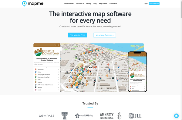
Mapme is an intuitive and collaborative online mind mapping and brainstorming application. It enables individuals and teams to visually organize ideas, projects, and workflows all in one place.Key features of Mapme include:Real-time collaboration - Work together on mindmaps at the same time for seamless brainstorming sessionsDiagramming and visualization - Easily...
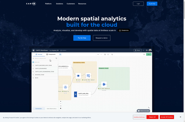
CartoDB is an open source platform for building location intelligence applications. It provides capabilities for spatial data storage, visualization, analysis, and publishing. Key features include:User-friendly drag and drop interface for creating interactive maps and dashboardsVisualization of geospatial datasets such as points, lines, and polygonsOptions for customizing maps with different basemaps,...
OpenGeo Suite is a comprehensive open source geospatial software stack used for building spatial data infrastructures and deploying web mapping applications. It brings together key open source geospatial components like PostGIS, GeoServer, GeoWebCache, and GeoExplorer into a single integrated suite.Some key capabilities and features of OpenGeo Suite include:PostGIS for spatial...
Mapotic is an open-source, self-hosted alternative to Mapbox that provides developers and designers with tools for creating interactive maps. Some key features of Mapotic include:Ability to design custom base maps with Mapnik and CartoCSSSupport for overlaying vector and raster map tiles from various sourcesTools for visualizing, analyzing, and processing geospatial...
Apple Maps is a web mapping service developed by Apple Inc. It was introduced in 2012 with iOS 6 as a replacement for Google Maps on Apple devices. Apple Maps offers turn-by-turn navigation, interactive panoramic street views, Flyover mode for photorealistic 3D views of certain cities, support for transit routing...
Map3 is a versatile mind mapping and brainstorming software used to visually organize ideas, concepts, notes, and tasks. With Map3, users can create flexible and free-flowing maps to connect thoughts and information.Some key features and capabilities of Map3 include:Tree, org chart, flowchart map views to structure informationTagging and searching maps...
Felt is an open-source web-based application for kanban-style project management and task tracking. It provides a visual interface for organizing tasks into pipelines represented as boards, lists, and cards.Some key features of Felt include:Boards to organize projects and track progress across different stagesCustom lists within each board to categorize tasks...
GeoServer is an open source server for sharing geospatial data. It is the reference implementation of the Open Geospatial Consortium (OGC) Web Feature Service (WFS) and Web Coverage Service (WCS) standards, as well as a high performance certified compliant Web Map Service (WMS). GeoServer forms a core component of the...
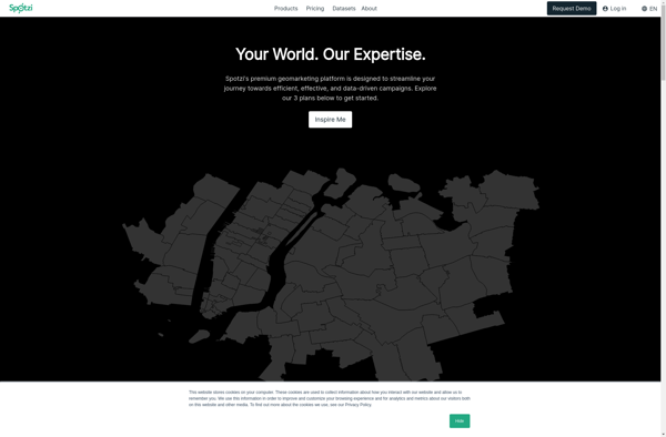
Spotzi is an alternative music streaming service similar to Spotify. It has many of the same core features as Spotify such as:Streaming music on-demandPlaylists and music recommendationsSocial features to follow friends and artistsMobile and desktop appsWhere Spotzi differs from Spotify is its focus on emerging and independent artists. Over half...
MapQuest is a free online mapping service launched in 1996 that provides users with driving directions, traffic conditions, route planning, and interactive maps. It was one of the first and most popular online mapping sites before the rise of Google Maps and Bing Maps.Key features of MapQuest include:Driving directions for...
Sharemap is an open-source web-based mind mapping and brainstorming application. It allows users to create colorful and visually engaging mind maps to organize ideas, concepts, and information. Some of the key features of Sharemap include:Real-time collaboration - Multiple users can work on the same mind map simultaneouslyRich formatting options -...
IndieMapper is an open source, offline-capable web map editor tailored for field mappers and humanitarians. It provides an intuitive and easy-to-use interface for collecting, editing, analyzing and exporting geographic data without an internet connection.Some key features of IndieMapper include:Works completely offline for areas with limited connectivityOpenStreetMap-based base maps with global...
OpenMapTiles is an open-source project that provides software and data to self-host various mapping services and capabilities. Some of the key components and capabilities include:Vector and raster map tiles - OpenMapTiles provides scripts and data to generate your own map tile sets including OpenStreetMap data. This allows hosting them yourself...
Google Maps Engine is a cloud-based mapping platform launched by Google in 2012. It allows users to store, visualize and share geographic data by creating custom maps.Some key features of Google Maps Engine include:Ability to upload spreadsheet data, KML files, geoJSON files to create layers on a mapConnect to external...
The Google Maps API for Business is a paid version of the Google Maps API targeted at business users. It provides additional features and services beyond the free Google Maps API, such as:Custom styling options - Businesses can customize the look and feel of maps to match their brand.Enhanced data...
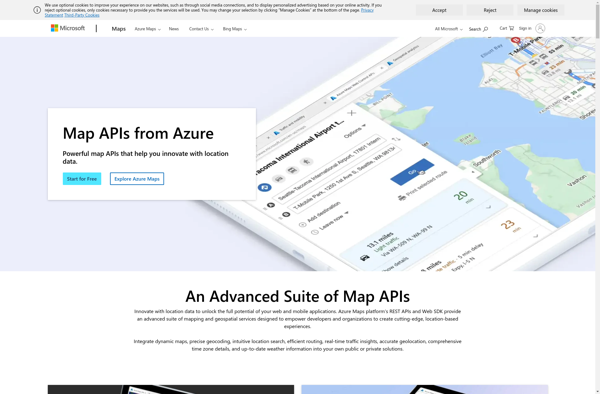
The Bing Map API by Microsoft is a robust mapping platform that enables developers to integrate interactive maps and spatial data into web or mobile applications. Some key capabilities include:Interactive map controls like panning, zooming, and map stylingAerial, road, and hybrid map viewsGeocoding to convert addresses to coordinates and vice...
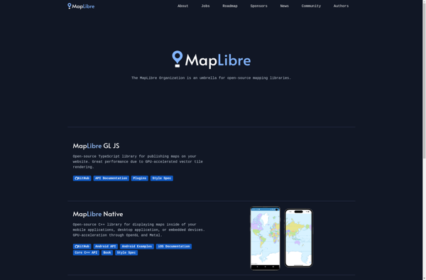
MapLibre is an open-source, community-led mapping platform designed as an alternative to proprietary solutions like Google Maps. Based on Leaflet and Mapbox GL JavaScript libraries, MapLibre provides embeddable interactive maps that can be customized via a JavaScript API or CSS.Key features of MapLibre include:Interactive slippy maps with panning, zooming, markers,...
TomTom Maps APIs are a suite of RESTful APIs that give developers access to TomTom's industry-leading mapping and traffic data. The APIs allow developers to tap into TomTom's global database of maps, routing intelligence, search capability, and real-time traffic information.Some key features of TomTom Maps APIs include:Routing API - Calculates...
MAPCAT.com is an intuitive yet powerful online map creation and sharing platform. It enables anyone to quickly and easily create custom interactive maps, without needing any design or technical skills.With MAPCAT, users can add markers, lines, shapes, and custom icons to a map. Rich data can be connected to map...