TomTom Maps APIs provide access to TomTom's global mapping and traffic data services for developers to integrate into their applications. The APIs offer routing, search, mapping visualization, and traffic analysis functions.
TomTom Maps APIs provide access to TomTom's global mapping and traffic data services for developers to integrate into their applications. The APIs offer routing, search, mapping visualization, and traffic analysis functions.
What is TomTom Maps APIs?
TomTom Maps APIs are a suite of RESTful APIs that give developers access to TomTom's industry-leading mapping and traffic data. The APIs allow developers to tap into TomTom's global database of maps, routing intelligence, search capability, and real-time traffic information.
Some key features of TomTom Maps APIs include:
Routing API - Calculates optimal routes between locations taking into account current traffic conditions. Supports features like waypoints, avoidance areas and electric vehicle routing.
Search API - Allows searching for points of interest by name or category. Results include location, contact info, ratings, etc.
Maps API - Provides map images, metadata and map interactivity using vector tiles. Customizable via themes.
Traffic API - Offers real-time traffic flow and incident data to enable traffic-aware routing and ETAs.
Geocoding & Reverse Geocoding - Converts locations into coordinates and vice versa.
Time Zone API - Determines the time zone for a given latitude/longitude.
Supported platforms - Browsers, Mobile, Server environments.
Global coverage - APIs provide data for North America, Europe, Australia & New Zealand so far.
Some common use cases include navigation and mobility apps, fleet management, asset tracking, urban planning, logistics and AI. Flexible licensing options from free Web Services to premium enterprise plans.
TomTom Maps APIs Features
Features
Global mapping and traffic data coverage
Routing and navigation capabilities
Search and geocoding functionality
Mapping visualization tools
Traffic analysis and real-time updates
Pricing
Pay-As-You-Go
Subscription-Based
Pros
Comprehensive and reliable mapping data
Wide range of location-based services
Customizable and scalable solutions
Enterprise-level support and documentation
Cons
Pricing can be complex and potentially costly for large-scale applications
Limited free usage tier
Potential vendor lock-in due to proprietary data and APIs
Mapbox Studio is a powerful desktop application for designing custom map styles. It provides a graphical user interface that allows you to visually style vector tiles created with Mapbox tools and services.Some key features of Mapbox Studio include:Import vector tilesets created with Mapbox tools like Mapbox Streets and SatelliteStyle map...
Mapotic is an open-source, self-hosted alternative to Mapbox that provides developers and designers with tools for creating interactive maps. Some key features of Mapotic include:Ability to design custom base maps with Mapnik and CartoCSSSupport for overlaying vector and raster map tiles from various sourcesTools for visualizing, analyzing, and processing geospatial...
Map3 is a versatile mind mapping and brainstorming software used to visually organize ideas, concepts, notes, and tasks. With Map3, users can create flexible and free-flowing maps to connect thoughts and information.Some key features and capabilities of Map3 include:Tree, org chart, flowchart map views to structure informationTagging and searching maps...
Felt is an open-source web-based application for kanban-style project management and task tracking. It provides a visual interface for organizing tasks into pipelines represented as boards, lists, and cards.Some key features of Felt include:Boards to organize projects and track progress across different stagesCustom lists within each board to categorize tasks...
The Google Maps API for Business is a paid version of the Google Maps API targeted at business users. It provides additional features and services beyond the free Google Maps API, such as:Custom styling options - Businesses can customize the look and feel of maps to match their brand.Enhanced data...
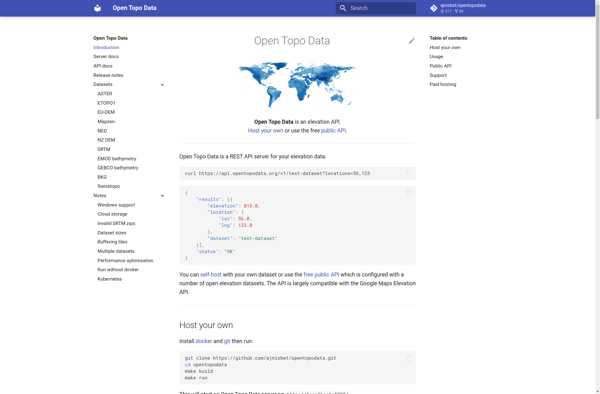
Open Topo Data is a free, open-source topographic map dataset that covers the entire continental United States. It is developed and maintained by volunteers with the goal of providing high-quality topographic data for public use.The dataset includes detailed vector-based mapping data such as contours, hydrography, landcover, transportation, boundaries, structures, and...
The Bing Map API by Microsoft is a robust mapping platform that enables developers to integrate interactive maps and spatial data into web or mobile applications. Some key capabilities include:Interactive map controls like panning, zooming, and map stylingAerial, road, and hybrid map viewsGeocoding to convert addresses to coordinates and vice...
MapTiler Cloud is a cloud-based solution that allows users to create, style, optimize and deliver map tiles for web and mobile applications. Some key features include:Upload your own geospatial data like satellite/aerial imagery, DEMs, shapefiles, KMLs etc.Tiling engine that efficiently slices geospatial data into map tiles for zoom levelsMap styling...