Modest Maps is an open source JavaScript mapping library for embedding interactive maps in web pages. It provides a simple API for panning, zooming, overlays and markers.
Modest Maps: Open Source Interactive Mapping Library
An open source JavaScript mapping library for embedding interactive maps in web pages, providing a simple API for panning, zooming, overlays and markers.
What is Modest Maps?
Modest Maps is an open source JavaScript mapping library designed for easily embedding interactive maps into web pages. Some key features of Modest Maps include:
Lightweight and customizable - Only about 6KB when minified and gzipped
Supports various map tile sources including OpenStreetMap, MapQuest, and CloudMade
Provides API for basic interactions like panning, zooming, adding markers, polygons, and polylines
Abstracts away browser differences and handles events cross-browser
Actively maintained on GitHub with over 5 years of development
Modest Maps is a good choice if you need to embed customizable interactive maps that work across devices and platforms. The small footprint makes it well-suited for integrating into existing web applications without bloat. Developers can use the extension framework to add features like geosearch and geometry overlays. The API focuses on geographic functions rather than UI controls, making Modest Maps flexible to build upon.
Modest Maps Features
Features
Open source JavaScript library for interactive maps
Supports panning, zooming, overlays, markers
Lightweight and customizable
Works with tile services like OpenStreetMap
Client-side rendering
Mobile support
Plugin architecture
Pricing
Open Source
Pros
Lightweight and fast
Easy to integrate and customize
Good documentation
Active community support
Free and open source
Cons
Limited built-in features compared to commercial alternatives
Google Maps is a web mapping platform and consumer application offered by Google. It offers satellite imagery, aerial photography, street maps, 360° interactive panoramic views of streets, real-time traffic conditions, and route planning for traveling by foot, car, bicycle and air, or public transportation.Key features of Google Maps include:Interactive street...
Google Earth is a geobrowser that accesses satellite and aerial imagery, ocean bathymetry, and other geographic data over the internet to represent the Earth as a three-dimensional globe. It was originally developed by Keyhole, Inc., a company acquired by Google in 2004.Google Earth allows users to search for addresses and...
OsmAnd (OpenStreetMap Automated Navigation Directions) is a free and open-source mobile map and navigation application developed for Android and iOS devices. It relies entirely on detailed, community-driven maps from the OpenStreetMap project and allows accessing them offline without an internet connection.Some of the key features and capabilities of OsmAnd include:Turn-by-turn...
OpenStreetMap (OSM) is a collaborative project to create a free and editable map of the world. Unlike proprietary map data from companies like Google or Apple, OSM map data is open and licensed under the Open Database License (ODbL), which allows anyone to use, modify, and distribute the data freely.The...
HERE WeGo is a free map and navigation app developed by HERE Technologies for iOS and Android devices. It allows users to navigate by car, public transportation, foot or bike using turn-by-turn voice guided directions. Key features of HERE WeGo include:Offline maps - Download maps to your device so you...
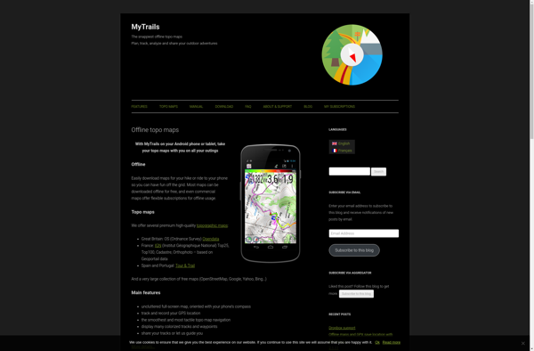
MyTrails is a custom trail mapping application designed for outdoor enthusiasts who want to record details of trails they have hiked, biked, or explored. With MyTrails, users can log vital stats for each trail like length, elevation gain, difficulty rating, etc. as well as document their experience through photos, maps,...
What Is Organic Maps?Organic Maps is a free, open-source maps and navigation app for Android and iOS. It uses OpenStreetMap data and works entirely offline — no internet connection needed for navigation, search, or route planning.Key FeaturesThe app provides turn-by-turn navigation for driving, cycling, and walking with voice guidance. Maps...
Bing Maps 3D is a 3D mapping platform from Microsoft that provides interactive maps and location intelligence services. It is part of the Bing Maps product suite.Some key features of Bing Maps 3D include:Interactive 3D map views with support for aerial, road, and hybrid map stylesAbility to incorporate 3D maps...
Apple Maps is a web mapping service developed by Apple Inc. It was introduced in 2012 with iOS 6 as a replacement for Google Maps on Apple devices. Apple Maps offers turn-by-turn navigation, interactive panoramic street views, Flyover mode for photorealistic 3D views of certain cities, support for transit routing...
Leaflet is an open-source JavaScript library for building web mapping applications. Here is a more detailed overview:- Leaflet is designed with simplicity, performance and usability in mind. It offers easy integration with other mapping libraries and APIs.- The library is extremely lightweight at only about 38 KB, which allows for...
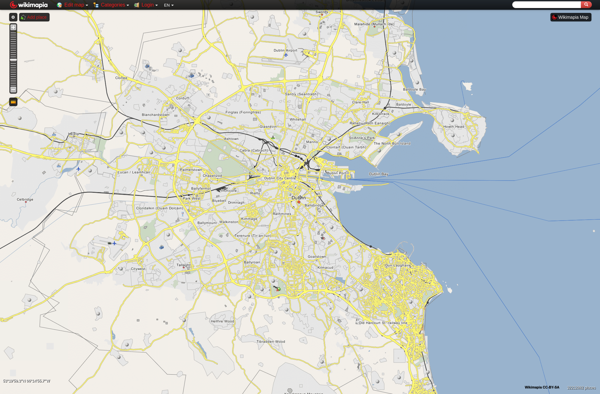
Wikimapia is a free, online map and satellite imaging resource that combines the functionality of Google Maps with a wiki component that allows users to add information, edits, and notes to any location in the world.Launched in 2006, Wikimapia aims to create a highly detailed, user-generated world map. The goal...
Yandex.Navigator is a popular free turn-by-turn navigation app developed by Yandex for Android and iOS devices. It provides real-time traffic information, speed limit warnings, lane assistance and offline maps for over 190 countries.Some key features of Yandex.Navigator include:Turn-by-turn voice guided navigation with offline maps so you can navigate without an...
Showmystreet is an open source web application developed by mySociety that enables citizens to report, view, and discuss local issues in their area. Users can pinpoint problems like potholes, broken streetlights, graffiti, rubbish dumping, etc. on an interactive map and submit reports to their local councils.Some key features of Showmystreet...
2GIS is a popular free map, local search and business directory mobile app and website operating in over 1800 cities across Russia, CIS, Europe, Asia and other countries. It offers detailed interactive maps, local business listings, navigation, reviews and other local information.Some key features of 2GIS include:Detailed vector maps for...
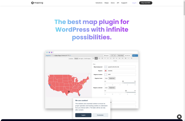
MapSVG is a feature-rich JavaScript SVG mapping library used to build interactive vector maps. It provides an easy way to display different geographical maps like country maps, state maps, city maps, maps with multiple layers, and floorplans.Some key features of MapSVG include:Creating interactive clickable maps from SVG filesConfiguring tooltips, popups,...
Transportr is an open-source public transportation app for Android devices. It is designed to help users search, plan, and navigate public transit systems in cities around the world.Some key features of Transportr include:Intuitive user interface for searching routes, planning trips, and viewing schedules and maps.Support for public transit systems in...
OpenMaps is an open source web mapping platform built on top of OpenStreetMap data. It allows users to create custom maps by drawing on top of existing maps and adding their own annotations, text labels, and lines/shapes. These custom maps can then be exported, embedded on websites, or shared publicly...
MapDroyd is a free, open-source map viewing and editing app for Android. It allows users to download map data for offline use and view, create, and edit maps when internet connectivity is limited.Key features of MapDroyd include:Ability to download OpenStreetMap data for offline map viewingSupport for standard mapping features like...
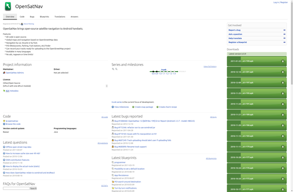
OpenSatNav is an open source navigation software that provides turn-by-turn GPS navigation and route planning for personal use. It can be installed on Windows, Linux, and Android devices and used completely offline thanks to its support for offline map downloads.Key features of OpenSatNav include:Turn-by-turn voice guided GPS navigationSupport for offline...
GeoFlow is a no-code platform used to create interactive maps and spatial data visualizations. It provides an easy-to-use visual interface that allows users to import, analyze, and visualize location data without writing any code.Some key features of GeoFlow include:Intuitive drag-and-drop interface to build maps and dashboardsVariety of customizable and interactive...