Bing Maps 3D icon

Bing Maps 3D

Bing Maps 3D is a 3D mapping platform from Microsoft that provides interactive maps and location intelligence services. It allows developers to incorporate 3D maps into websites and applications with support for custom styling, search, routing, and traffic data.

What is Bing Maps 3D?

Bing Maps 3D is a 3D mapping platform from Microsoft that provides interactive maps and location intelligence services. It is part of the Bing Maps product suite.

Some key features of Bing Maps 3D include:

  • Interactive 3D map views with support for aerial, road, and hybrid map styles
  • Ability to incorporate 3D maps into websites and applications using the Bing Maps API
  • Custom 3D map styling options
  • 3D landmark building overlays for major cities
  • Search functionality to find locations and points of interest
  • Routing and traffic data to provide directions and visualize real-time traffic conditions
  • Support for custom 3D pushpins, shapes, and image overlays
  • Options for rotating, tilting, and controlling the 3D map perspective
  • Spatial data management and analysis through the platform

Bing Maps 3D provides an interactive way to visualize location-based data and build geo-aware applications and websites. Its API allows developers to tap into these 3D mapping capabilities. The platform is offered as part of Microsoft's Bing Maps product suite.

The Best Bing Maps 3D Alternatives

Top Apps like Bing Maps 3D

Google Maps, Google Earth, HERE WeGo, Microsoft MapPoint, Modest Maps, Apple Maps, TransforMap, Leaflet, TerraExplorer, Google Earth VR, showmystreet, TomTom MyDrive, Mapline, Hyperlapse Map, eyeMaps, Urthecast are some alternatives to Bing Maps 3D.

Google Maps

Google Maps is a web mapping platform and consumer application offered by Google. It offers satellite imagery, aerial photography, street maps, 360° interactive panoramic views of streets, real-time traffic conditions, and route planning for traveling by foot, car, bicycle and air, or public transportation.Key features of Google Maps include:Interactive...

Google Earth

Google Earth is a geobrowser that accesses satellite and aerial imagery, ocean bathymetry, and other geographic data over the internet to represent the Earth as a three-dimensional globe. It was originally developed by Keyhole, Inc., a company acquired by Google in 2004.Google Earth allows users to search for addresses and...

HERE WeGo

HERE WeGo is a free map and navigation app developed by HERE Technologies for iOS and Android devices. It allows users to navigate by car, public transportation, foot or bike using turn-by-turn voice guided directions. Key features of HERE WeGo include:Offline maps - Download maps to your device so...

Microsoft MapPoint

Microsoft MapPoint is a discontinued mapping and geographic information system (GIS) software application. It was developed by Microsoft to help users visualize data on maps, create custom maps, perform geographic analysis, and integrate location intelligence into various business processes and workflows.MapPoint allowed users to import, analyze and map data...

Modest Maps

Modest Maps is an open source JavaScript mapping library designed for easily embedding interactive maps into web pages. Some key features of Modest Maps include:Lightweight and customizable - Only about 6KB when minified and gzippedSupports various map tile sources including OpenStreetMap, MapQuest, and CloudMadeProvides API for basic interactions like...

Apple Maps

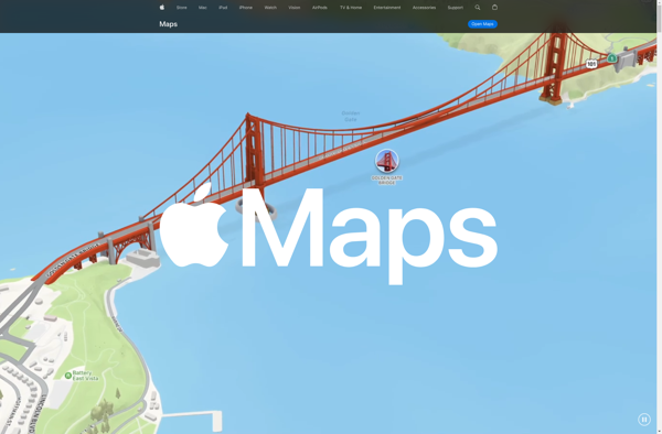
Apple Maps is a web mapping service developed by Apple Inc. It was introduced in 2012 with iOS 6 as a replacement for Google Maps on Apple devices. Apple Maps offers turn-by-turn navigation, interactive panoramic street views, Flyover mode for photorealistic 3D views of certain cities, support for transit routing and real-time...

TransforMap

TransforMap is a free, open-source mind mapping and brainstorming software. It allows users to visually organize ideas, tasks, projects, and other information with the flexibility of a mind map interface.With TransforMap, users can:Create branching mind maps to break down large concepts and projects into an organized structureConnect related...

Leaflet

Leaflet is an open-source JavaScript library for building web mapping applications. Here is a more detailed overview:- Leaflet is designed with simplicity, performance and usability in mind. It offers easy integration with other mapping libraries and APIs.- The library is extremely lightweight at only about 38 KB, which allows...

TerraExplorer

TerraExplorer is a powerful 3D GIS software solution developed by Skyline Software Systems. It enables users to import, analyze, and visualize complex 3D geospatial data from a variety of sources including GIS, CAD, BIM, and point clouds.With TerraExplorer, users can create highly accurate and realistic 3D environments by overlaying...

Google Earth VR

Google Earth VR is a virtual reality application developed by Google that allows users to explore the planet through an immersive 3D environment. It works with VR headsets like the Oculus Rift, HTC Vive, and Windows Mixed Reality headsets to give users the experience of flying over cities, landmarks, and...

Showmystreet

Showmystreet is an open source web application developed by mySociety that enables citizens to report, view, and discuss local issues in their area. Users can pinpoint problems like potholes, broken streetlights, graffiti, rubbish dumping, etc. on an interactive map and submit reports to their local councils.Some key features of...

TomTom MyDrive

TomTom MyDrive is a free desktop and mobile app that interfaces with TomTom GPS navigation devices to provide expanded features and functionality. With MyDrive, users can plan routes and destinations on their computer, tablet, or phone and seamlessly send that information to their TomTom device.Key features of TomTom MyDrive...

Mapline

Mapline is an open-source, self-hosted web application that allows users to create custom maps for free. It is an alternative to proprietary services like Google My Maps.Some key features of Mapline include:Ability to add markers, lines, shapes, and text notes to your mapsSupport for multiple layers on a...

Hyperlapse Map

Hyperlapse Map is a mobile app that makes time-lapse videography simple and accessible. It utilizes a phone's camera and GPS to capture timelapses that can be mapped to the route traveled.To use the app, you simply open it and press record as you walk, drive, or move along any...

EyeMaps

eyeMaps is a feature-rich mind mapping and brainstorming software used by individuals and teams to visually organize ideas and concepts. It provides an intuitive drag-and-drop interface that allows users to easily create mind maps that include topics, subtopics, notes, attachments, task lists and more.With eyeMaps, users can brainstorm ideas...

Urthecast

Urthecast is a Vancouver-based technology company that specializes in geospatial data and services by leveraging its network of Earth Observation (EO) sensors in space. The company provides imagery and data for a wide range of industries through its UrtheDaily, streaming video, and API services.Urthecast operates the world's first commercially-available...