TransforMap is an open-source mind mapping and brainstorming software. It allows users to visually organize ideas, tasks, and projects into mind maps with branches, connect related elements with arrows, customize colors/fonts, and export maps as images.
Visualize your ideas with TransforMap, an open-source mind mapping and brainstorming tool, customize colors and fonts, export maps as images, and organize tasks and projects in a unique way.
What is TransforMap?
TransforMap is a free, open-source mind mapping and brainstorming software. It allows users to visually organize ideas, tasks, projects, and other information with the flexibility of a mind map interface.
With TransforMap, users can:
Create branching mind maps to break down large concepts and projects into an organized structure
Connect related topics, ideas, or tasks with arrows to show relationships
Customize the colors, fonts, icons, and styles used in mind maps for enhanced visual organization
Add notes, attachments, and links to mind map topics for additional context and information
Export mind maps as image files like JPEG, PNG, PDF to share with others or insert into documents
TransforMap gives users an intuitive and visual way to lay out complex ideas as well as brainstorm new ones. Its mind mapping format helps improve organization, long-term recall, and productive thinking. As an open-source software, TransforMap is completely free and available for Windows, Mac, and Linux operating systems.
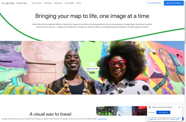
Google Street View is a technology featured in Google Maps and Google Earth that provides interactive panoramic views from positions along many streets in the world. It was launched in 2007 originally only for a few cities in the United States, but has expanded to include cities and rural areas...
Google Maps is a web mapping platform and consumer application offered by Google. It offers satellite imagery, aerial photography, street maps, 360° interactive panoramic views of streets, real-time traffic conditions, and route planning for traveling by foot, car, bicycle and air, or public transportation.Key features of Google Maps include:Interactive street...
Google Earth is a geobrowser that accesses satellite and aerial imagery, ocean bathymetry, and other geographic data over the internet to represent the Earth as a three-dimensional globe. It was originally developed by Keyhole, Inc., a company acquired by Google in 2004.Google Earth allows users to search for addresses and...
What Is MAPS.ME?MAPS.ME is a mobile maps and navigation app that provides detailed offline maps for over 200 countries. Originally open source, it was one of the first apps to make OpenStreetMap data accessible on mobile with a polished interface.Key FeaturesUsers download maps by country or region for fully offline...
OsmAnd (OpenStreetMap Automated Navigation Directions) is a free and open-source mobile map and navigation application developed for Android and iOS devices. It relies entirely on detailed, community-driven maps from the OpenStreetMap project and allows accessing them offline without an internet connection.Some of the key features and capabilities of OsmAnd include:Turn-by-turn...
OpenStreetMap (OSM) is a collaborative project to create a free and editable map of the world. Unlike proprietary map data from companies like Google or Apple, OSM map data is open and licensed under the Open Database License (ODbL), which allows anyone to use, modify, and distribute the data freely.The...
HERE WeGo is a free map and navigation app developed by HERE Technologies for iOS and Android devices. It allows users to navigate by car, public transportation, foot or bike using turn-by-turn voice guided directions. Key features of HERE WeGo include:Offline maps - Download maps to your device so you...
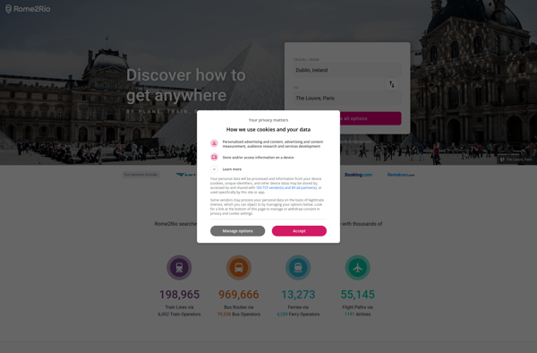
Rome2rio is a popular travel search engine and route planning website and app. It allows users to explore all possible transport options and routes between locations, compare prices across different modes of transport like flights, trains, buses and ferries, and book tickets from its site.Some key features of Rome2rio include:Comprehensive...
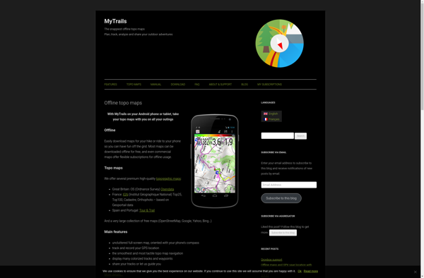
MyTrails is a custom trail mapping application designed for outdoor enthusiasts who want to record details of trails they have hiked, biked, or explored. With MyTrails, users can log vital stats for each trail like length, elevation gain, difficulty rating, etc. as well as document their experience through photos, maps,...
What Is Organic Maps?Organic Maps is a free, open-source maps and navigation app for Android and iOS. It uses OpenStreetMap data and works entirely offline — no internet connection needed for navigation, search, or route planning.Key FeaturesThe app provides turn-by-turn navigation for driving, cycling, and walking with voice guidance. Maps...
Bing Maps 3D is a 3D mapping platform from Microsoft that provides interactive maps and location intelligence services. It is part of the Bing Maps product suite.Some key features of Bing Maps 3D include:Interactive 3D map views with support for aerial, road, and hybrid map stylesAbility to incorporate 3D maps...
Apple Maps is a web mapping service developed by Apple Inc. It was introduced in 2012 with iOS 6 as a replacement for Google Maps on Apple devices. Apple Maps offers turn-by-turn navigation, interactive panoramic street views, Flyover mode for photorealistic 3D views of certain cities, support for transit routing...
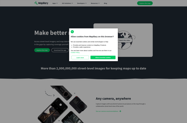
Mapillary is an open source platform for sharing and using crowdsourced street-level imagery. It combines high-resolution 360-degree panoramic photos taken by users all over the world with computer vision algorithms to map and understand what is captured in those images.Users can explore places virtually through immersive panoramic photo spheres mapped...
Leaflet is an open-source JavaScript library for building web mapping applications. Here is a more detailed overview:- Leaflet is designed with simplicity, performance and usability in mind. It offers easy integration with other mapping libraries and APIs.- The library is extremely lightweight at only about 38 KB, which allows for...
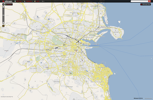
Wikimapia is a free, online map and satellite imaging resource that combines the functionality of Google Maps with a wiki component that allows users to add information, edits, and notes to any location in the world.Launched in 2006, Wikimapia aims to create a highly detailed, user-generated world map. The goal...
Yandex.Navigator is a popular free turn-by-turn navigation app developed by Yandex for Android and iOS devices. It provides real-time traffic information, speed limit warnings, lane assistance and offline maps for over 190 countries.Some key features of Yandex.Navigator include:Turn-by-turn voice guided navigation with offline maps so you can navigate without an...
Showmystreet is an open source web application developed by mySociety that enables citizens to report, view, and discuss local issues in their area. Users can pinpoint problems like potholes, broken streetlights, graffiti, rubbish dumping, etc. on an interactive map and submit reports to their local councils.Some key features of Showmystreet...
Map Pad is a free, open-source note-taking and information management software that provides an alternative to commercial options like Microsoft OneNote or Evernote. It uses an interactive and customizable map interface to help users visually organize their notes and information.With Map Pad, all your notes, documents, links and media files...
2GIS is a popular free map, local search and business directory mobile app and website operating in over 1800 cities across Russia, CIS, Europe, Asia and other countries. It offers detailed interactive maps, local business listings, navigation, reviews and other local information.Some key features of 2GIS include:Detailed vector maps for...
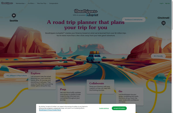
Roadtrippers is a popular road trip planning and navigation app and website. It allows users to easily map out road trip routes, find interesting stops and places to stay along the way, and estimate drive times and fuel costs.Some key features of Roadtrippers include:A database of over 1.5 million attractions,...
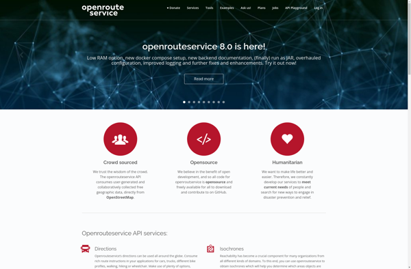
OpenRouteService.org (ORS) is an open source routing service developed by HeiGIT (Heidelberg Institute for Geoinformation Technology) at Heidelberg University. It provides services for route planning and navigation for various modes of transportation including driving, walking, and cycling.Some key features of ORS include:Supports route planning and navigation for driving cars, riding...
Pixel Map Generator is a free online application that makes it easy for anyone to create customized pixelated images, maps, game assets, and more. With its user-friendly interface, you can easily draw and edit pixel art without needing any artistic or technical skills.To start designing pixel art, you simply open...
Hyperlapse Map is a mobile app that makes time-lapse videography simple and accessible. It utilizes a phone's camera and GPS to capture timelapses that can be mapped to the route traveled.To use the app, you simply open it and press record as you walk, drive, or move along any path....
OpenMaps is an open source web mapping platform built on top of OpenStreetMap data. It allows users to create custom maps by drawing on top of existing maps and adding their own annotations, text labels, and lines/shapes. These custom maps can then be exported, embedded on websites, or shared publicly...
UMP-pcPL is an open-source, cross-platform packet manipulation and traffic generation software designed for testing and benchmarking networks and devices. It provides a suite of tools that allow users to construct custom packets, replay traffic from packet captures, generate traffic and flows, and assess performance.Some key features of UMP-pcPL include:Constructing custom...
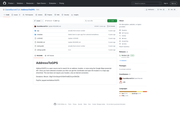
AddressToGPS is a Windows-based geocoding software used to convert street addresses into geographic coordinates like latitude and longitude. It has an easy-to-use interface where users can enter addresses, which are then converted into GPS coordinates that can be used in mapping software and GPS devices.Some key features of AddressToGPS include:Works...
MapDroyd is a free, open-source map viewing and editing app for Android. It allows users to download map data for offline use and view, create, and edit maps when internet connectivity is limited.Key features of MapDroyd include:Ability to download OpenStreetMap data for offline map viewingSupport for standard mapping features like...
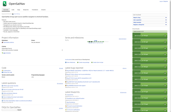
OpenSatNav is an open source navigation software that provides turn-by-turn GPS navigation and route planning for personal use. It can be installed on Windows, Linux, and Android devices and used completely offline thanks to its support for offline map downloads.Key features of OpenSatNav include:Turn-by-turn voice guided GPS navigationSupport for offline...
CMaps Analytics is a business intelligence and data visualization platform designed to help companies unlock insights from their data. Some key capabilities and benefits include:Intuitive drag-and-drop interface to build interactive dashboards and reports without codingConnect to various data sources such as SQL, NoSQL databases, cloud apps, etc.Perform ad hoc analysis...
GeoFlow is a no-code platform used to create interactive maps and spatial data visualizations. It provides an easy-to-use visual interface that allows users to import, analyze, and visualize location data without writing any code.Some key features of GeoFlow include:Intuitive drag-and-drop interface to build maps and dashboardsVariety of customizable and interactive...
Old Maps Online is a free web application to view, search, share and georeference historical maps. It was launched in 2010 by Klokan Technologies GmbH in cooperation with libraries and archives from all over the world.The site contains a collection of over 370,000 maps and views from the 15th to...
Tagzania is a productivity browser extension used to organize, tag and annotate web content you discover while browsing the internet. It works across various websites and platforms like news sites, blogs, social media, and more to help you save key information from online content.Some key features of Tagzania include:Adding custom...
Where To Travel Next is an AI-powered travel recommendation platform that aims to take the guesswork out of travel planning. The website prompts users with a series of questions about their budget, previous trips, interests, preferred climate, and more in order to generate a tailored list of destination ideas.Using complex...
tubenav is an open source YouTube desktop client for Linux operating systems. It provides an alternative user interface and feature set compared to YouTube's official website or mobile apps.Some of the key features of tubenav include:Browsing and searching YouTube videosPlaying videos in a custom playerManaging subscriptions and playlistsDownloading videosListening to...
QLook is an open-source alternative to QuickBooks aimed at small businesses and freelancers who need an easy way to manage their finances. Here are some key details about QLook:Free and open-source software licensed under GPLv3.Supports common small business accounting needs like invoicing, expense/income tracking, financial reporting, bank imports, bill payments,...
HoursOf is an easy-to-use time tracking and invoicing software designed for freelancers, consultants, agencies, and small business teams. Its key features include:Time Tracking - Use running timers to track time as you work. Enter time manually with quick calendar entries. Tag times to projects, clients, and tasks.Productivity Reports - Generate...