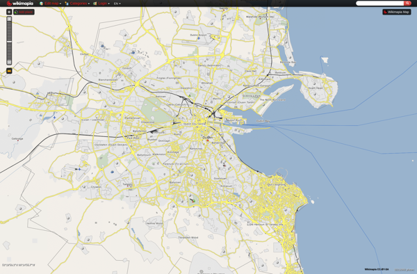
Wikimapia is a free, online map and satellite imaging resource that combines Google Maps with a wiki component. Users can add information, edits, and notes to any location in the world. It allows users to learn about different places and contribute knowledge.
Discover a free online map and satellite imaging resource combining Google Maps with a wiki component, allowing users to add information, edits, and notes to any location in the world.
What is Wikimapia?
Wikimapia is a free, online map and satellite imaging resource that combines the functionality of Google Maps with a wiki component that allows users to add information, edits, and notes to any location in the world.
Launched in 2006, Wikimapia aims to create a highly detailed, user-generated world map. The goal is to allow users to learn about different places and contribute their local knowledge. Any registered user can add a point, draw a polygon, or edit information about a location.
Some key features of Wikimapia include:
Interactive world map powered by Google Maps
Ability for users to describe and tag any location
Categories like buildings, restaurants, roads, etc.
Photos, links, and references can be added for points of interest
Multilingual - available in over 100 languages
User ratings and reviews
Dedicated discussion section for every place
XML data export option
Overall, Wikimapia leverages its community of users to create a rich, informative and multilingual map that documents the world around us. It allows anyone to contribute knowledge and learn about locations at both a macro and micro level.
Wikimapia Features
Features
Allows users to add notes, edits, and information to any location in the world
Combines satellite imagery with crowd-sourced information
Has a wiki component that allows collaborative editing of location information
Integrates with Google Maps for base mapping
Includes street view and aerial imagery in many locations
Pricing
Free
Pros
Free and easy to use
Contains a large amount of user-generated location information
Allows anyone to contribute knowledge about places
Provides both maps and satellite imagery
Interface is similar to Google Maps so easy to navigate
Cons
Information quality can vary since anyone can edit
Limited tools for verifying accuracy of user contributions
Google Maps is a web mapping platform and consumer application offered by Google. It offers satellite imagery, aerial photography, street maps, 360° interactive panoramic views of streets, real-time traffic conditions, and route planning for traveling by foot, car, bicycle and air, or public transportation.Key features of Google Maps include:Interactive street...
Google Earth is a geobrowser that accesses satellite and aerial imagery, ocean bathymetry, and other geographic data over the internet to represent the Earth as a three-dimensional globe. It was originally developed by Keyhole, Inc., a company acquired by Google in 2004.Google Earth allows users to search for addresses and...
OpenStreetMap (OSM) is a collaborative project to create a free and editable map of the world. Unlike proprietary map data from companies like Google or Apple, OSM map data is open and licensed under the Open Database License (ODbL), which allows anyone to use, modify, and distribute the data freely.The...
Modest Maps is an open source JavaScript mapping library designed for easily embedding interactive maps into web pages. Some key features of Modest Maps include:Lightweight and customizable - Only about 6KB when minified and gzippedSupports various map tile sources including OpenStreetMap, MapQuest, and CloudMadeProvides API for basic interactions like panning,...
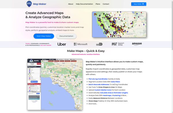
Map Maker by Google is a free, web-based tool that allows anyone to create custom Google Maps without needing expertise in geographic information systems (GIS). It has an intuitive drag-and-drop interface that makes it easy for users to add their own locations, landmarks, boundaries, lines, shapes, notes, and custom imagery...
Apple Maps is a web mapping service developed by Apple Inc. It was introduced in 2012 with iOS 6 as a replacement for Google Maps on Apple devices. Apple Maps offers turn-by-turn navigation, interactive panoramic street views, Flyover mode for photorealistic 3D views of certain cities, support for transit routing...
TransforMap is a free, open-source mind mapping and brainstorming software. It allows users to visually organize ideas, tasks, projects, and other information with the flexibility of a mind map interface.With TransforMap, users can:Create branching mind maps to break down large concepts and projects into an organized structureConnect related topics, ideas,...
Leaflet is an open-source JavaScript library for building web mapping applications. Here is a more detailed overview:- Leaflet is designed with simplicity, performance and usability in mind. It offers easy integration with other mapping libraries and APIs.- The library is extremely lightweight at only about 38 KB, which allows for...
TomTom MyDrive is a free desktop and mobile app that interfaces with TomTom GPS navigation devices to provide expanded features and functionality. With MyDrive, users can plan routes and destinations on their computer, tablet, or phone and seamlessly send that information to their TomTom device.Key features of TomTom MyDrive include:Updated...
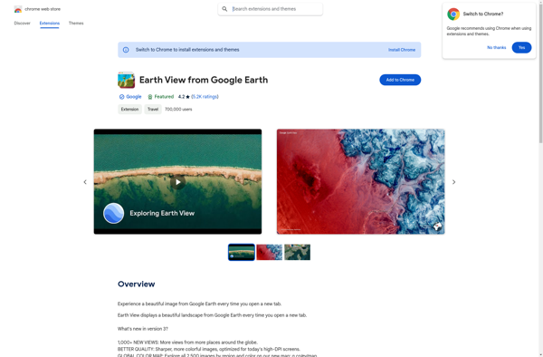
Earth View from Google Earth is a free browser extension available for Chrome, Firefox, and Edge that changes your new tab page to showcase gorgeous satellite photos of places around the world sourced from Google Earth. When you open a new tab, you'll be greeted with a breathtaking high resolution...
Mapline is an open-source, self-hosted web application that allows users to create custom maps for free. It is an alternative to proprietary services like Google My Maps.Some key features of Mapline include:Ability to add markers, lines, shapes, and text notes to your mapsSupport for multiple layers on a single mapOptions...
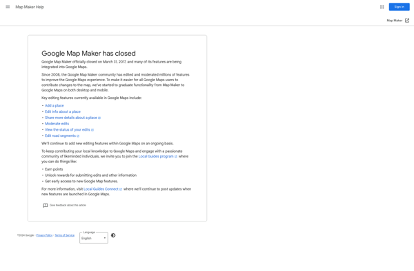
Google Map Maker was a crowdsourced mapping service launched by Google in 2008. It allowed volunteer mappers to edit and update Google Maps with local geographical information and knowledge. The goal of Map Maker was to harness contributions from the public to improve the accuracy, coverage, and freshness of Google...
GeoFlow is a no-code platform used to create interactive maps and spatial data visualizations. It provides an easy-to-use visual interface that allows users to import, analyze, and visualize location data without writing any code.Some key features of GeoFlow include:Intuitive drag-and-drop interface to build maps and dashboardsVariety of customizable and interactive...
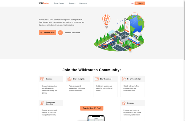
Wikiroutes is an open-source web application designed to help travelers plan and organize trips. It works by tapping into the vast amounts of up-to-date travel information on Wikipedia to provide users with curated guides and customizable itineraries.Some key features of Wikiroutes include:Destination explorer - Browse through popular destinations and dig...