OpenMaps is an open source, collaborative mapping platform allowing users to create and edit custom maps. It provides tools for drawing, labeling, and annotating maps that can be shared and embedded online.
Open source mapping platform for creating, editing and sharing custom maps with drawing, labeling and annotation tools
What is OpenMaps?
OpenMaps is an open source web mapping platform built on top of OpenStreetMap data. It allows users to create custom maps by drawing on top of existing maps and adding their own annotations, text labels, and lines/shapes. These custom maps can then be exported, embedded on websites, or shared publicly for collaboration or viewing.
Some key features of OpenMaps include:
Ability to draw points, lines, shapes, and text boxes on the map for annotation
Customizable appearance of map elements including colors, line widths, icons, etc.
Import/export map data in standard formats like GeoJSON
Public URLs for sharing read-only views of custom maps
User authorization system for managing edit permissions
Tile serving for embedding maps in external websites
Developer APIs for building mapping apps on top of the platform
As an open source project, OpenMaps benefits from contributions from developers worldwide. It is built to be easily extended and customized for niche mapping applications. The collaborative feature set facilitates uses like participatory mapping campaigns, interactive museum/campus maps, mapping assets for humanitarian organizations or crisis response, and more.
OpenMaps Features
Features
Open source code allows customization
Supports multiple map layers and data formats
Annotation and drawing tools for map editing
Embeddable web maps
Collaborative editing and version control
Pricing
Open Source
Pros
Free and open source
Active developer community
Customizable and extensible
Good for collaborative projects
Powerful editing and annotation tools
Cons
Limited documentation and support
Steep learning curve
Not as full-featured as proprietary options
Lacks some advanced GIS capabilities
Hosting and maintenance requires technical expertise
Google Maps is a web mapping platform and consumer application offered by Google. It offers satellite imagery, aerial photography, street maps, 360° interactive panoramic views of streets, real-time traffic conditions, and route planning for traveling by foot, car, bicycle and air, or public transportation.Key features of Google Maps include:Interactive street...
What Is MAPS.ME?MAPS.ME is a mobile maps and navigation app that provides detailed offline maps for over 200 countries. Originally open source, it was one of the first apps to make OpenStreetMap data accessible on mobile with a polished interface.Key FeaturesUsers download maps by country or region for fully offline...
OsmAnd (OpenStreetMap Automated Navigation Directions) is a free and open-source mobile map and navigation application developed for Android and iOS devices. It relies entirely on detailed, community-driven maps from the OpenStreetMap project and allows accessing them offline without an internet connection.Some of the key features and capabilities of OsmAnd include:Turn-by-turn...
Modest Maps is an open source JavaScript mapping library designed for easily embedding interactive maps into web pages. Some key features of Modest Maps include:Lightweight and customizable - Only about 6KB when minified and gzippedSupports various map tile sources including OpenStreetMap, MapQuest, and CloudMadeProvides API for basic interactions like panning,...
Apple Maps is a web mapping service developed by Apple Inc. It was introduced in 2012 with iOS 6 as a replacement for Google Maps on Apple devices. Apple Maps offers turn-by-turn navigation, interactive panoramic street views, Flyover mode for photorealistic 3D views of certain cities, support for transit routing...
TransforMap is a free, open-source mind mapping and brainstorming software. It allows users to visually organize ideas, tasks, projects, and other information with the flexibility of a mind map interface.With TransforMap, users can:Create branching mind maps to break down large concepts and projects into an organized structureConnect related topics, ideas,...
Leaflet is an open-source JavaScript library for building web mapping applications. Here is a more detailed overview:- Leaflet is designed with simplicity, performance and usability in mind. It offers easy integration with other mapping libraries and APIs.- The library is extremely lightweight at only about 38 KB, which allows for...
Mapline is an open-source, self-hosted web application that allows users to create custom maps for free. It is an alternative to proprietary services like Google My Maps.Some key features of Mapline include:Ability to add markers, lines, shapes, and text notes to your mapsSupport for multiple layers on a single mapOptions...
Magic Earth is an open-source, free mobile map application developed for Android and iOS devices. It can be used as a fully-functional GPS navigation software both online and offline. Some of the key features include:Downloads offline vector maps worldwide for using the app without internet connection.Supports turn-by-turn voice navigation and...
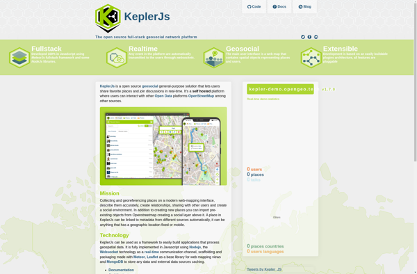
KeplerJs is an open-source web application framework for Node.js focused on scalability and high performance. It uses an asynchronous, non-blocking architecture optimized for handling a high volume of concurrent requests with low latency.Some key features of KeplerJs include:Built-in support for horizontal scaling across multiple CPU cores/serversFirst-class support for real-time features...