Magic Earth
Magic Earth is an open-source, free mobile map app available for Android and iOS devices. It comes packed with features like offline maps, navigation, route planning, and POI search.

Magic Earth: Free Mobile Map App
Open-source map app for Android and iOS with offline navigation, route planning, POI search, and more, free to download and use
What is Magic Earth?
Magic Earth is an open-source, free mobile map application developed for Android and iOS devices. It can be used as a fully-functional GPS navigation software both online and offline. Some of the key features include:
- Downloads offline vector maps worldwide for using the app without internet connection.
- Supports turn-by-turn voice navigation and route planning for driving, walking, and cycling.
- Allows searching for Points of Interests like restaurants, gas stations, attractions, etc.
- Traffic information shows live conditions and automatic rerouting to avoid jams.
- Map updates are released periodically with new places data.
- Customizable map themes including day and night modes.
- Completely ad-free and open-source.
Magic Earth competes with Google Maps and other paid navigation apps by providing a solid set of navigation capabilities in an ad-free format focused on privacy. With worldwide offline maps and regular updates, it works well as an open alternative GPS software for mobile devices.
Magic Earth Features
Features
- Offline maps
- Navigation
- Route planning
- POI search
Pricing
- Free
- Open Source
Pros
Free to use
No ads
Open source
Works offline
Cons
Limited features compared to paid options
Less accurate than Google Maps
Smaller map database
No voice navigation
Official Links
Reviews & Ratings
Login to ReviewThe Best Magic Earth Alternatives
View all Magic Earth alternatives with detailed comparison →
Top Travel & Location and Maps & Navigation and other similar apps like Magic Earth
Here are some alternatives to Magic Earth:
Suggest an alternative ❐Waze
Waze is a crowd-sourced GPS navigation and traffic app launched in 2008. It provides turn-by-turn navigation along with real-time traffic updates, road hazard reports, and user-submitted edits of roads and addresses.Key features of Waze include:Real-time traffic updates - Users can report accidents, traffic jams, police traps, etc. to alert other...

OsmAnd
OsmAnd (OpenStreetMap Automated Navigation Directions) is a free and open-source mobile map and navigation application developed for Android and iOS devices. It relies entirely on detailed, community-driven maps from the OpenStreetMap project and allows accessing them offline without an internet connection.Some of the key features and capabilities of OsmAnd include:Turn-by-turn...

Organic Maps
What Is Organic Maps?Organic Maps is a free, open-source maps and navigation app for Android and iOS. It uses OpenStreetMap data and works entirely offline — no internet connection needed for navigation, search, or route planning.Key FeaturesThe app provides turn-by-turn navigation for driving, cycling, and walking with voice guidance. Maps...

Arcane Maps
Arcane Maps is a feature-rich yet easy-to-use fantasy map creation tool designed specifically for tabletop roleplaying games like Dungeons & Dragons. With an intuitive interface, users can quickly sketch out custom maps with a variety of terrains, landmarks, borders, text labels, and other cartography elements.The software provides numerous brush styles...
Apple Maps
Apple Maps is a web mapping service developed by Apple Inc. It was introduced in 2012 with iOS 6 as a replacement for Google Maps on Apple devices. Apple Maps offers turn-by-turn navigation, interactive panoramic street views, Flyover mode for photorealistic 3D views of certain cities, support for transit routing...

Pure Maps
Pure Maps is an open-source mapping platform developed as an alternative to Google Maps that focuses on user privacy. Unlike Google Maps, Pure Maps does not collect or store any personal user data.Some key features of Pure Maps include:Open-source codebase that allows anyone to contribute and audit the projectVector-based map...
Planet Labs
Planet Labs is an earth imaging company founded in 2010 and based in San Francisco, California. They operate the world's largest commercial satellite constellation with over 200 satellites in orbit, collecting imagery of the entire land mass of the Earth every day.Their high revisit rate and global coverage allows them...

Universal Maps Downloader
Universal Maps Downloader is a free and open source software application that provides the ability to download map images from various popular online map services, including Google Maps, Bing Maps, OpenStreetMap, MapQuest, Yandex Maps, and more.Some key features of Universal Maps Downloader:Supports downloading map images at various zoom levels ranging...

TomTom MyDrive
TomTom MyDrive is a free desktop and mobile app that interfaces with TomTom GPS navigation devices to provide expanded features and functionality. With MyDrive, users can plan routes and destinations on their computer, tablet, or phone and seamlessly send that information to their TomTom device.Key features of TomTom MyDrive include:Updated...

Guru Maps
Guru Maps is an online mind mapping and brainstorming application designed to help users organize ideas and information visually. As an intuitive tool for project planning, brainstorming sessions, and task management, Guru Maps enables users to create colorful nonlinear maps to connect ideas, notes, files, links, and more.Key features of...
Windows Maps
Windows Maps is a mapping service developed by Microsoft as part of the company's Windows services. It provides users with interactive road maps, aerial and streetside imagery, walking and driving directions, traffic information, location search, and the ability to save and sync collections like favorite places and routes across devices.Key...

Garmin StreetPilot Onboard
Garmin StreetPilot Onboard is an in-vehicle GPS navigation system made by Garmin. It comes preloaded with detailed maps that provide turn-by-turn directions and voice guidance to help drivers navigate to their destinations.Key features of StreetPilot Onboard include:Millions of points of interest like gas stations, restaurants, hotels, ATMs, etc.Lane assist with...

PocketMaps
PocketMaps is an open source, offline GPS navigation app for Android devices. It allows users to download OpenStreetMap maps for offline use so navigation is possible without an internet connection. Some key features of PocketMaps include:Completely offline maps - no data connection needed once maps are downloadedTurn-by-turn voice guided GPS...
GeoNET
GeoNET is an open-source desktop application for geographic network analysis. Developed by CHAMP (Center for Health Assessment, Monitoring, and Policy), GeoNET provides tools for modeling, visualizing, and analyzing spatial networks such as transportation, infrastructure, and utility systems.With GeoNET, users can import existing GIS network datasets, or create new network models...

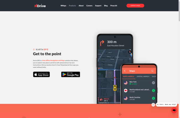
Karta GPS
Karta GPS is a mapping, navigation, and GPS tracking app designed specifically for outdoor adventures like hiking, backpacking, cycling, and more. It provides topographic and terrain maps that work offline so you can navigate trails and rural areas without cell service.Some key features of Karta GPS include:Detailed topographic maps with...
Transportr
Transportr is an open-source public transportation app for Android devices. It is designed to help users search, plan, and navigate public transit systems in cities around the world.Some key features of Transportr include:Intuitive user interface for searching routes, planning trips, and viewing schedules and maps.Support for public transit systems in...

OpenMaps
OpenMaps is an open source web mapping platform built on top of OpenStreetMap data. It allows users to create custom maps by drawing on top of existing maps and adding their own annotations, text labels, and lines/shapes. These custom maps can then be exported, embedded on websites, or shared publicly...
GPS Navigator with Offline Maps
GPS Navigator is a feature-rich navigation and maps app for Android and iOS that is focused on providing accurate turn-by-turn directions even when offline. It sets itself apart by offering free offline map downloads for over 200 countries and territories worldwide, meaning you can navigate unfamiliar areas without racking up...

Google Maps Go
Google Maps Go is a streamlined version of the Google Maps app designed for Android Go edition devices. Android Go edition is a configuration of Android optimized for devices with less than 2GB of RAM, aimed at improving performance and accessibility in emerging markets.Some key features of Google Maps Go...
Wisepilot
Wisepilot is a comprehensive yet intuitive project management software designed specifically for creative agencies, marketing and production teams. It provides a complete set of features to help you plan projects, break down complex tasks, assign work to team members, track time and collaborate smoothly at every stage.Key features of Wisepilot...
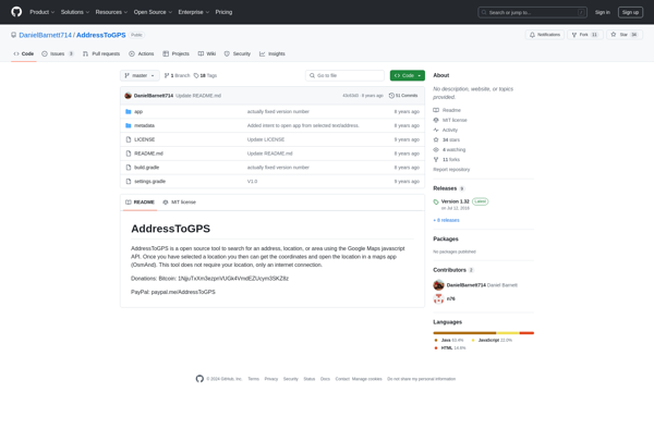
AddressToGPS
AddressToGPS is a Windows-based geocoding software used to convert street addresses into geographic coordinates like latitude and longitude. It has an easy-to-use interface where users can enter addresses, which are then converted into GPS coordinates that can be used in mapping software and GPS devices.Some key features of AddressToGPS include:Works...
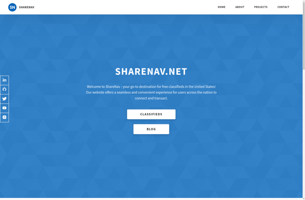
ShareNav
ShareNav is a browser extension and web application designed to help users organize, discover, and share links for research and reference. It serves as a central platform to capture and access references encountered during Web browsing and reading.Some of the key features of ShareNav include:Save links, PDFs, images, and snippets...
Mappy
Mappy is an online and mobile map service mainly focused on Europe. It provides detailed street-level maps for over 40 European countries, covering popular travel destinations like France, Germany, Italy, Spain, and the UK as well as smaller countries across the region.Key features of Mappy include:Interactive maps with zoom, pan,...
Doko Maps
Doko Maps is an open-source, privacy-focused alternative to Google Maps. Developed by a non-profit organization, Doko Maps aims to provide an ethical mapping service that respects user privacy.Like Google Maps, Doko Maps offers features like turn-by-turn navigation for driving, walking, biking and public transit. It allows users to search for...
Gokivo Navigator
Gokivo Navigator is a free, open-source web browser developed as an alternative to more complex browsers. It was created with simplicity, speed, and ease-of-use as the main priorities.The interface has been designed to be clean and minimal, allowing users to focus on the web content rather than the browser itself....