Universal Maps Downloader is a free software that allows users to download map images from various online map services like Google Maps, Bing Maps, OpenStreetMap, and more. It supports downloading at different zoom levels and map sizes.
Download map images from Google Maps, Bing Maps, OpenStreetMap and more with Universal Maps Downloader, a free software that supports different zoom levels and map sizes.
What is Universal Maps Downloader?
Universal Maps Downloader is a free and open source software application that provides the ability to download map images from various popular online map services, including Google Maps, Bing Maps, OpenStreetMap, MapQuest, Yandex Maps, and more.
Some key features of Universal Maps Downloader:
Supports downloading map images at various zoom levels ranging from 1 to 21, allowing you to get views from a full region down to street level.
Lets you specify the exact bounding box coordinates or search for a location to download maps for that area.
Provides options to set the exported map image size from 100x100 pixels up to 15000x15000 pixels.
Ability to download map layers separately, like satellite, terrain, traffic, and more depending on map provider.
Exports downloaded maps to JPG, PNG, BMP and TIFF file formats.
Completely free and open source software published under GNU GPL v3 license.
Available as installable software for Windows and Linux systems.
Intuitive graphical user interface for easy use without any technical skills.
Overall, Universal Maps Downloader is a handy tool for professionals and hobbyists who need to download maps from various online mapping services for diverse applications and usage.
Universal Maps Downloader Features
Features
Supports downloading map images from Google Maps, Bing Maps, OpenStreetMap, MapQuest, Yandex Maps
Allows downloading maps at different zoom levels
Lets you select map size - standard or custom dimensions
Batch downloading for downloading multiple maps
Supports proxies for accessing blocked mapping services
Works on Windows, Mac and Linux
Pricing
Free
Open Source
Pros
Free and open source
Simple and easy to use interface
Good range of supported map providers
Customizable map sizes
Useful for downloading maps for projects/presentations
Active development and updates
Cons
Limited to image downloads - no vector data
No mobile app - desktop only
Lacks some advanced features like scripting/automation
Google Maps is a web mapping platform and consumer application offered by Google. It offers satellite imagery, aerial photography, street maps, 360° interactive panoramic views of streets, real-time traffic conditions, and route planning for traveling by foot, car, bicycle and air, or public transportation.Key features of Google Maps include:Interactive street...
Waze is a crowd-sourced GPS navigation and traffic app launched in 2008. It provides turn-by-turn navigation along with real-time traffic updates, road hazard reports, and user-submitted edits of roads and addresses.Key features of Waze include:Real-time traffic updates - Users can report accidents, traffic jams, police traps, etc. to alert other...
What Is MAPS.ME?MAPS.ME is a mobile maps and navigation app that provides detailed offline maps for over 200 countries. Originally open source, it was one of the first apps to make OpenStreetMap data accessible on mobile with a polished interface.Key FeaturesUsers download maps by country or region for fully offline...
OsmAnd (OpenStreetMap Automated Navigation Directions) is a free and open-source mobile map and navigation application developed for Android and iOS devices. It relies entirely on detailed, community-driven maps from the OpenStreetMap project and allows accessing them offline without an internet connection.Some of the key features and capabilities of OsmAnd include:Turn-by-turn...
OpenStreetMap (OSM) is a collaborative project to create a free and editable map of the world. Unlike proprietary map data from companies like Google or Apple, OSM map data is open and licensed under the Open Database License (ODbL), which allows anyone to use, modify, and distribute the data freely.The...
HERE WeGo is a free map and navigation app developed by HERE Technologies for iOS and Android devices. It allows users to navigate by car, public transportation, foot or bike using turn-by-turn voice guided directions. Key features of HERE WeGo include:Offline maps - Download maps to your device so you...
What Is Organic Maps?Organic Maps is a free, open-source maps and navigation app for Android and iOS. It uses OpenStreetMap data and works entirely offline — no internet connection needed for navigation, search, or route planning.Key FeaturesThe app provides turn-by-turn navigation for driving, cycling, and walking with voice guidance. Maps...
Apple Maps is a web mapping service developed by Apple Inc. It was introduced in 2012 with iOS 6 as a replacement for Google Maps on Apple devices. Apple Maps offers turn-by-turn navigation, interactive panoramic street views, Flyover mode for photorealistic 3D views of certain cities, support for transit routing...
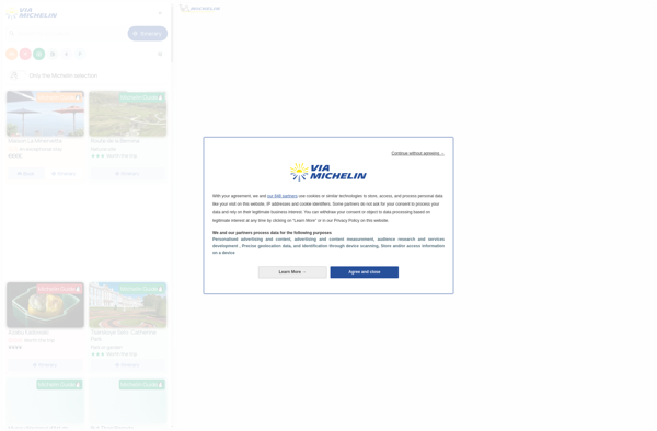
ViaMichelin is a popular travel website and mobile app focused on providing information and services for driving in Europe. It was launched in 2001 by Michelin, the French tire company.Some key features of ViaMichelin include:Interactive maps of European countries with the option to plan routes and get turn-by-turn GPS navigation.Tourist...
Leaflet is an open-source JavaScript library for building web mapping applications. Here is a more detailed overview:- Leaflet is designed with simplicity, performance and usability in mind. It offers easy integration with other mapping libraries and APIs.- The library is extremely lightweight at only about 38 KB, which allows for...
Qwant Maps is an open-source web mapping service developed by the French company Qwant aimed at providing privacy and protecting user data. Launched in 2019, Qwant Maps does not track user searches or collect private information the way many other mapping services do.Some key features of Qwant Maps include:Search for...
2GIS is a popular free map, local search and business directory mobile app and website operating in over 1800 cities across Russia, CIS, Europe, Asia and other countries. It offers detailed interactive maps, local business listings, navigation, reviews and other local information.Some key features of 2GIS include:Detailed vector maps for...
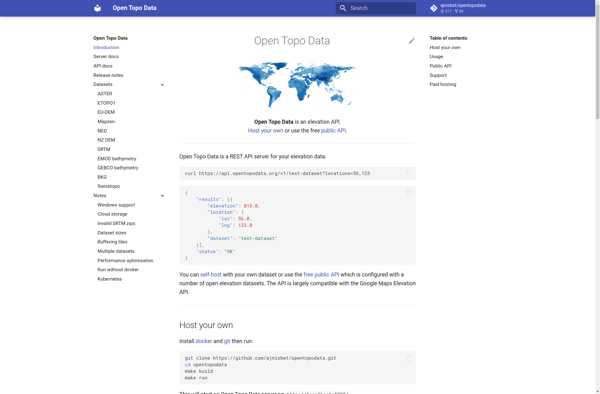
Open Topo Data is a free, open-source topographic map dataset that covers the entire continental United States. It is developed and maintained by volunteers with the goal of providing high-quality topographic data for public use.The dataset includes detailed vector-based mapping data such as contours, hydrography, landcover, transportation, boundaries, structures, and...
Magic Earth is an open-source, free mobile map application developed for Android and iOS devices. It can be used as a fully-functional GPS navigation software both online and offline. Some of the key features include:Downloads offline vector maps worldwide for using the app without internet connection.Supports turn-by-turn voice navigation and...
Acastus Photon is an open-source web application that serves as a self-hosted alternative to Pinterest. Like Pinterest, it allows users to create visual inspiration boards to collect, organize, and share images, links, notes, and other content.Some key features of Acastus Photon include:Creating public and private boards to organize contentFollowing other...
Anyplace is an open-source virtual workspace platform designed for remote teams. It provides an all-in-one solution for online collaboration with features including:Video conferencing with screen sharingInteractive whiteboards for brainstorming and ideationBuilt-in chat and messagingCustomizable digital workspacesSupport for integrations with other toolsAnyplace aims to recreate the flexibility and spontaneity of in-person...
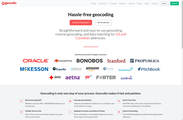
Geocodio is a geocoding and reverse geocoding web service API designed to help developers add location data and mapping capabilities to their applications. The API converts street addresses and locations into geographic coordinates (latitude and longitude) and vice versa through a simple HTTP request interface.Some key features of Geocodio include:Geocoding...
CMaps Analytics is a business intelligence and data visualization platform designed to help companies unlock insights from their data. Some key capabilities and benefits include:Intuitive drag-and-drop interface to build interactive dashboards and reports without codingConnect to various data sources such as SQL, NoSQL databases, cloud apps, etc.Perform ad hoc analysis...
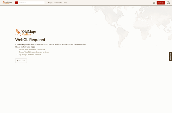
Old Maps Online is a free web application to view, search, share and georeference historical maps. It was launched in 2010 by Klokan Technologies GmbH in cooperation with libraries and archives from all over the world.The site contains a collection of over 370,000 maps and views from the 15th to...
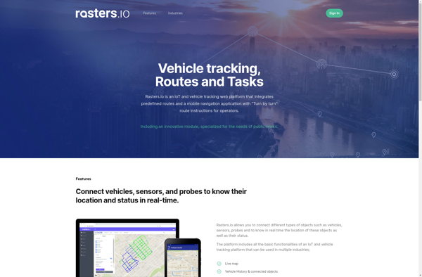
Rasters.io is an online graphic design and image editing application. It provides an extensive set of tools for working with raster graphics and images in a web browser without needing to install any software.Some key features of Rasters.io include:Intuitive drawing and painting tools like brushes, pencils, shapes, text, and morePowerful...
Cartogram is an open-source data visualization application developed by the Cartogram team at Michigan State University. It allows users to create cartograms, which are maps that distort geography in order to better visualize quantitative information and statistics.With Cartogram, users can upload a geospatial vector file such as a shapefile, choose...
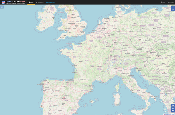
OpenLevelUp is an open source and free platform for learning languages online. Developed as an alternative to commercial apps like Duolingo or Babbel, OpenLevelUp provides interactive lessons, vocabulary flashcards, short stories, and quizzes to help users learn languages.The platform focuses on developing core language skills like vocabulary, grammar, reading, writing,...
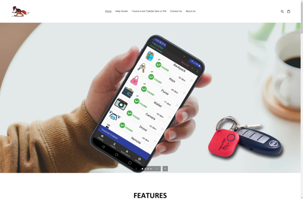
TallyGo is an intuitive yet powerful cloud-based accounting and bookkeeping solution designed specifically for small businesses and entrepreneurs. It provides a user-friendly way for non-accountants to track their finances, manage invoices and payments, categorize business transactions, generate insightful financial reports, and stay on top of taxes.Key features of TallyGo include:Income...
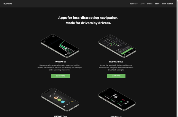
HUDWAY Go is a heads-up display designed for car windshields to promote safer and smarter driving. It wirelessly connects to smartphones via Bluetooth and projects an augmented reality display directly in the driver's line of sight that includes useful information like current speed, speed limits, navigation prompts, weather data, and...
tubenav is an open source YouTube desktop client for Linux operating systems. It provides an alternative user interface and feature set compared to YouTube's official website or mobile apps.Some of the key features of tubenav include:Browsing and searching YouTube videosPlaying videos in a custom playerManaging subscriptions and playlistsDownloading videosListening to...
Inkata is a free, open-source alternative to Microsoft Visio for creating diagrams and vector graphics. As an alternative, Inkata provides many of the key features of Visio at no cost.Like Visio, Inkata is designed specifically for diagramming and includes intuitive tools for creating flowcharts, UML diagrams, network maps, floor plans,...
HoursOf is an easy-to-use time tracking and invoicing software designed for freelancers, consultants, agencies, and small business teams. Its key features include:Time Tracking - Use running timers to track time as you work. Enter time manually with quick calendar entries. Tag times to projects, clients, and tasks.Productivity Reports - Generate...