Urthecast is a geospatial data company that provides high-resolution Earth imagery and geospatial data by leveraging its Earth Observation (EO) sensors and services in space. Its software and API offer real-time data feeds for the analysis of real world change.
Urthecast: High-Resolution Earth Imagery & Geospatial Data
Real-time data feeds for analyzing earth's changes, leveraging EO sensors and services in space, with software and API offerings.
What is Urthecast?
Urthecast is a Vancouver-based technology company that specializes in geospatial data and services by leveraging its network of Earth Observation (EO) sensors in space. The company provides imagery and data for a wide range of industries through its UrtheDaily, streaming video, and API services.
Urthecast operates the world's first commercially-available, full-color video camera satelllite constellation called UrtheDaily that provides daily, medium-resolution optical imagery of the entire planet's landmass. This allows users to detect changes and track trends through frequently refreshed data. The company also has high-resolution cameras aboard the International Space Station.
The platform and API provides real-time data feeds that businesses and governments can use to monitor assets, detect real world change, and perform analytics. Key capabilities and use cases include:
Monitoring infrastructure and assets
Detecting changes for insurance services
Agriculture and forestry management
Disaster response
City planning and mapping
Overall, Urthecast uses its network of satellites and sensors to empower organizations with frequently refreshed geospatial data and real-time analytics capabilities to make better decisions about resources, infrastructure, and our changing planet.
Urthecast Features
Features
High-resolution satellite imagery
Video capture from the International Space Station
API access to imagery and data
Image processing and analytics
Change detection
3D models and point clouds
Pricing
Subscription-Based
Pay-As-You-Go
Pros
Very high resolution imagery for detailed analysis
Frequent revisits allow change monitoring
Global coverage
Video provides unique perspective
Powerful API for integrating into other software
Cons
Can be expensive for large areas or frequent access
Limited historical imagery
Dependent on cloud cover for optical imagery quality
Google Earth is a geobrowser that accesses satellite and aerial imagery, ocean bathymetry, and other geographic data over the internet to represent the Earth as a three-dimensional globe. It was originally developed by Keyhole, Inc., a company acquired by Google in 2004.Google Earth allows users to search for addresses and...
Bing Maps 3D is a 3D mapping platform from Microsoft that provides interactive maps and location intelligence services. It is part of the Bing Maps product suite.Some key features of Bing Maps 3D include:Interactive 3D map views with support for aerial, road, and hybrid map stylesAbility to incorporate 3D maps...
Earth Browser is an interactive 3D globe software program that provides a highly detailed visualization of planet Earth by integrating a wide range of geographic datasets. It enables users to explore the Earth's surface, oceans, atmosphere, and outer space in an immersive and customizable 3D environment.Key features of Earth Browser...
Marble is a free and open source note taking application designed specifically for Linux desktop environments like KDE Plasma and GNOME. It provides a simple yet effective way to create rich text notes, tackle checklists, set reminders, and organize your notes into notebooks.Some of the key features of Marble include:Rich...
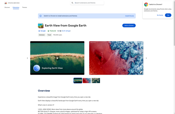
Earth View from Google Earth is a free browser extension available for Chrome, Firefox, and Edge that changes your new tab page to showcase gorgeous satellite photos of places around the world sourced from Google Earth. When you open a new tab, you'll be greeted with a breathtaking high resolution...
Earth 3D is an interactive 3D simulation of Planet Earth developed by Rephlexions. It renders a highly detailed virtual globe using real satellite imagery and topographic data to showcase an accurate model of Earth's terrain, oceans, and cloud cover.With Earth 3D, users can freely navigate around the planet to explore...
Spectator is a desktop application designed to mirror and control Android devices from a Windows or Mac computer. It provides a convenient way to fully interact with your Android device without touching it.Some key features of Spectator include:Real-time mirroring of your Android screen to your computer via USB or WiFi...
MapSphere is an open-source web mapping platform designed for creating custom interactive maps. It provides a user-friendly editor that allows users without GIS expertise to easily visualize various types of data on maps.Key features of MapSphere include:Intuitive drag-and-drop editor for adding vector and raster data layersCustom base maps using WMS,...
Flash Earth is a free, interactive 3D globe developed using Adobe Flash. It allows users to visually explore the Earth through high-resolution satellite imagery and aerial photography.Some key features of Flash Earth include:Seamless, zoomable maps from space down to street level3D terrain showing topological features like mountains and valleysOcean floor...