Flash Earth is an interactive 3D globe that uses satellite imagery and aerial photography to allow users to visually explore the Earth. It offers seamless, zoomable maps and terrain for easy navigation.
An interactive 3D globe using satellite imagery and aerial photography for visual exploration of the Earth, with seamless zoomable maps and terrain
What is Flash Earth?
Flash Earth is a free, interactive 3D globe developed using Adobe Flash. It allows users to visually explore the Earth through high-resolution satellite imagery and aerial photography.
Some key features of Flash Earth include:
Seamless, zoomable maps from space down to street level
3D terrain showing topological features like mountains and valleys
Ocean floor mapping and undersea terrain
Multiple map layers including political boundaries, roads, locations, etc.
Place search to easily find and navigate to locations
Support for embedded Flash content into web pages and apps
Intuitive navigation controls like zoom, pan, rotate, etc.
Detailed location information via pop-ups
Community-added placemarks and features
Flash Earth offers an immersive way to explore the world through maps and satellite imagery. Its high-resolution photos and terrain mapping capabilities allow users to visually traverse the globe as if in a game or simulation. The easy-to-use navigation and wealth of geographical data make Flash Earth a versatile educational and reference tool.
Google Earth is a geobrowser that accesses satellite and aerial imagery, ocean bathymetry, and other geographic data over the internet to represent the Earth as a three-dimensional globe. It was originally developed by Keyhole, Inc., a company acquired by Google in 2004.Google Earth allows users to search for addresses and...
SAS.Planet is a free, open-source desktop application designed for viewing and downloading satellite imagery. It provides access to a wide variety of satellite data sources, allowing users to search, preview, and download high-resolution aerial and satellite photos.Some key features of SAS.Planet include:Intuitive user interface for searching locations and browsing image...
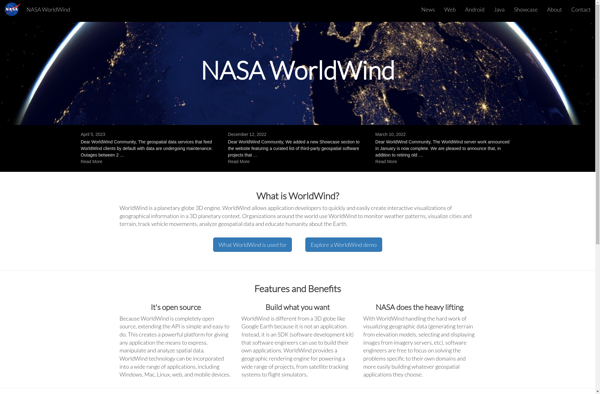
NASA World Wind is an open source, cross-platform virtual globe software that allows users to visualize the Earth and its terrain in 3D. Developed by NASA, it provides a detailed and interactive view of the planet using NASA satellite imagery and aerial photography.Key features of NASA World Wind include:Interactive 3D...
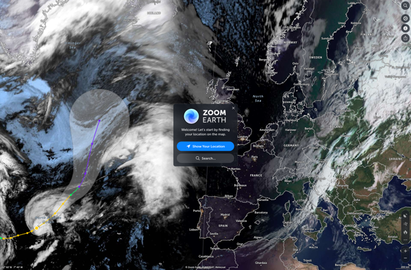
Zoom Earth is an interactive, real-time map of the planet that uses high-resolution satellite imagery and other geographical data to create a detailed and customizable view of locations around the world. Users can zoom in from space all the way to street level, tracking everything from weather systems to city...
Earth Browser is an interactive 3D globe software program that provides a highly detailed visualization of planet Earth by integrating a wide range of geographic datasets. It enables users to explore the Earth's surface, oceans, atmosphere, and outer space in an immersive and customizable 3D environment.Key features of Earth Browser...
Marble is a free and open source note taking application designed specifically for Linux desktop environments like KDE Plasma and GNOME. It provides a simple yet effective way to create rich text notes, tackle checklists, set reminders, and organize your notes into notebooks.Some of the key features of Marble include:Rich...
Mapline is an open-source, self-hosted web application that allows users to create custom maps for free. It is an alternative to proprietary services like Google My Maps.Some key features of Mapline include:Ability to add markers, lines, shapes, and text notes to your mapsSupport for multiple layers on a single mapOptions...
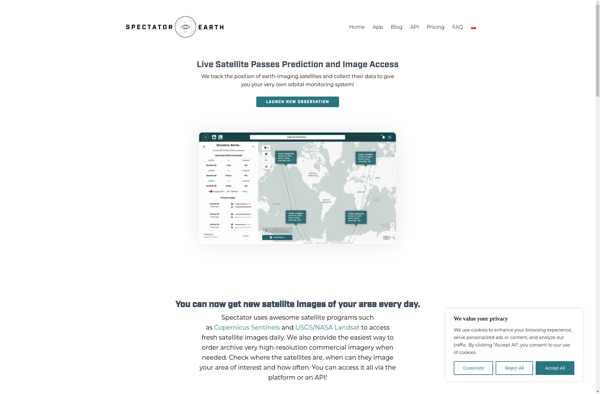
Spectator is a desktop application designed to mirror and control Android devices from a Windows or Mac computer. It provides a convenient way to fully interact with your Android device without touching it.Some key features of Spectator include:Real-time mirroring of your Android screen to your computer via USB or WiFi...
MapSphere is an open-source web mapping platform designed for creating custom interactive maps. It provides a user-friendly editor that allows users without GIS expertise to easily visualize various types of data on maps.Key features of MapSphere include:Intuitive drag-and-drop editor for adding vector and raster data layersCustom base maps using WMS,...
GMap.NET is an open source .NET control that allows embedding interactive maps from providers like Google, Bing, OpenStreetMap, WikiMapia, Yandex, ArcGIS and more into .NET applications. It was created in 2008 by Jan Mojžíš and is distributed under the LGPL license.Some key features of GMap.NET include:Support for various map providers...
pTolemy3D is a free, open-source 3D modeling and animation suite. It provides a complete set of tools for creating 3D content, including modeling, texturing, animation, rendering, and more.Some key features of pTolemy3D include:Intuitive user interface and workflow designed specifically for 3D content creationExtensive modeling tools for creating detailed 3D models...
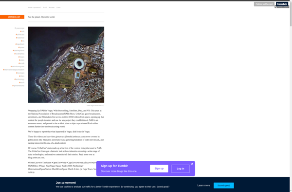
Urthecast is a Vancouver-based technology company that specializes in geospatial data and services by leveraging its network of Earth Observation (EO) sensors in space. The company provides imagery and data for a wide range of industries through its UrtheDaily, streaming video, and API services.Urthecast operates the world's first commercially-available, full-color...