Mapy.cz icon

Mapy.cz

Mapy.cz is a popular online map service in the Czech Republic. It offers detailed maps, route planning, GPS navigation, satellite and aerial imagery, street view, and more. Mapy.cz has good coverage of the Czech Republic and some coverage of other European countries.

What is Mapy.cz?

Mapy.cz is a comprehensive online map service based in the Czech Republic. It was launched in 2005 and is one of the most widely used map services for the Czech Republic and Slovakia.

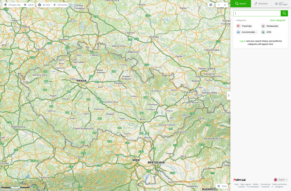
Mapy.cz provides detailed street maps, topographic maps, satellite and aerial imagery of the Czech Republic and Slovakia. It also offers streetview imagery of major Czech and Slovak cities and towns. The map data covers a wide range of points of interest including businesses, restaurants, accommodation, petrol stations, tourist attractions, and more.

For navigation, Mapy.cz enables driving, walking, and cycling directions and route planning within the Czech Republic and Slovakia. Users can get turn-by-turn voice guided GPS navigation using the Mapy.cz mobile apps for Android and iOS.

Beyond maps and navigation, some of the other major features offered by Mapy.cz include a route planner for public transit in Czech cities, elevation profiles for hiking routes, an offline mobile map option, and integration with various activity tracking apps.

While Mapy.cz's strongest coverage is of the Czech Republic and Slovakia, their maps also cover surrounding European countries including Germany, Poland, Austria, with basic road maps and local detail for major cities. Mapy.cz offers localized interfaces in Czech, English, German and Slovak.

Official Links

Official Website
mapy.cz

The Best Mapy.cz Alternatives

Top Apps like Mapy.cz

Google Maps, Waze, MAPS.ME, OsmAnd, OpenStreetMap, HERE WeGo, Organic Maps, Apple Maps, Yandex Maps, Transportr are some alternatives to Mapy.cz.

Google Maps

Google Maps is a web mapping platform and consumer application offered by Google. It offers satellite imagery, aerial photography, street maps, 360° interactive panoramic views of streets, real-time traffic conditions, and route planning for traveling by foot, car, bicycle and air, or public transportation.Key features of Google Maps include:Interactive...

Waze

Waze is a crowd-sourced GPS navigation and traffic app launched in 2008. It provides turn-by-turn navigation along with real-time traffic updates, road hazard reports, and user-submitted edits of roads and addresses.Key features of Waze include:Real-time traffic updates - Users can report accidents, traffic jams, police traps, etc. to alert...

MAPS.ME

MAPS.ME is a popular free mobile app that provides offline maps and turn-by-turn GPS navigation for over 200 countries around the world. It was launched in 2012 by MapsWithMe GmbH and allows users to download highly detailed OpenStreetMap maps to their device for access completely offline.Some key features of MAPS...

OsmAnd

OsmAnd (OpenStreetMap Automated Navigation Directions) is a free and open-source mobile map and navigation application developed for Android and iOS devices. It relies entirely on detailed, community-driven maps from the OpenStreetMap project and allows accessing them offline without an internet connection.Some of the key features and capabilities of OsmAnd...

OpenStreetMap

OpenStreetMap (OSM) is a collaborative project to create a free and editable map of the world. Unlike proprietary map data from companies like Google or Apple, OSM map data is open and licensed under the Open Database License (ODbL), which allows anyone to use, modify, and distribute the data freely...

HERE WeGo

HERE WeGo is a free map and navigation app developed by HERE Technologies for iOS and Android devices. It allows users to navigate by car, public transportation, foot or bike using turn-by-turn voice guided directions. Key features of HERE WeGo include:Offline maps - Download maps to your device so...

Organic Maps

Organic Maps is an open-source, privacy-focused maps and navigation application for Android devices. Developed by Organic Maps Foundation, it provides an alternative to proprietary map apps like Google Maps or Apple Maps.Some key features of Organic Maps include:Turn-by-turn navigation with voice guidanceAbility to download maps for offline useRoute...

Apple Maps

Apple Maps is a web mapping service developed by Apple Inc. It was introduced in 2012 with iOS 6 as a replacement for Google Maps on Apple devices. Apple Maps offers turn-by-turn navigation, interactive panoramic street views, Flyover mode for photorealistic 3D views of certain cities, support for transit routing and real-time...

Yandex Maps

Yandex Maps is a free online map service developed by Yandex, a Russian multinational technology company specializing in Internet-related services and products. Yandex Maps offers highly detailed and searchable maps, turn-by-turn navigation, public transit information, traffic data, and 360-degree panoramic street view images for over 220 countries around the world.The...

Transportr

Transportr is an open-source public transportation app for Android devices. It is designed to help users search, plan, and navigate public transit systems in cities around the world.Some key features of Transportr include:Intuitive user interface for searching routes, planning trips, and viewing schedules and maps.Support for public...