iCoyote is a GPS-based app designed to alert drivers to upcoming speed traps, speed limits, red light cameras, and more. It aims to help drivers avoid speeding tickets.
GPS-based app designed to alert drivers to upcoming speed traps, speed limits, red light cameras, and more, aiming to help avoid speeding tickets
What is ICoyote?
iCoyote is a popular GPS-based app that alerts drivers in real-time to upcoming speed traps, speed limits, red light cameras, and more. Its key goal is to help drivers avoid speeding tickets and stay safe on the road.
The app uses crowd-sourced user reports and publicly available data to identify the location of speed traps, accidents, traffic jams, and other hazards. As drivers approach these spots, iCoyote will sound an alarm and show the driver the upcoming speed limit, potential threats, and safe driving speed.
Key features of iCoyote include:
Audible and visual speed limit alerts
Warnings for red light cameras, speed traps, and high accident areas
Feedback tools to report new speed traps, traffic jams, etc.
Speedometer OBD integration
Available on iOS and Android devices
iCoyote aims to create a collaborative community of drivers where real-time warnings and feedback help everyone drive more safely and avoid costly speeding fines. While not a substitute for safe driving practices, it can be a useful aid for staying updated on the road's conditions.
ICoyote Features
Features
Real-time speed limit and speed camera alerts
Warnings for upcoming red lights and stop signs
Ability to report new speed traps and traffic hazards
Traffic and congestion notifications
Works offline once maps are downloaded
Available on iOS and Android
Pricing
Subscription-Based
Pros
Helps drivers avoid speeding tickets
Increases awareness of local speed limits
Large database of speed camera locations
Alerts are visual and audible
Can be used across North America and Europe
Cons
Requires a paid subscription
Accuracy depends on GPS signal strength
Does not replace safe and attentive driving
May encourage speeding behavior in some drivers
Requires constant app updates as new cameras are added
Waze is a crowd-sourced GPS navigation and traffic app launched in 2008. It provides turn-by-turn navigation along with real-time traffic updates, road hazard reports, and user-submitted edits of roads and addresses.Key features of Waze include:Real-time traffic updates - Users can report accidents, traffic jams, police traps, etc. to alert other...
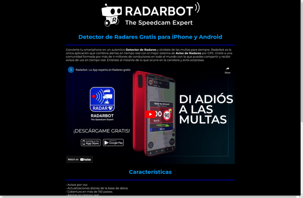
Radarbot is a comprehensive social media automation and content marketing solution for businesses. It provides an easy-to-use interface to streamline social media marketing and collaborate as a team. Some key features include:Content scheduling: Schedule unlimited posts to all major social media platforms like Facebook, Twitter, LinkedIn, and more. Supports scheduling...
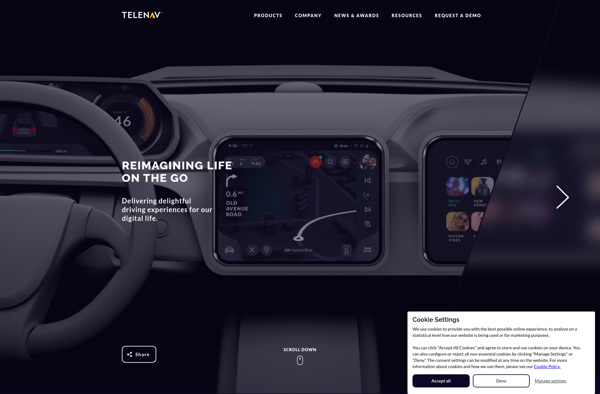
Scout by Telenav is a free GPS navigation and maps app available for Android and iOS. It provides turn-by-turn voice guided navigation to help you get to your destination quickly and easily. Some key features of Scout include:Traffic avoidance - Scout will automatically route you around traffic jams to save...
Windows Maps is a mapping service developed by Microsoft as part of the company's Windows services. It provides users with interactive road maps, aerial and streetside imagery, walking and driving directions, traffic information, location search, and the ability to save and sync collections like favorite places and routes across devices.Key...
Garmin StreetPilot Onboard is an in-vehicle GPS navigation system made by Garmin. It comes preloaded with detailed maps that provide turn-by-turn directions and voice guidance to help drivers navigate to their destinations.Key features of StreetPilot Onboard include:Millions of points of interest like gas stations, restaurants, hotels, ATMs, etc.Lane assist with...
GeoNET is an open-source desktop application for geographic network analysis. Developed by CHAMP (Center for Health Assessment, Monitoring, and Policy), GeoNET provides tools for modeling, visualizing, and analyzing spatial networks such as transportation, infrastructure, and utility systems.With GeoNET, users can import existing GIS network datasets, or create new network models...
Gokivo Navigator is a free, open-source web browser developed as an alternative to more complex browsers. It was created with simplicity, speed, and ease-of-use as the main priorities.The interface has been designed to be clean and minimal, allowing users to focus on the web content rather than the browser itself....