Cesium is an open-source JavaScript library for creating 3D globes and 2D maps in a web browser without a plugin. It offers high-performance 3D visualization of geospatial data and provides easy-to-use APIs for camera control, data manipulation, terrain, imagery layers, and more.
Cesium: Open-Source JavaScript Library for 3D Globes and 2D Mapss
Cesium offers high-performance 3D visualization of geospatial data and provides easy-to-use APIs for camera control, data manipulation, terrain, imagery layers, and more.
What is Cesium?
Cesium is an open-source JavaScript library for creating interactive 3D globes and 2D maps in a web browser without the need for a plugin. Developed by Analytical Graphics, Inc. (AGI), Cesium uses WebGL for hardware-accelerated graphics to visualize large geospatial datasets including 3D terrain, imagery, vector data, and point clouds. Key capabilities include:
High-performance 3D globe visualization handling large geospatial datasets with global coverage
Fluid camera control for panning, zooming, and flying to locations
Visualization layers for imagery, terrain, vector data, point clouds, and 3D models
Accurate mapping from 3D to 2D coordinate reference systems
Client-side data manipulation and analysis without server-side processing
Cross-platform and cross-browser support including mobile devices
Easy to integrate and customize with JavaScript API
With its complete set of geospatial visualization and analysis tools, Cesium enables creating a wide range of applications such as flight simulators, forest fire spread modeling, GPS tracking visualizations, virtual globes, and oil/gas exploration data viewers.
Cesium Features
Features
3D globe visualization
2D map visualization
Camera control APIs
Geospatial data manipulation APIs
Imagery layer support
Terrain support
Pricing
Open Source
Pros
Open source
High performance 3D visualization
Easy to use APIs
Works in web browsers without plugins
Cons
Steep learning curve
Limited documentation
Not as full featured as some commercial alternatives
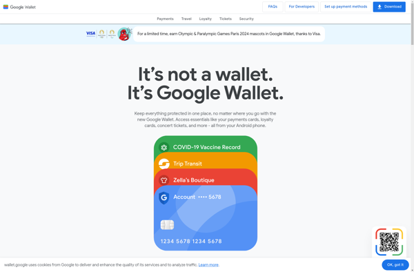
Google Wallet is a mobile payment service and digital wallet developed and operated by Google that enables users to store debit cards, credit cards, loyalty cards, gift cards and other payment methods in one app on their mobile devices. It allows for tap-and-pay style contactless payments in-stores using near-field communication...
Amazon Pay is an online payment processing service owned by Amazon that allows users to make purchases on third-party websites and mobile apps using the payment and shipping information stored in their Amazon account. It provides a streamlined, one-click checkout experience for customers by eliminating the need to manually enter...
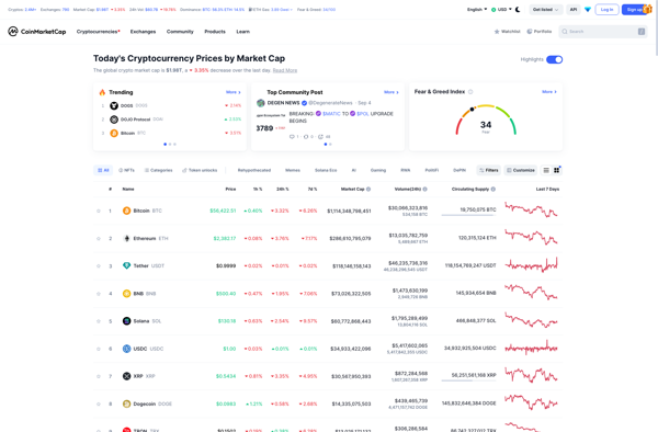
CoinMarketCap is a leading website that tracks metrics and rankings for cryptocurrencies. Launched in 2013, it has become one of the most referenced data sites in the crypto space.The main feature of CoinMarketCap is its tables and charts showing the price, market capitalization, trading volume and other key statistics for...
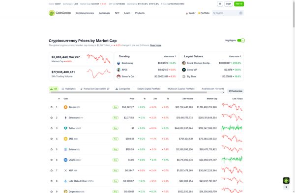
Coingecko is a leading cryptocurrency market data aggregator platform, founded in 2014. The platform tracks data on over 10,000 cryptocurrencies across 500+ exchanges. It provides coin prices, market capitalizations, volumes, developer and community statistics, and other analytics. Some key features of Coingecko include:Detailed price tracking for coins and tokens across...
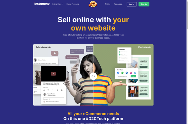
Instamojo is an Indian fintech company that provides payment gateway and merchant services. It allows individuals and businesses to collect payments online by providing instant payment pages and payment links.Some key features of Instamojo include:Easy integration into websites and mobile apps via API and plugins to start collecting payments instantlyPayment...
BitInfoCharts is a comprehensive source of information and metrics on various cryptocurrencies such as Bitcoin, Ethereum, Litecoin, and more. The website provides detailed analytics and statistics showcasing the historical and current status of crypto networks.Some of the key features of BitInfoCharts include:Graphical charts for crypto metrics like price, market cap,...
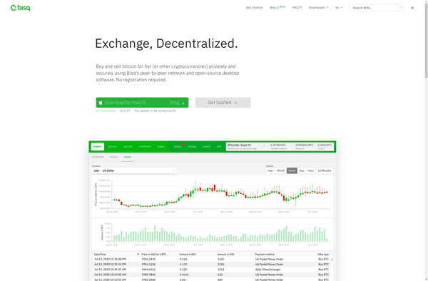
Bisq is a decentralized, open-source cryptocurrency exchange and trading platform. It allows users to trade national currencies and popular cryptocurrencies privately and securely without requiring personal information or relying on a centralized entity.Some key features of Bisq include:Decentralized and peer-to-peer - There are no centralized servers that hold funds or...
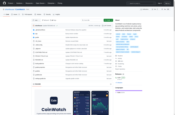
CoinWatch is a leading cryptocurrency portfolio tracker and market data platform founded in 2018. The app allows users to connect exchange accounts and wallets to track portfolio balances, transactions, and performance across over 10,000 cryptocurrencies.Key features of CoinWatch include:Portfolio tracking - Automatically sync exchange data to track balances, buys, sells,...
Coinsflare is a desktop application for cryptocurrency mining on Windows, MacOS, and Linux operating systems. With its intuitive graphical user interface, Coinsflare allows anyone to start mining popular cryptocurrencies like Bitcoin, Litecoin, Ethereum without dealing with command lines or configuration files.After a quick and easy one-time setup, Coinsflare detects the...
CryptoView is a free, open-source cryptocurrency portfolio tracking application that allows users to easily track the performance of their crypto investments. With support for over 7,000 cryptocurrencies, CryptoView enables users to get detailed price and market data as well as create fully customized portfolios to fit their investment strategy.Some of...
Blockchain Wallet is a leading cryptocurrency wallet platform launched in 2011. It enables users to securely store, send, and receive Bitcoin, Ethereum, and other digital currencies through its easy-to-use web and mobile interfaces.Key features of Blockchain Wallet include:Secure storage of crypto assets with private keys encrypted and stored client-sideSupport for...
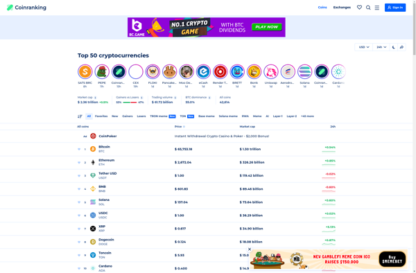
Coinranking.com is a comprehensive cryptocurrency data website that provides real-time information on over 6000 cryptocurrencies. The site includes detailed coin data, prices, market capitalizations, and more to help users track the crypto market.Some key features of Coinranking.com include:Real-time price tracking for major cryptocurrencies like Bitcoin, Ethereum, and stablecoins.Historical price data...
Coinarbitrage is a desktop application designed for cryptocurrency arbitrage trading across exchanges. It allows traders to take advantage of price discrepancies by buying on one exchange and selling on another to lock in small profits. Key features of Coinarbitrage include:Real-time price monitoring across multiple exchanges like Binance, Coinbase Pro, Kraken,...
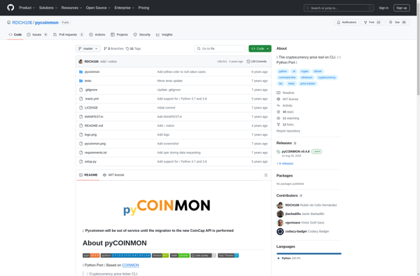
pyCOINMON is an open-source cryptocurrency portfolio management and analysis tool. It enables cryptocurrency investors to track, analyze and manage their digital asset portfolio from a single intuitive interface.Some of the key features of pyCOINMON include:Unified portfolio view - Connect to exchanges, wallets and blockchains to get a consolidated view of...
Countthecoins.com is a convenient online tool for counting and calculating the value of coins. It's completely free to use with no signup required. You simply select each type of coin you have - pennies, nickels, dimes, quarters, half dollars, and dollar coins - and input the quantity of each.The tool...
ICO Watch List is a comprehensive database and information hub for initial coin offerings (ICOs). As a go-to resource for the cryptocurrency community, it aims to bring transparency and clarity to the ICO market.The platform allows users to easily search and filter for upcoming, ongoing, and finished ICOs. Detailed profile...
Livecoin24 is a comprehensive website for viewing live cryptocurrency market data. It tracks the price, market capitalization, circulating supply, and other metrics for over 8000 cryptocurrencies in real-time.Some key features of Livecoin24 include:Real-time pricing data and percentage changes for a huge range of coins and tokensInteractive graphs showing historical price...
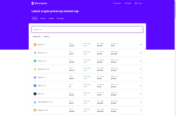
Bitcompare is a cryptocurrency comparison website launched in 2018. It allows users to easily compare key data points and features across different cryptocurrencies side by side.Some of the key things users can compare on Bitcompare include:Latest cryptocurrency prices and market caps24 hour trading volumesTotal and circulating suppliesAll-time price charts and...
blockchainMe is a software service that leverages blockchain technology to give users more control over their digital identity and personal data. It functions as a decentralized database for identity attributes, documents, and other private data.Some key features of blockchainMe include:Decentralized storage - Data is stored across a distributed network of...
LiveMarketCap is a comprehensive website for viewing real-time information and data on the cryptocurrency market. It allows users to track the latest prices, market capitalization, trading volume, and more for over 8,000 cryptocurrencies including Bitcoin, Ethereum, and other major coins and tokens.Some key features of LiveMarketCap include:Real-time price data and...
CoinMarketBook is a comprehensive source of cryptocurrency market data designed to help cryptocurrency enthusiasts, traders, and investors access reliable and up-to-date information on digital asset markets. The platform tracks the price movements and market capitalizations of over 7,000 cryptocurrencies in real-time.Key features of CoinMarketBook include:Real-time price tracking - Current and...
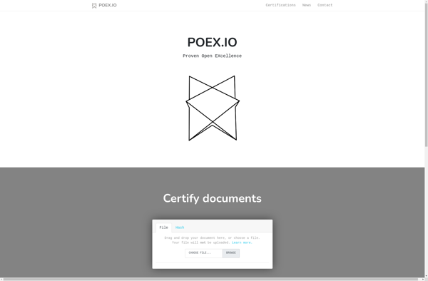
Woleet is a software service built on blockchain technology that offers trusted timestamping and proof of existence solutions. It allows users to anchor documents, data, media files, and other digital content on the Bitcoin blockchain to certify and prove ownership at a specific point in time.The service uses advanced cryptographic...
Proof of existence is a service used to cryptographically prove and timestamp the existence of documents without revealing actual contents. It allows you to anonymously and securely store an online distributed proof of existence for any document. Here's how it works:You upload a document to the proof of existence service.The...
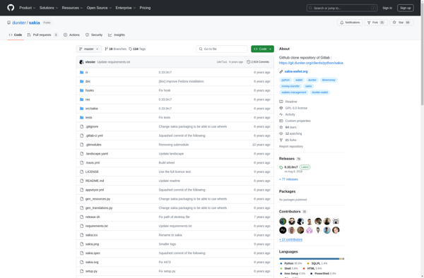
Sakia is an open-source, multi-platform desktop wallet for the privacy-focused cryptocurrency Monero (XMR). It allows users to securely send, receive, and store Monero with the currency's built-in privacy features like ring signatures, stealth addresses, and ring confidential transactions.Some key features of Sakia include:Open-source code that is community-driven and auditableCompatibility with...
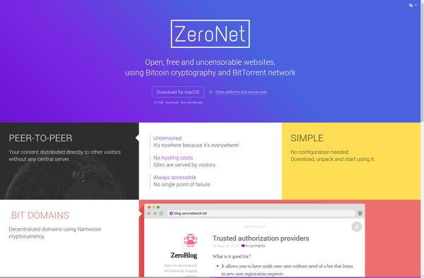
ZeroVerse is an open source platform for creating and hosting 3D virtual worlds, games, and social spaces online. Developed by ZeroProjects, ZeroVerse provides users with intuitive world building tools to construct detailed 3D environments without needing advanced 3D modeling skills.Some key features of ZeroVerse include:Easy-to-use world building tools - Build...
CoinPrice is a popular cryptocurrency price tracking and portfolio management platform founded in 2018. The platform consists of a website and mobile apps available for both iOS and Android devices. It enables cryptocurrency investors to track prices, charts, market caps, volumes, and other detailed metrics for over 8,000 coins and...
Stampery is a web service that allows users to certify the existence of digital assets by storing cryptographic proofs on the Bitcoin blockchain. It leverages the security and decentralization of blockchain technology to timestamp documents, proving they existed at a certain point in time.Here's how Stampery works: Users upload a...
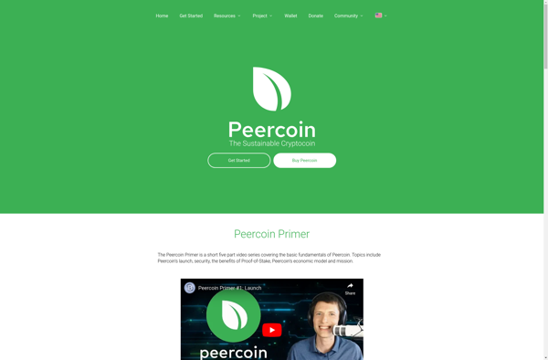
Peercoin (PPC) is a pioneering cryptocurrency that was launched in 2012. It utilizes both proof-of-work and proof-of-stake protocols to secure its network. Peercoin aims to be an energy-efficient cryptocurrency as the proof-of-stake protocol allows coins to be minted, or generated, based on the number of coins a user holds, rather...
OneName is an enterprise identity and access management (IAM) solution used by organizations to manage user identities and control access to applications and resources. It provides capabilities for:Single sign-on (SSO) - Users can log in once to access multiple applications without reauthenticating.Multi-factor authentication - Extra login security using methods like...
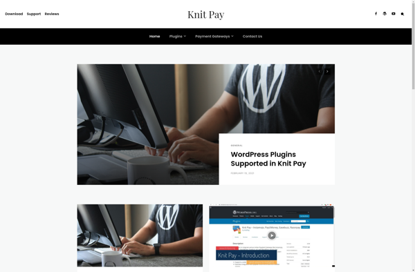
Knit Pay is a cloud-based invoicing and payments management platform designed for freelancers, consultants, and small business owners. Its key features include:Creating professional invoices with customized templatesAccepting online payments via credit card, PayPal, ACH or wire transferAutomatic payment reminders to clientsIncome and expense trackingClient database and contract/project managementTime tracking integrationReceipts...