Mylnikov Geo-Location API for mobile towers
Mylnikov Geo-Location API: Precise Location for Mobile Devices
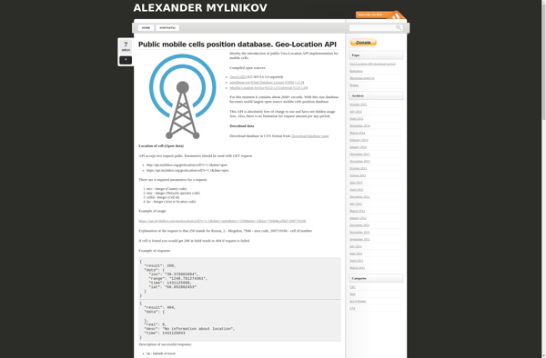
Mylnikov Geo-Location API provides approximate geographic coordinates based on data from mobile phone towers, offering a reliable solution for device location determination without relying on GPS.
What is Mylnikov Geo-Location API for mobile towers?
The Mylnikov Geo-Location API is a cloud-based service that can estimate a mobile device's location using cell tower and WiFi network data. Without needing access to GPS, it can locate Android and iOS devices to within several hundred meters in cities, or up to a few kilometers in rural areas.
It works by looking up the mobile tower and WiFi network information that a device is connected to, and cross-referencing that with an extensive database of tower and network locations. Sophisticated algorithms take into account signal strengths and other data to triangulate an approximate latitude and longitude for the device.
The Mylnikov Geo-Location API is easy to implement and has versatile use cases. For example, it could provide a fallback location when GPS is unavailable, enable geo-fencing and local notifications, drive location-based user experiences, optimize routing, or detect suspicious login activities. It’s scalable to any number of requests and supports global coverage.
Compared to alternatives like Google's Geolocation API or IP geolocation, Mylnikov specializes in tower-based positioning and works well even without WiFi. It’s also designed to be battery-efficient on mobile. The API is billed based on the volume of requests, making it a cost-effective way to add location context to mobile apps and websites.
Mylnikov Geo-Location API for mobile towers Features
Features
- Provides approximate geographic coordinates of a mobile device based on data from nearby cell towers
- Does not require GPS access on the device to determine location
- Can locate devices indoors where GPS may not work reliably
- Works on all major mobile platforms like Android, iOS, etc
- Easy to integrate REST API with JSON responses
- No need to build and maintain own cell tower database
Pricing
- Freemium
- Pay-As-You-Go
Pros
Cons
Official Links
Reviews & Ratings
Login to ReviewNo reviews yet
Be the first to share your experience with Mylnikov Geo-Location API for mobile towers!
Login to ReviewThe Best Mylnikov Geo-Location API for mobile towers Alternatives
View all Mylnikov Geo-Location API for mobile towers alternatives with detailed comparison →
Top Travel & Location and Geolocation and other similar apps like Mylnikov Geo-Location API for mobile towers
Here are some alternatives to Mylnikov Geo-Location API for mobile towers:
Suggest an alternative ❐CellID Finder
OpenSignal

Cell2gps
OpenBmap