openBmap is an open-source, collaborative map project aimed at providing free geographic data worldwide. It allows users to view, edit, and contribute map data to help build a comprehensive global map.
Open-source, collaborative map project providing free geographic data worldwide for viewing, editing, and contributing to build a comprehensive global map.
What is OpenBmap?
openBmap is an open-source, collaborative mapping project with the goal of creating a free and comprehensive map of the entire world. The project relies on volunteer mappers to collect and contribute geographic data which is then made available for anyone to use under an open license.
Some key aspects of openBmap include:
Open data - All map data contributed to openBmap is available under the Open Database License, allowing free use and redistribution.
Comprehensive coverage - The project aims to map the entire world, even areas not covered by other map providers.
Community-driven - openBmap is built by a global community of volunteer mappers and contributors.
Variety of data - The maps incorporate not just roads, but also points of interest, land use and land cover, building footprints, political boundaries, and more.
Multiple editing tools - Contributors can use aerial imagery or GPS tracks along with online and desktop editing tools.
Frequent updates - Data is updated rapidly as new areas are mapped and existing data is improved.
The openBmap project provides both rich, up-to-date geospatial data as well as an opportunity for individuals to engage collaboratively with mapping their communities and world.
OpenBmap Features
Features
Allows users to view map data
Allows users to edit map data
Allows users to contribute new map data
Aims to build a free, open-source, collaborative global map
Pricing
Open Source
Pros
Free to use
Open source so anyone can contribute
Collaborative so draws on knowledge of many contributors
Comprehensive by aiming to map the whole world
Cons
Quality of data depends on contributors so may be inconsistent
Limited features compared to paid mapping platforms
Data may not be as frequently updated as commercial platforms
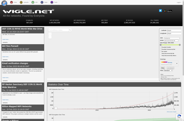
WiGLE (Wireless Geographic Logging Engine) is an open-source web application and API that collects information about wireless networks around the world and maps their geographic locations. It was created in 2001 and relies on a community of users to perform Wi-Fi scans using apps or hardware and submit data about...
CellID Finder is a mobile application designed for identifying cell tower locations and related parameters in cellular networks. It allows users to easily view information such as CellID, network type (2G/3G/4G/5G), signal strength, Location Area Code (LAC), Mobile Country Code (MCC), and other metrics when connected to a cellular network.The...
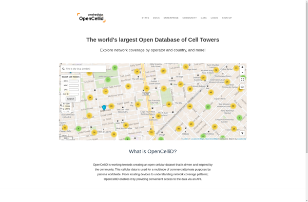
OpenCellID is an open source collaborative project to create a worldwide database of cell tower locations and other related data. It crowd sources data from mobile devices and apps that have OpenCellID SDK integrated to collect information on cell towers in range such as Cell ID, Location Area Code, Mobile...
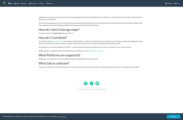
CellMapper is a crowd-sourced mobile phone signal and cellular tower mapping service. It relies on a mobile app that users can install on their phones to detect nearby cell towers, measure signal strength levels, network technology types, and other cellular network metadata as they travel around.The app runs passively in...
Profone Tracker is an open-source call tracking and analytics platform that helps businesses better understand phone-based interactions with customers. With Profone Tracker, businesses can:Set up customizable call flows to route and process incoming callsRecord calls for quality assurance, training, and legal complianceView real-time dashboards showing key call volume and performance...
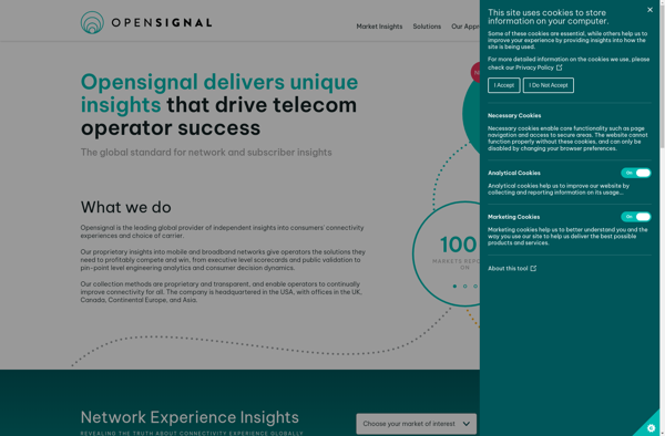
OpenSignal is a free mobile app and website that provides users with information about cellular, Wi-Fi, and other signals in their area. It functions by crowdsourcing data from the devices of users who have installed the app.When OpenSignal is running on a user's phone, it passively collects information about the...
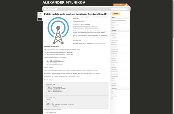
The Mylnikov Geo-Location API is a cloud-based service that can estimate a mobile device's location using cell tower and WiFi network data. Without needing access to GPS, it can locate Android and iOS devices to within several hundred meters in cities, or up to a few kilometers in rural areas.It...
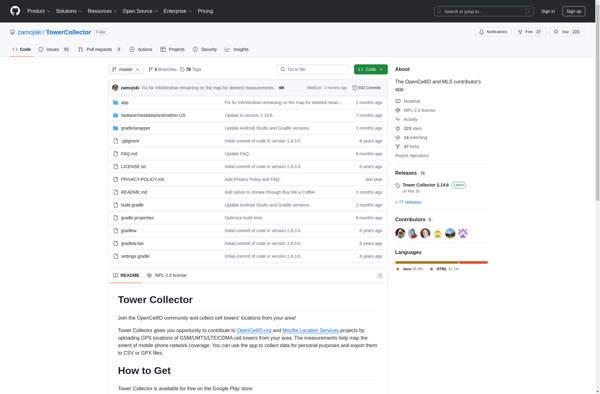
Tower Collector is comic book collection management software for Windows designed to help users organize, catalog, and track their personal comic book collections. It includes extensive database support to store detailed metadata on each comic such as publisher, series, issue number, cover date, writer, penciller, etc.Key features include:Barcode scanning support...
cell2gps is an open source software application that can estimate the location of a mobile phone based on its connections to nearby cell phone towers and their associated signal strengths. It functions without needing access to GPS location data from the phone.The software has a database that maps cell tower...
GSMmap is an open-source web-based geographic information system (GIS) designed to display the real-time location of GSM cells and devices on a map interface. It works by interfacing with a compatible GSM modem connected to the server to obtain location data from nearby mobile devices and cells.Some key features of...
Mozilla Stumbler is an open source application developed by Mozilla for mapping the geography of wireless network signals. It enables users to view the locations and signal strengths of Wi-Fi access points in an area as they move around with a mobile device.Mozilla Stumbler functions by continuously scanning for Wi-Fi...
Cellumap is an open-source software application designed specifically for the analysis and visualization of single-cell spatial transcriptomics data. Single-cell spatial transcriptomics is a novel technique that allows researchers to measure gene expression patterns in individual cells while retaining information about the cells' spatial locations within a tissue sample.Cellumap provides a...