Merkaartor
Description: Merkaartor is an open source editor for OpenStreetMap, allowing users to view, edit, and upload OpenStreetMap data. It provides tools for tracing satellite imagery and importing GPS tracks.
Type: software
Pricing: Open Source
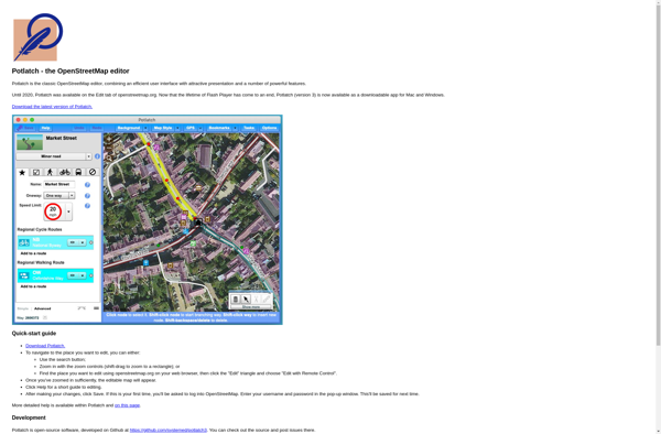
Potlatch
Description: Potlatch is a free and open-source web-based editor for OpenStreetMap, a crowdsourced mapping project. It allows users to create, edit, and manipulate OpenStreetMap geospatial data.
Type: software
Pricing: Open Source