GeoTagEd
GeoTagEd: Free Open Source Photo Geotagging Software for Windows
A free and open source photo geotagging software for Windows, allowing users to view and edit location data in photos, and bulk geotag photos by matching locations based on time correlation.
What is GeoTagEd?
GeoTagEd is a free, open source software application for geotagging photos on Windows platforms. It provides an intuitive interface for viewing and editing location data that is embedded in your photos using EXIF metadata.
The key features of GeoTagEd include:
- Bulk geotagging of photos by matching photo timestamps to location data from GPS tracks
- Interactive map view to manually add geotags by pinpointing locations
- Search and apply location data from OpenStreetMap to tag photos
- Export geotagged photos to Google Earth KML files
- Supports numerous raw image formats like JPEG, RAW, DNG etc.
- Free and open source software published under GNU GPL v3 license
GeoTagEd enables photographers to easily embed rich geographic information in their photo collection. It correlates photos to GPS tracking data using time similarity to batch assign location coordinates. The mapping interface makes geotagging process intuitive. Overall, it's a handy desktop application for geo-organizing personal photo archives.
GeoTagEd Features
Features
- View and edit location data embedded in photos
- Bulk geotag photos by matching locations based on time correlation
- Supports a variety of location formats like GPS coordinates, address, etc
- Allows drag-and-drop for easy bulk geotagging
- Integrates with online maps for geotagging
- Works offline without internet connection
Pricing
- Open Source
Pros
Cons
Official Links
Reviews & Ratings
Login to ReviewThe Best GeoTagEd Alternatives
View all GeoTagEd alternatives with detailed comparison →
Top Photos & Graphics and Photo Editing and other similar apps like GeoTagEd
Geosetter
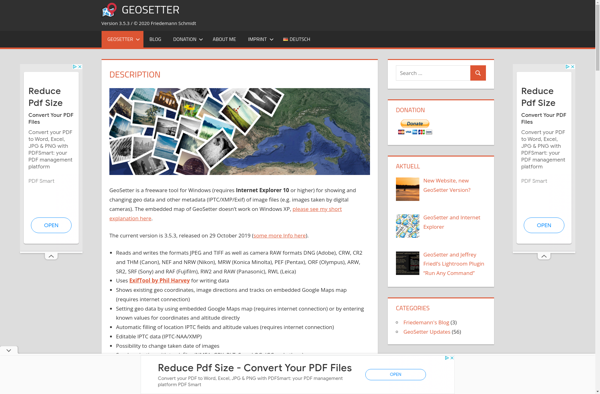
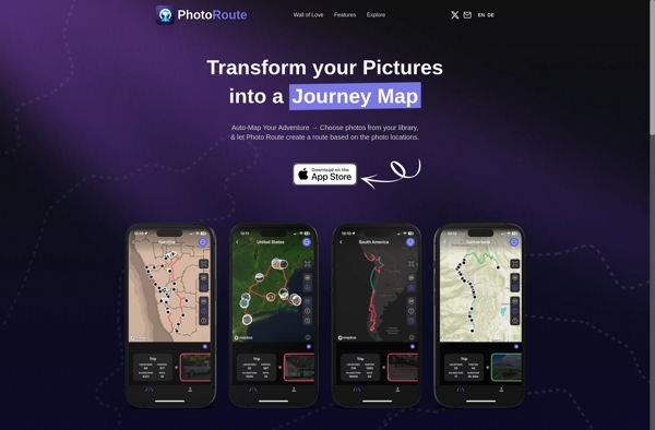
Photo Route
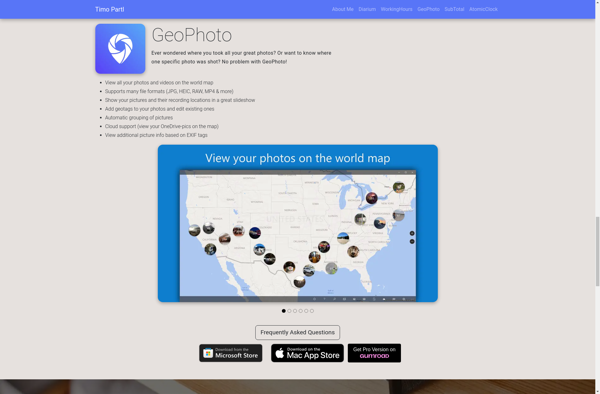
GeoPhoto