Moon Phase Photo Maps
Moon Phase Photo Maps: Plan Your Photos with Lunar Insights
Discover when and where the perfect moon phase occurs, plan your photo shoots and capture stunning visuals with optimal lighting conditions.
What is Moon Phase Photo Maps?
Moon Phase Photo Maps is a specialized software designed to help photographers plan shoots around specific moon phases. It displays an interactive map that shows when and where various moon phases will occur on any given date.
Some of the key features include:
- Ability to see moonrise/moonset times for any location
- Visualization of the path the moon takes across the sky
- Moon phase forecasts for up to a year in advance
- Notifications for upcoming full moons, supermoons, lunar eclipses etc.
- Moon illumination data for optimal photo lighting
- Map tools for scouting shooting locations ahead of time
- Save your favorite photo spots for quick reference
Whether you want to plan a shoot around a full moon over a landscape or silhouette a lunar eclipse behind an urban skyline, Moon Phase Photo Maps gives photographers unique planning capabilities tailored to lunar conditions. Its intuitive interface and powerful mapping features make complicated moon phase forecasting simple and accessible.
Moon Phase Photo Maps Features
Features
- Shows moon phase on map for any date
- Can plan photo shoots based on moon phase
- Shows illumination percentage
- Shows moonrise and moonset times
- Shows eclipse paths
Pricing
- One-time purchase
Pros
Cons
Official Links
Reviews & Ratings
Login to ReviewThe Best Moon Phase Photo Maps Alternatives
View all Moon Phase Photo Maps alternatives with detailed comparison →
Top Photos & Graphics and Photo Editing and other similar apps like Moon Phase Photo Maps
Here are some alternatives to Moon Phase Photo Maps:
Suggest an alternative ❐Air Moon

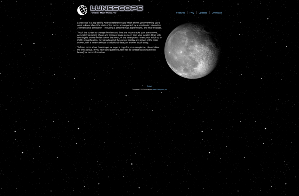
Lunescope Moon Viewer
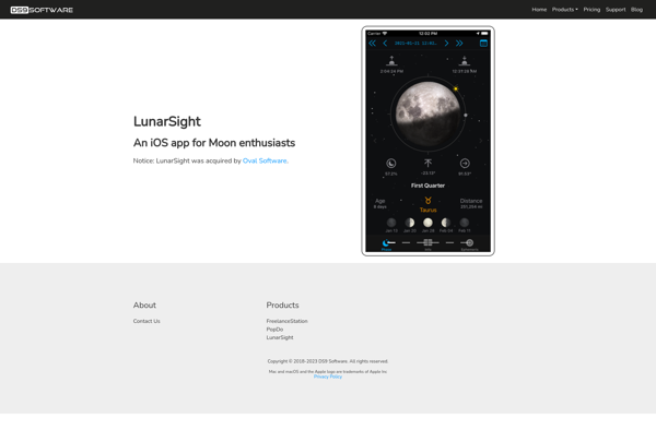
LunarSight