Noaa-apt
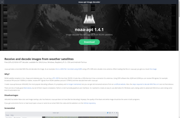
noaa-apt: Open Source Software for Receiving Satellite Images
Receives and decodes satellite images from NOAA polar orbiting weather satellites, suitable for low-cost ground stations with RTL-SDR dongle and antenna
What is Noaa-apt?
noaa-apt is free and open source software designed to receive and decode high resolution weather satellite images from NOAA polar orbiting weather satellites. It works with inexpensive RTL-SDR dongles to set up a low-cost satellite ground station capable of pulling real-time weather data and imagery.
Some key features include:
- Decodes APT transmissions from NOAA 15, 18 and 19 satellites in real time
- Generates PNG images with temperature data, satellite projection and annotations
- Built in database stores images and allows viewing historical passes
- Supports map overlays to match satellite passes to geographic regions
- Cross platform application for Linux, Mac and Windows
With an appropriate antenna and line of sight to NOAA satellites, noaa-apt allows weather enthusiasts, students and researchers to build an affordable ground station to monitor the latest pass over their location. The generated images contain visible and infrared channels providing cloud cover and temperature information useful for meteorology and environmental monitoring.
Noaa-apt Features
Features
- Receives and decodes images from NOAA polar orbiting weather satellites
- Supports RTL-SDR dongles for setting up a low-cost satellite ground station
- Open source software with community support and development
Pricing
- Open Source
Pros
Cons
Official Links
Reviews & Ratings
Login to ReviewThe Best Noaa-apt Alternatives
View all noaa-apt alternatives with detailed comparison →
Top Science & Weather and Satellite Imaging and other similar apps like Noaa-apt
WXtoIMG Restored
SatDump