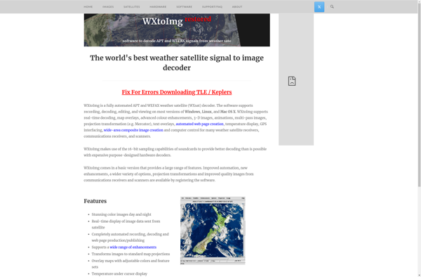
WXtoIMG Restored
WXtoIMG Restored is a free, open-source program that captures images from weather satellites and creates maps from them. It works with various satellites like NOAA, Meteor, FengYun, and Okean.
WXtoIMG Restored
Free & Open-Source Software for Satellite Imagery Capture and Map Creation
What is WXtoIMG Restored?
WXtoIMG Restored is a popular, free, open-source software used to receive and process images from weather satellites. It supports a wide range of satellites including NOAA, Meteor, FengYun, and Okean. Some key features include:
- Automated image capture from satellite passes
- Image enhancement tools like contrast, brightness, and sharpening adjustments
- Annotation options to label images
- Projection transformation to create navigational maps
- Time lapse creation and animated GIF exporting
- Supports various hardware like RTL-SDR devices or satellie dishes for signal reception
The 'Restored' version is a community-updated fork that provides bug fixes and new features compared to the original unmaintained WXtoIMG program. It remains popular in the weather satellite hobbyist community for being free, cross-platform, and open-source.
WXtoIMG Restored Features
Features
- Captures images from weather satellites
- Creates maps from satellite images
- Works with NOAA, Meteor, FengYun, Okean and other satellites
- Can schedule automatic image captures
- Adjusts images for skew and rotation
- Enhances images using filters
- Exports images to various formats like JPEG, PNG, GeoTIFF
- Creates timelapse videos from image sequences
- Open source and cross-platform
Pricing
- Open Source
Pros
Free and open source
Works on Windows, Mac and Linux
Easy to use interface
Supports many satellite types
Can automate image captures
Good image enhancement capabilities
Exports images in various formats
Cons
Steep learning curve for new users
Requires additional hardware like antenna and receiver
Limited documentation and support
Development seems inactive currently
Some features need improvement
Official Links
Reviews & Ratings
Login to ReviewThe Best WXtoIMG Restored Alternatives
View all WXtoIMG Restored alternatives with detailed comparison →
Top Science & Weather and Satellite Imaging and other similar apps like WXtoIMG Restored
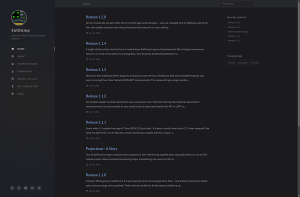
SatDump
SatDump is an open source, free software application designed for automated searching, downloading, and preprocessing of satellite imagery data from various freely available online repositories. It supports downloading imagery from satellites such as Landsat (5, 7, 8), Sentinel (Sentinel-1, Sentinel-2), and MODIS.Some key features of SatDump include:Automated batch downloading of...
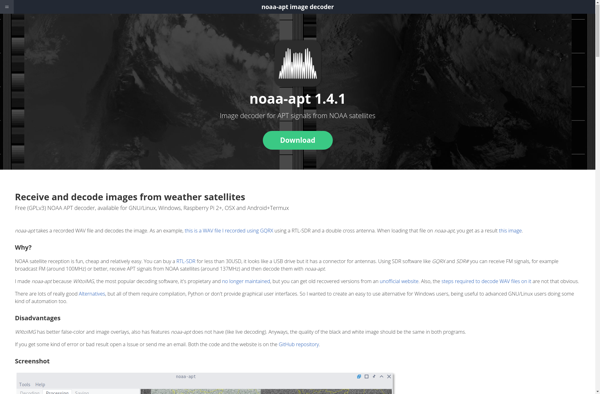
Noaa-apt
noaa-apt is free and open source software designed to receive and decode high resolution weather satellite images from NOAA polar orbiting weather satellites. It works with inexpensive RTL-SDR dongles to set up a low-cost satellite ground station capable of pulling real-time weather data and imagery.Some key features include:Decodes APT transmissions...