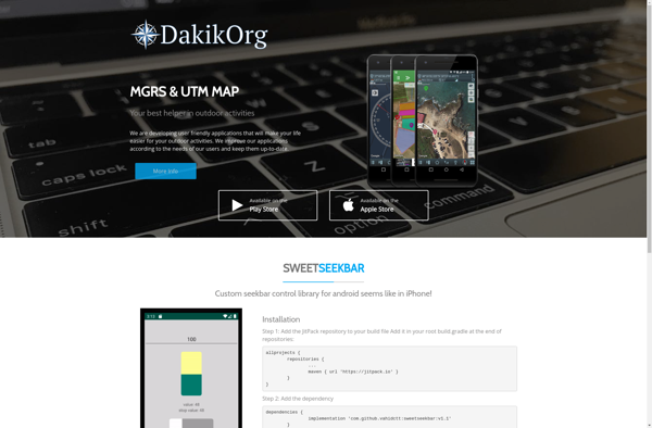
Mgrs & Utm Map
Mgrs & Utm Map: Software Tool for Coordinate Conversion
Mgrs & Utm Map is a software tool used for converting between geographic coordinates and military grid reference systems. It allows users to easily translate between latitude/longitude, MGRS, USNG, UTM, and GEOREF coordinates.
What is Mgrs & Utm Map?
Mgrs & Utm Map is mapping software designed specifically for use by military, government, and geographic professionals. It enables easy conversion between common geographic coordinate systems including latitude/longitude, Military Grid Reference System (MGRS), United States National Grid (USNG), Universal Transverse Mercator (UTM), and World Geographic Reference System (GEOREF).
Key features include:
- Bidirectional coordinate conversion between geographic and grid systems
- Support for a wide variety of datums and projections
- Customizable interface with support for importing/exporting waypoints
- Ability to plot locations and measure distances on maps
- Compatible with GPS devices to import/export waypoints
Mgrs & Utm Map provides an intuitive way for defense forces, government agencies, surveyors, and GIS professionals to work with multiple coordinate reference systems. Its versatility makes it useful for navigation, creating tactical maps, geocoding assets, and other spatial applications.
Mgrs & Utm Map Features
Features
- Converts between geographic coordinates and military grid systems like MGRS, USNG, UTM, GEOREF
- Supports multiple coordinate formats: latitude/longitude, degrees/minutes/seconds, decimal degrees
- Interactive map allows clicking to get coordinates or enter coordinates to pan map
- Customizable interface with options for coordinate precision, grids, etc
- Works offline without internet access
- Available on multiple platforms: Windows, Mac, Linux, Android, iOS
Pricing
- Free
- Open Source
Pros
Cons
Official Links
Reviews & Ratings
Login to ReviewThe Best Mgrs & Utm Map Alternatives
View all Mgrs & Utm Map alternatives with detailed comparison →
Top Travel & Location and Mapping & Navigation and other similar apps like Mgrs & Utm Map
No alternatives found for Mgrs & Utm Map. Why not suggest an alternative?