OpenCPN
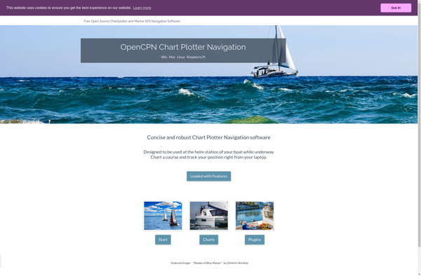
OpenCPN: Open Source Chart Plotter & Marine Navigation Software
OpenCPN is an open source chart plotter and marine navigation software. It supports vector and raster charts, GPS/chart alignment, routing, weather data overlays, anchor alarms, AIS display, and instrument display plugins.
What is OpenCPN?
OpenCPN is an open source, free software project focused on marine navigation needs. It provides a chart plotter and navigation software designed for use underway or as a planning tool. Key features include:
- Supports various vector and raster nautical charts
- Built-in worldwide vector shoreline data
- Displays vessel position from GPS and related instrument data
- Routing, anchor alarms, tide/current data
- GRIB weather overlay plugin included
- Compatible chart object and position display on secondary device
- Route planning, monitoring, logging
- AIS display, radar overlay and instrument display via plugins
- Runs on Windows, Linux, Mac OSX
With support for worldwide charts and flexible instrument integration via plugins, OpenCPN provides capable navigation software customizable to a range of marine use cases. The open source nature allows user customization and plugins not feasible in proprietary marine packages.
OpenCPN Features
Features
- Vector and raster chart support
- GPS/chart alignment
- Routing
- Weather data overlays
- Anchor alarms
- AIS display
- Plugin support
Pricing
- Open Source
Pros
Cons
Official Links
Reviews & Ratings
Login to ReviewThe Best OpenCPN Alternatives
View all OpenCPN alternatives with detailed comparison →
Top Travel & Location and Marine Navigation and other similar apps like OpenCPN
No alternatives found for OpenCPN. Why not suggest an alternative?