WhatIsWhere icon

WhatIsWhere

WhatIsWhere is a database and search engine software that allows users to easily find information about locations around the world. It includes data on countries, cities, landmarks, and more to help answer questions like 'What country is the Eiffel Tower in?'

What is WhatIsWhere?

WhatIsWhere is a robust database and search engine software focused on geographic locations and places around the world. It contains extensive information on over 200 countries and territories, including details on capitals, languages, currencies, population demographics, and more.

In addition to country data, WhatIsWhere also includes information on hundreds of thousands of cities and towns globally. Each city listing provides details like country and region, latitude and longitude coordinates, population statistics, local time zone, and nearby airports.

The database also contains data on iconic landmarks and places of interest across the globe. This includes famous structures like the Eiffel Tower, Statue of Liberty, and Taj Mahal as well as notable natural landscapes like Mount Everest, the Sahara Desert, and the Great Barrier Reef.

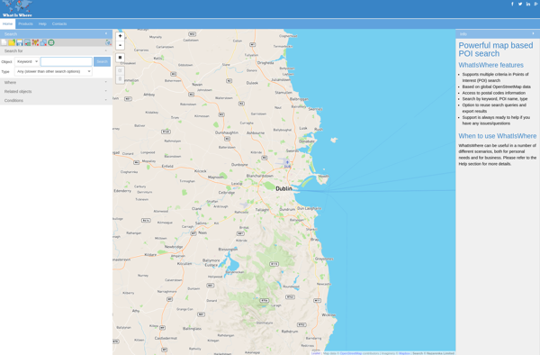
One of the key features that makes WhatIsWhere valuable is its powerful location-based search engine. Users can enter any city, landmark, or place name and instantly get information back matching their query. This makes it easy to quickly answer questions like "What country is the Eiffel Tower in?" or "What is the capital of Australia?"

Overall, WhatIsWhere serves as an essential geography reference guide in website or software form. Its vast database provides details on places worldwide while its search functionality allows users to easily lookup and validate geographic facts and data.

The Best WhatIsWhere Alternatives

Top Apps like WhatIsWhere

Google Maps, OpenStreetMap, Yelp, Apple Maps, Planet Labs, Yandex Maps, TomTom MyDrive, ListPM, GPS Navigator with Offline Maps are some alternatives to WhatIsWhere.

Google Maps

Google Maps is a web mapping platform and consumer application offered by Google. It offers satellite imagery, aerial photography, street maps, 360° interactive panoramic views of streets, real-time traffic conditions, and route planning for traveling by foot, car, bicycle and air, or public transportation.Key features of Google Maps include:Interactive...

OpenStreetMap

OpenStreetMap (OSM) is a collaborative project to create a free and editable map of the world. Unlike proprietary map data from companies like Google or Apple, OSM map data is open and licensed under the Open Database License (ODbL), which allows anyone to use, modify, and distribute the data freely...

Yelp

Yelp is a website and mobile app that hosts crowdsourced reviews about local businesses. It allows users to search for and find information about businesses such as restaurants, shopping, nightlife, services and more. Users can read and write reviews that detail their experiences at those businesses, give star ratings, upload...

Apple Maps

Apple Maps is a web mapping service developed by Apple Inc. It was introduced in 2012 with iOS 6 as a replacement for Google Maps on Apple devices. Apple Maps offers turn-by-turn navigation, interactive panoramic street views, Flyover mode for photorealistic 3D views of certain cities, support for transit routing and real-time...

Planet Labs

Planet Labs is an earth imaging company founded in 2010 and based in San Francisco, California. They operate the world's largest commercial satellite constellation with over 200 satellites in orbit, collecting imagery of the entire land mass of the Earth every day.Their high revisit rate and global coverage allows them to...

Yandex Maps

Yandex Maps is a free online map service developed by Yandex, a Russian multinational technology company specializing in Internet-related services and products. Yandex Maps offers highly detailed and searchable maps, turn-by-turn navigation, public transit information, traffic data, and 360-degree panoramic street view images for over 220 countries around the world.The...

TomTom MyDrive

TomTom MyDrive is a free desktop and mobile app that interfaces with TomTom GPS navigation devices to provide expanded features and functionality. With MyDrive, users can plan routes and destinations on their computer, tablet, or phone and seamlessly send that information to their TomTom device.Key features of TomTom MyDrive...

ListPM

ListPM is a flexible personal task management application designed to help users stay organized and productive. With an easy-to-use interface, ListPM allows you to create multiple to-do lists to manage all your tasks in one place.Key features of ListPM include:Add, edit and delete tasks across multiple customizable listsSet...

GPS Navigator with Offline Maps

GPS Navigator is a feature-rich navigation and maps app for Android and iOS that is focused on providing accurate turn-by-turn directions even when offline. It sets itself apart by offering free offline map downloads for over 200 countries and territories worldwide, meaning you can navigate unfamiliar areas without racking up roaming...