FlightAirMap
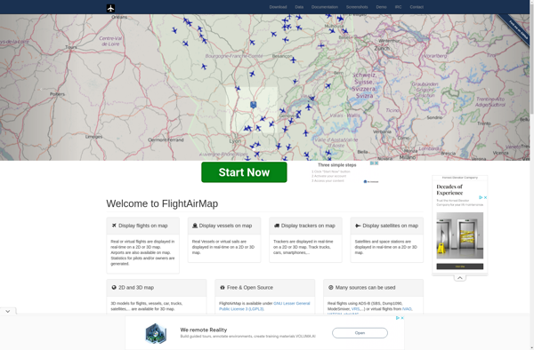
FlightAirMap: Aviation Navigation Software
FlightAirMap is a flight planning and navigation software for pilots. It provides detailed aviation maps, weather information, route planning tools, and in-flight navigation to help pilots effectively plan flights and navigate while in the air.
What is FlightAirMap?
FlightAirMap is an innovative flight planning and navigation solution designed specifically for pilots. It integrates aviation maps, weather data, route planning tools, and in-flight navigation into one comprehensive system to streamline flight planning and enhance situational awareness.
Key features of FlightAirMap include:
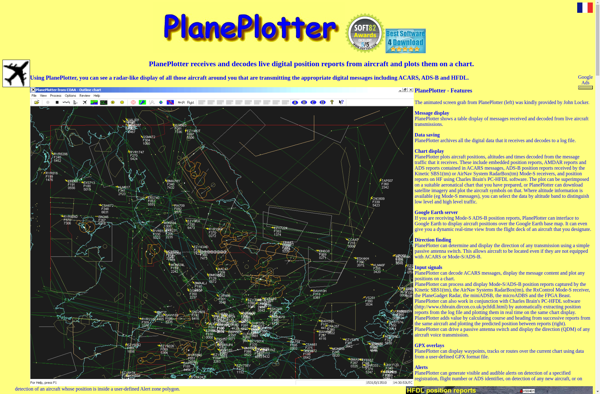
- Global aviation maps with terrain, airspaces, navaids, airports, air routes, and more
- Accurate and up-to-date weather layers showing winds, temperatures, precipitation, lightning strikes, and more
- Intelligent route planning taking into account aircraft performance, winds, and airspaces
- In-flight moving map with precise aircraft positioning for navigation
- Digital flight logging automatically recording route, duration, weather, and other statistics
- Filing and activation of flight plans with many country-specific protocols
- Sync between mobile and desktop apps to easily move planning and docs
- Integration with popular wearables for hands-free navigation
With its advanced mapping and planning capabilities, FlightAirMap gives pilots greater confidence and awareness during all phases of flight. Its intuitive design makes flight planning and navigation easy even for novice GA pilots while still providing sophisticated tools for experienced aviators. Whether flying cross-country or just pattern work close to an airport, FlightAirMap aims to be every pilot's trustworthy co-pilot.
FlightAirMap Features
Features
- Detailed aviation maps
- Weather information
- Route planning tools
- In-flight navigation
Pricing
- Subscription-Based
Pros
Cons
Official Links
Reviews & Ratings
Login to ReviewThe Best FlightAirMap Alternatives
View all FlightAirMap alternatives with detailed comparison →
Top Travel & Location and Aviation and other similar apps like FlightAirMap
Here are some alternatives to FlightAirMap:
Suggest an alternative ❐FlightRadar24

ADS-B Exchange

RadarBox

FlightAware

AirLabs API
PlanePlotter