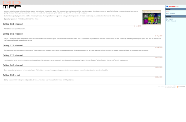
GD Map
GD Map is an open source, web-based geographic information system (GIS) software. It allows users to view, edit, analyze, and publish geospatial data through a web browser.
GD Map: Open Source Web GIS Software
An open source web-based geographic information system (GIS) software for viewing, editing, analyzing, and publishing geospatial data through a web browser.
What is GD Map?
GD Map is an open source, web-based geographic information system (GIS) software. It provides capabilities to visualize, manage, edit, analyze, and publish geospatial data through a standard web browser.
Key features of GD Map include:
- Interactive web maps with layer control, scale bar, legend etc.
- Support for multiple coordinate reference systems and projections
- Import/Export of various geospatial data formats like Shapefile, GeoJSON, KML etc.
- Advanced cartography and styling of vector and raster data
- Spatial analysis tools for buffer, clip, union, intersect etc.
- Measurements, print layouts, geocoding and routing
- User management, access control and permissions
- Customizable interface through themes and widgets
As an open source solution, GD Map is free to download, use and modify. It provides capabilities comparable to commercial desktop GIS software in an easy-to-use web interface. The active developer community ensures continued enhancements and bug fixes.
GD Map Features
Features
- Web-based GIS
- Open source
- View, edit, analyze geospatial data
- Publish maps and data
- Support various data formats
- Customizable interface
- Plugin architecture
Pricing
- Open Source
- Free
Pros
Free and open source
Easy to use web interface
Support common GIS data formats
Customizable and extensible
Active development community
Can be self-hosted
Cons
Limited native analysis functions
Not as full-featured as desktop GIS
Performance limitations in browser
Steep learning curve for developers
Limited documentation
Official Links
Reviews & Ratings
Login to ReviewThe Best GD Map Alternatives
View all GD Map alternatives with detailed comparison →
Top Travel & Location and Mapping & Navigation and other similar apps like GD Map
Here are some alternatives to GD Map:
Suggest an alternative ❐Ncdu
ncdu, short for NCurses Disk Usage, is a command-line disk usage analyzer utility. It provides a visual representation of disk usage in a specified directory or file system. Developed using the NCurses library, ncdu offers an interactive and text-based interface, making it well-suited for use in terminal environments. Key Features:...
TreeSize
TreeSize is a powerful disk space manager for Windows that provides an in-depth analysis of disk usage to help free up space. It scans local drives, external drives, network shares and cloud storage to build an interactive tree map visualization that displays the size of folders and files down to...
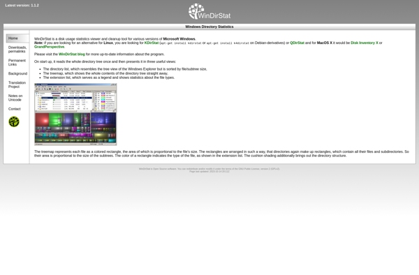
WinDirStat
WinDirStat is a graphical disk usage utility for Microsoft Windows that allows users to easily visualize disk space usage on their computer's hard drive. Developed as an open source tool, WinDirStat aims to be an alternative to the built-in Windows Explorer disk usage function.When launched, WinDirStat scans the selected drive...
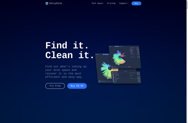
DaisyDisk
DaisyDisk is a popular disk space analyzer and cleanup utility designed specifically for Mac. It provides a visual overview of the files and folders taking up space on your hard drives, making it easy to see what is using up capacity so you can free up more space.When launched, DaisyDisk...
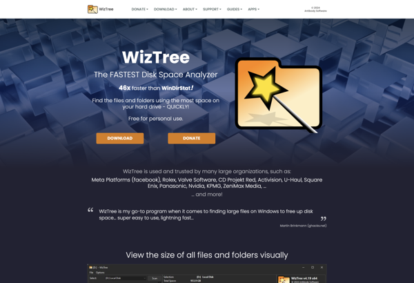
WizTree
WizTree is a powerful disk space analyzer and cleanup tool for Windows. It provides ultra-fast scanning of hard drives to give you a complete visualization of disk usage broken down by file types, folders, and drive usage. Key features of WizTree include:Very fast scanning and analysis - it can scan...
Baobab Disk Usage Analyzer
Baobab is a graphical disk usage analyzer for Linux designed to help users understand what is taking up space on their hard drives or folders. It features an intuitive tree map visualization that allows you to easily identify large files and folders, making it simple to free up space by...

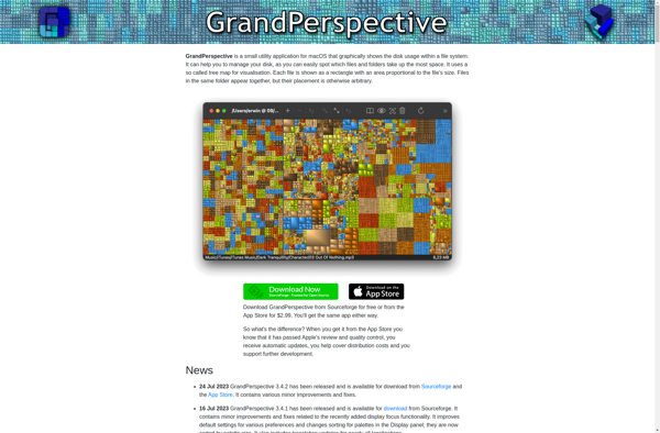
GrandPerspective
GrandPerspective is a free and open source disk space analyzer application designed specifically for the macOS operating system. It provides users with a graphical visualization of what files and folders are taking up space on their hard drives.One of the key features of GrandPerspective is its use of treemap layouts....
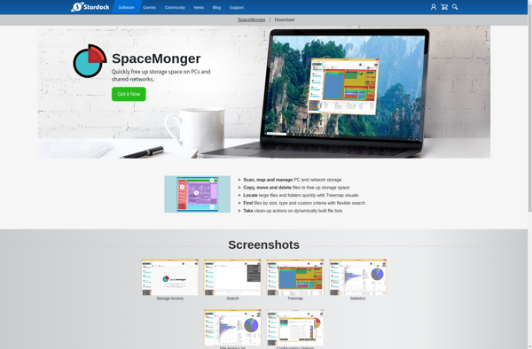
SpaceMonger
SpaceMonger is a Windows utility that provides a visual representation of the files and folders on your computer's hard drives. It uses colored blocks to represent the space taken up by each file and folder, giving you a graphical overview of disk space usage.One of the key features of SpaceMonger...
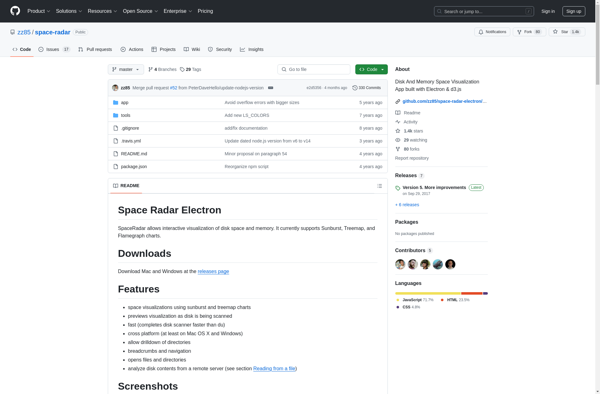
Space Radar
Space Radar is an innovative software solution designed for accurately tracking and monitoring objects in Earth orbit and deep space. It utilizes a global network of powerful radar systems and telescopes to continuously scan the sky, providing up-to-date orbital data on everything from communication satellites and space stations to space...
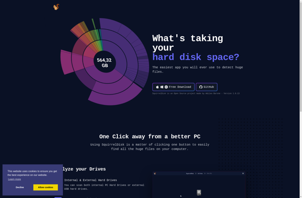
SquirrelDisk
SquirrelDisk is a free open source desktop application for Windows that enables users to create encrypted virtual disk drives to securely store sensitive files and folders. It utilizes the industry standard AES encryption algorithm with 256-bit keys to protect data from unauthorized access.Some key features of SquirrelDisk include:Ability to create...
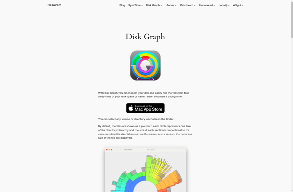
Disk Graph
Disk Graph is a disk space usage visualization and analysis tool for Windows. It provides an interactive, zoomable treemap that allows you to easily see what is taking up space on your disks down to the folder and even individual file level.Some key features of Disk Graph include:Scans local disks...