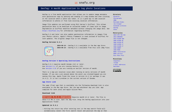
GeoTag for macOS
GeoTag is a free photo metadata editor for macOS. It allows you to view and edit location data as well as other EXIF and IPTC metadata attached to your images.
GeoTag: Free Photo Metadata Editor for macOS
View, edit, and manage photo metadata like location data, EXIF, and IPTC on your macOS device with GeoTag, a free and powerful tool.
What is GeoTag for macOS?
GeoTag is a free and open source photo metadata viewer and editor for macOS. It enables you to view and edit geotags (location data) as well other metadata like EXIF and IPTC attached to your images.
Key features include:
- View and edit location data like latitude, longitude, and altitude
- Add geotags to photos using a map interface or by entering coordinates
- View and edit other EXIF metadata like date, camera settings, etc.
- View and edit IPTC metadata like keywords, captions, copyright info
- Supports common image formats like JPG, RAW, TIFF
- Batch edit metadata for multiple photos
- Free and open source software
GeoTag provides an easy way to view and manage photo metadata on macOS without needing any advanced image editing tools. It's useful for photographers and other creative professionals working with geotagged images.
GeoTag for macOS Features
Features
- View and edit EXIF and IPTC metadata
- View and edit location data
- Batch edit metadata for multiple photos
- Export metadata to CSV/JSON
- Import metadata from CSV/JSON
- Geotag photos from GPS track logs
Pricing
- Free
- Open Source
Pros
Free and open source
Simple and easy to use interface
Supports many common image formats
Allows batch editing metadata
Can export/import metadata in CSV/JSON format
Cons
Limited to editing metadata only, no image editing features
Does not support some RAW image formats
No automation or workflow features
Official Links
Reviews & Ratings
Login to ReviewThe Best GeoTag for macOS Alternatives
View all GeoTag for macOS alternatives with detailed comparison →
Top Photos & Graphics and Photo Editing and other similar apps like GeoTag for macOS
Here are some alternatives to GeoTag for macOS:
Suggest an alternative ❐Geosetter
Geosetter is a free, cross-platform application used for organizing and geotagging images using their geographic coordinates and other metadata. It has an intuitive interface that allows users to:Import photos from various devices like cameras or phones and read their existing metadataView photos geo-positioned correctly on an integrated map for easy...
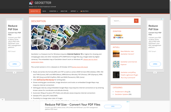
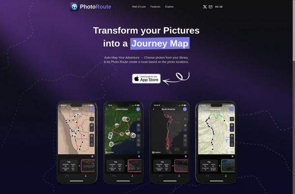
Photo Route
Photo Route is a photo organization and management software application designed for Windows. It provides a range of tools to help users organize, edit, and share their personal photo collections.One of the key features of Photo Route is the ability to tag and rate photos. Users can create custom tags...
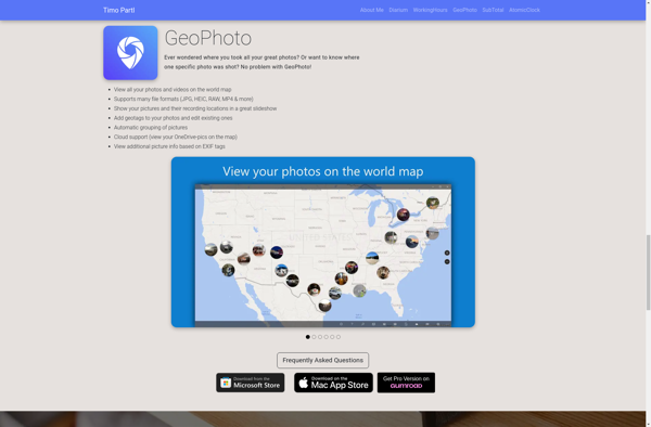
GeoPhoto
GeoPhoto is a photo organization and management application designed specifically for geotagged photos. It allows users to upload photos from their devices, tag them with GPS coordinates or location names, and then view and browse those photos on a map interface.Once photos are uploaded to GeoPhoto, the software extracts any...
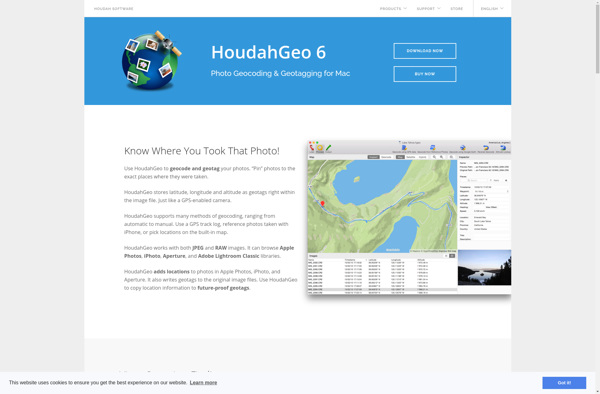
Houdahgeo
HoudahGeo is a feature-rich GPS geocoding application designed for Mac users to easily geotag and organize their photo library. It provides a comprehensive set of tools to tag photos with GPS coordinates and location names by matching them to GPS track logs recorded by cameras, smartphones or handheld GPS devices.Some...
RoboGEO
RoboGEO is an open-source desktop application for geospatial data visualization, editing, analysis and processing. It is designed to handle various types of vector (shape files, KML, GeoJSON etc.) and raster geospatial data.With RoboGEO, users can view, explore and query 2D or 3D maps loaded from GIS datasets. It supports display...
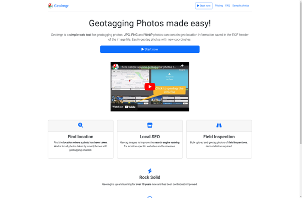
GeoImgr.com
GeoImgr.com is a leading cloud-based geospatial data management and analysis platform designed to help organizations and individuals easily upload, store, manage, analyze, visualize, and share geospatial data. It provides a intuitive yet powerful interface that allows users with no prior GIS experience to leverage the capabilities of geospatial data.Key features...
Pictomio
Pictomio is an easy-to-use graphic design and image editing application suitable for beginners and professionals alike. With an intuitive drag-and-drop user interface, Pictomio makes creating designs, editing photos, and modifying images accessible to everyone.Despite its simple interface, Pictomio is packed with powerful features. It comes with numerous built-in design templates...

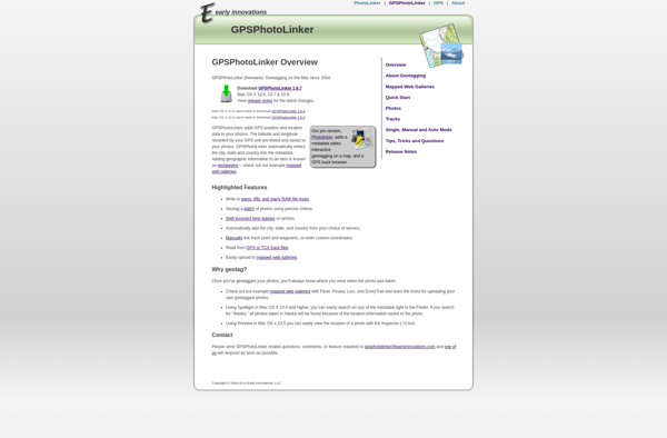
GPSPhotoLinker
GPSPhotoLinker is a standalone Windows application used to geotag photos by matching them to GPS log data from a separate device like a handheld GPS or smartphone. It allows photographers to embed location information into their image metadata for organizational purposes and mapping.To use GPSPhotoLinker, you first record a GPS...
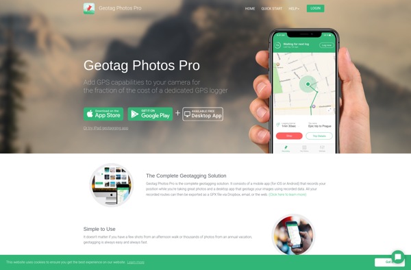
Geotag Photos Pro
Geotag Photos Pro is a robust yet easy-to-use photo geotagging application for Windows. It enables photographers to automatically tag their images with geographic location metadata by matching time and date stamps from photos with GPS log data from external devices such as handheld GPS units or smartphones.Key features include:Clean and...