OpenJUMP GIS
OpenJUMP GIS is an open source Geographic Information System software used to view, edit, and analyze geospatial data. It supports many common GIS data formats and spatial analysis functions.

OpenJUMP GIS: Open Source GIS Software for Viewing, Editing, and Analyzing Geospatial Data
Open source Geographic Information System software supporting multiple GIS data formats and spatial analysis functions.
What is OpenJUMP GIS?
OpenJUMP GIS is a free, open source Geographic Information System (GIS) software used to view, edit, analyze, and process geospatial data. It is written in Java and runs on multiple platforms including Windows, Mac, and Linux.
Key features of OpenJUMP include:
- Supports viewing and editing of vector data in formats like Shapefile, GeoJSON, PostGIS, SpatiaLite.
- Provides basic GIS analysis tools like buffer, intersect, union, clip.
- Styling and symbology options to customize map presentation.
- Plug-in architecture to extend functionality.
- Connects to databases like PostGIS, MySQL to manage data.
- Exports maps and data to formats like PDF, SVG, GeoTIFF.
- Lightweight and customizable user interface.
With its wide format compatibility, analysis capabilities, and extensibility, OpenJUMP serves as a good open source alternative to commercial GIS software for basic mapping and geospatial tasks.
OpenJUMP GIS Features
Features
- Desktop GIS application
- Supports viewing, editing and analysis of vector and raster geospatial data
- Import/export many common GIS data formats like Shapefile, GeoTIFF
- Spatial analysis tools for buffering, intersecting, merging layers
- Create thematic maps and print layouts
- Extend functionality with plugins
Pricing
- Open Source
Pros
Free and open source
Cross-platform - runs on Windows, Mac, Linux
User-friendly interface
Support for many data formats and functions
Customizable and extensible
Cons
Limited raster support compared to other GIS
Steep learning curve for new users
Lacks some advanced analysis tools
Not as full-featured as proprietary desktop GIS
Official Links
Reviews & Ratings
Login to ReviewThe Best OpenJUMP GIS Alternatives
View all OpenJUMP GIS alternatives with detailed comparison →
Top Education & Reference and Geographic Information Systems and other similar apps like OpenJUMP GIS
Here are some alternatives to OpenJUMP GIS:
Suggest an alternative ❐QGIS
QGIS is a professional open-source Geographic Information System (GIS) software for working with maps and geospatial data. It is licensed under the GNU Public License. QGIS allows you to view, edit, analyze, process, and visualize spatial data in various formats including shapefiles, GeoTIFFs, PostGIS, SpatiaLite, GPX, and more. It supports...

ArcGIS
ArcGIS is a robust and comprehensive geographic information system (GIS) software developed by Esri. It provides a range of capabilities for creating, managing, analyzing, and sharing geospatial data and maps across desktop, mobile, web, and enterprise systems.Key features of ArcGIS include:Advanced geospatial analysis tools for proximity analysis, geocoding, routing, terrain...

SAGA GIS
SAGA GIS (System for Automated Geoscientific Analyses) is a free and open source geographic information system (GIS) software used for editing and analyzing spatial data. It contains a large set of geoscientific analysis functions and utilities for managing vector, raster and table data.Some key features of SAGA GIS include:Support for...

SuperGIS
SuperGIS is a comprehensive geographic information system (GIS) software developed by SuperMap. It provides a wide range of capabilities for working with maps and geographic data including:Data Capture and Management - SuperGIS can import, manage and analyze spatial data from various sources. It supports vector, raster, CAD, databases, lidar, BIM...
GvSIG Desktop
gvSIG Desktop is a free and open source geographic information system (GIS) software designed for capturing, storing, processing, analyzing and disseminating geospatial data. It is developed by the gvSIG Association and released under the GNU General Public License.Some key features of gvSIG Desktop include:Support for viewing and editing vector and...

Equator
Equator is a cloud-based digital asset management (DAM) and brand management platform used by global companies to easily manage their digital assets. It enables teams to efficiently organize, distribute, collaborate on, and track usage of brand assets from one central place.Key features of Equator include:Cloud-based storage for all digital assetsPowerful...

GRASS GIS
GRASS GIS (Geographic Resources Analysis Support System) is a free and open source geographic information system (GIS) software suite used for geospatial data management, analysis, graphics and maps production, spatial modeling, and visualization.Some key features of GRASS GIS include:Powerful raster, vector, and geospatial processing tools for analysis and data conversionAbility...

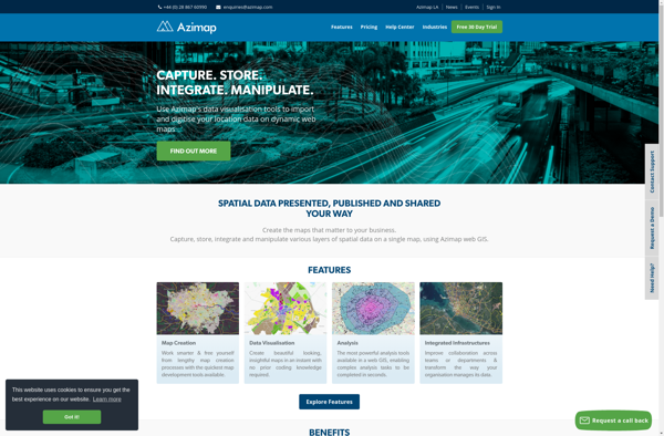
Azimap GIS
Azimap GIS is an open-source geographic information system (GIS) software application used to create, edit, visualize, analyze and publish geospatial information. It enables users to work with both raster and vector data, including the ability to create, edit and manage spatial datasets.Key features of Azimap GIS include:Interactive map display with...
TdhGIS
TdhGIS is an open-source geographic information system (GIS) software application developed by Terre des hommes (Tdh), an international NGO focused on humanitarian aid for children. It is designed specifically for public health professionals to map and analyze data to improve programs and policies.Key features of TdhGIS include:Interactive and dynamic mapping...

GeoMedia
GeoMedia is a leading Geographic Information System (GIS) software application developed by Hexagon for working with maps and geographic information. First released in 1991, GeoMedia has over 30 years of development behind it and is used across industries including government, utilities, natural resources, transportation, and defense sectors.GeoMedia enables both GIS...