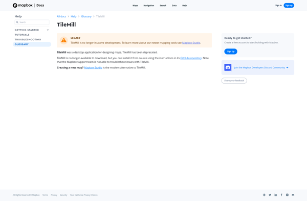
TileMill is an open source map design studio that allows users to quickly and easily create custom interactive maps for the web. It has an intuitive interface for styling maps with CartoCSS.
TileMill is an open source map design studio that allows users to quickly and easily create custom interactive maps for the web. It has an intuitive interface for styling maps with CartoCSS.
What is TileMill?
TileMill is an open source map design studio developed by MapBox that allows users to quickly and easily create custom interactive maps for the web. It has an intuitive user interface that allows users to import and style map data to create beautiful custom map visualizations.
Some key features of TileMill include:
Import GIS data such as shapefiles, GeoJSON files, KML files, and PostGIS databases
Style maps using CartoCSS, which is similar to CSS for maps
Easily customize every aspect of the map design - colors, fonts, interactivity, etc.
Preview maps in real-time to see changes as you style
Export tilesets for interactive web maps that can be embedded or hosted with services like MapBox
Open source and extensible so developers can expand capabilities
Cross-platform (Windows, Mac OS X, and Linux)
With its user-friendly interface and powerful CartoCSS styling capabilities, TileMill allows designers, developers, and GIS professionals to quickly turn geographic data into beautiful custom map visualizations for the web and mobile devices.
TileMill Features
Features
Intuitive graphical user interface for styling maps
Built-in CartoCSS support for applying styles to vector and raster data
Easily customize maps with Mapbox tools like Mapbox Studio
Export maps to web-ready formats like HTML, CSS, PNG, MBTiles
Integrates with open data sources like OpenStreetMap
Supports a variety of common geospatial data formats
Mapbox Studio is a powerful desktop application for designing custom map styles. It provides a graphical user interface that allows you to visually style vector tiles created with Mapbox tools and services.Some key features of Mapbox Studio include:Import vector tilesets created with Mapbox tools like Mapbox Streets and SatelliteStyle map...
Mapme is an intuitive and collaborative online mind mapping and brainstorming application. It enables individuals and teams to visually organize ideas, projects, and workflows all in one place.Key features of Mapme include:Real-time collaboration - Work together on mindmaps at the same time for seamless brainstorming sessionsDiagramming and visualization - Easily...
Sharemap is an open-source web-based mind mapping and brainstorming application. It allows users to create colorful and visually engaging mind maps to organize ideas, concepts, and information. Some of the key features of Sharemap include:Real-time collaboration - Multiple users can work on the same mind map simultaneouslyRich formatting options -...
MangoMap is an intuitive yet powerful online mind mapping and brainstorming software. It enables individuals and teams to visually organize ideas, concepts, notes, tasks, and more into flexible and customizable maps.Key features of MangoMap include:Simple and easy-to-use interface - No need for training, anyone can start creating maps right awayReal-time...
Mapline is an open-source, self-hosted web application that allows users to create custom maps for free. It is an alternative to proprietary services like Google My Maps.Some key features of Mapline include:Ability to add markers, lines, shapes, and text notes to your mapsSupport for multiple layers on a single mapOptions...
Mapserver is an open source geographic data rendering engine written in C. It allows users to publish spatial data and build interactive web mapping applications without the need for desktop GIS software. Mapserver excels at rendering spatial data and creating high-performance interactive maps that can be accessed via web browsers.Some...
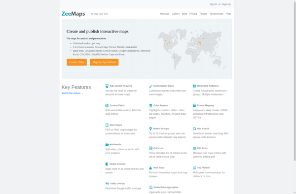
ZeeMaps is an easy-to-use online map creation and sharing application. It allows anyone to create great looking custom maps for free without GIS expertise or design skills.With ZeeMaps, you can add markers, lines, shapes, text notes, images, and videos to your maps to effectively visualize locations, routes, areas and associated...
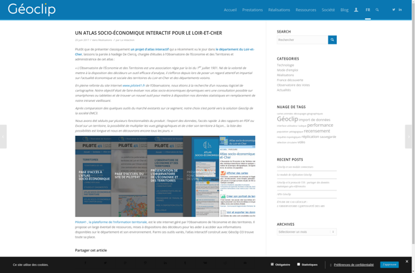
Geoclip is a user-friendly software solution for creating multimedia-enhanced interactive maps, timelines, and virtual tours. Its key features include:Intuitive drag-and-drop interface for adding and arranging locations, descriptions, images, videos, audio clips, hyperlinks, and more onto customizable maps or timelinesVariety of base maps including road, terrain, satellite, and open street mapsOptions...