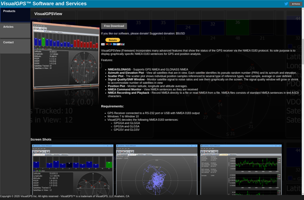
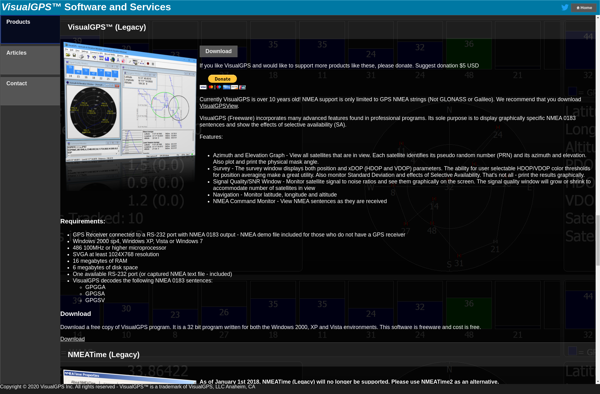
VisualGPSView
VisualGPSView is a free, open source GPS tracking software for Windows. It allows users to record, view and analyze GPS data from external devices. Useful for outdoor activities like hiking, cycling, and geocaching.
VisualGPSView: Free GPS Tracking Software for Windows
Record, view and analyze GPS data from external devices with VisualGPSView, a free and open source software for Windows.
What is VisualGPSView?
VisualGPSView is a free, open source GPS tracking and analysis software for Windows. It enables users to connect to a GPS device, record GPS tracks, and view detailed information such as location, elevation, speed etc. over time.
Some key features of VisualGPSView:
- Supports connecting to most consumer GPS devices and dashcams via USB or Bluetooth
- Logs GPS tracks with additional data like elevation, HDOP, number of satellites etc.
- Allows viewing recorded GPS tracks on interactive maps for analysis
- Generates detailed reports and statistics for tracks and routes
- Exports GPS data to various formats like GPX, KML, CSV etc.
- Useful for outdoor activities like hiking, running, cycling, sailing etc. to record routes and performance
- Ideal for geocaching to pinpoint cache locations accurately
- Free and open source software with no ads or paid versions
Overall, VisualGPSView is a handy GPS tracking utility for Windows users to visualize, record and analyze GPS data for travel, sports or other mapping applications.
VisualGPSView Features
Features
- Records GPS tracks and waypoints from external GPS devices
- Displays GPS tracks, routes and waypoints on maps
- Supports multiple map providers including OpenStreetMap, Bing Maps and MapQuest
- Analyze GPS data like total distance, average speed, elevation gain
- Export GPS data to GPX, KML, CSV and other formats
- User-friendly interface with customizable settings
Pricing
- Free
- Open Source
Pros
Free and open source
Works with most GPS devices
Good map support and customization options
Useful GPS data analysis features
Active development and user community support
Cons
Limited support for real-time tracking
No mobile app version
Steep learning curve for some advanced features
Reviews & Ratings
Login to ReviewThe Best VisualGPSView Alternatives
View all VisualGPSView alternatives with detailed comparison →
Top Travel & Location and Gps & Navigation and other similar apps like VisualGPSView
GPS Test
GPS Test is a popular GPS diagnostics app for Android. It provides a suite of tools for testing, troubleshooting, and analyzing the GPS capabilities of an Android device.Some key features of GPS Test include:Showing detailed technical data about GPS satellites in view, including satellite positions, signal strengths, and status informationRecording...

VisualGPS
VisualGPS is a leading software for visual location intelligence and spatial analytics. It enables organizations to visualize and analyze geographic data on interactive maps, revealing hidden patterns and valuable insights that drive data-confidence and better decision making.With VisualGPS, users can upload and integrate multiple data sources such as sales transactions,...
RTKLIB
RTKLIB is an versatile software package for precise positioning using Global Navigation Satellite Systems (GNSS) such as GPS, GLONASS, Galileo, BeiDou and QZSS. It supports standard point positioning, precise point positioning (PPP), real-time kinematic (RTK) positioning and precise orbit determination.Some key features of RTKLIB include:Supports a wide range of GNSS...