RTKLIB
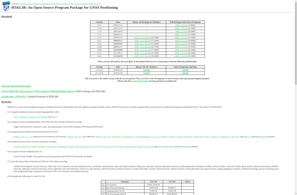
RTKLIB: Open Source GNSS Positioning Softwares
An open source software package for precise positioning using GNSS, supporting various satellite systems for real-time and post-processing applications.
What is RTKLIB?
RTKLIB is an versatile software package for precise positioning using Global Navigation Satellite Systems (GNSS) such as GPS, GLONASS, Galileo, BeiDou and QZSS. It supports standard point positioning, precise point positioning (PPP), real-time kinematic (RTK) positioning and precise orbit determination.
Some key features of RTKLIB include:
- Supports a wide range of GNSS receivers from low-cost single frequency to geodetic dual-frequency receivers
- Can process raw measurement data in a variety of formats
- Implements standard and precise point positioning, PPP, instantaneous RTK and post-processed RTK
- Graphical user interface for configuration and data analysis
- Command line interface for batch processing
- Flexible input and output data formats
- Open source software under BSD 2-clause license
RTKLIB is suitable for applications such as surveying, mapping, precision agriculture, UAVs, and autonomous vehicles where centimeter-level real-time or post-processed positioning is required. With an appropriate GNSS receiver it can achieve 1-2 cm horizontal and 2-5 cm vertical precision.
RTKLIB Features
Features
- Real-time positioning using GPS, GLONASS, Galileo, BeiDou, QZSS and SBAS
- Supports standard and precise positioning
- Can be used for real-time positioning, post-processing, PPP and RTK
- Open source software package
Pricing
- Open Source
Pros
Cons
Official Links
Reviews & Ratings
Login to ReviewThe Best RTKLIB Alternatives
View all RTKLIB alternatives with detailed comparison →
Top Science & Engineering and Geospatial and other similar apps like RTKLIB
GPS Test

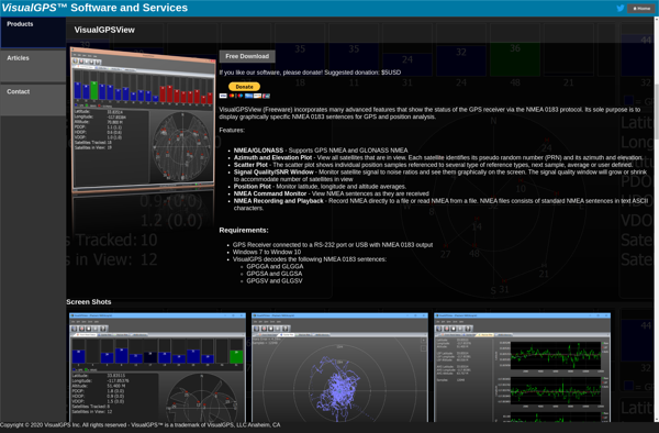
VisualGPS
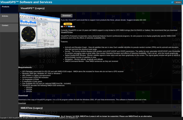
VisualGPSView