MapInfo Professional is a desktop GIS software used to view, edit, analyze, and interpret spatial data. It allows users to create interactive maps, perform spatial analysis, generate reports, and integrate data.
MapInfo Professional: Desktop GIS Software for Spatial Data Analysis
MapInfo Professional is a desktop GIS software used to view, edit, analyze, and interpret spatial data. It allows users to create interactive maps, perform spatial analysis, generate reports, and integrate data.
What is MapInfo Professional?
MapInfo Professional is a desktop geographic information system (GIS) software developed by Pitney Bowes for working with location-based data. It allows users to visualize, analyze, compile, and distribute spatial data.
Key features of MapInfo Professional include:
Interactive mapping - Easily create professional maps with layers, labels, scales, legends etc.
Spatial analysis - Perform proximity analysis, overlay analysis, routing and more to gain insights from spatial data.
Advanced data editing - Digitize, modify or update spatial data tables and geometry.
Visualization - Create thematic maps, heat maps, dot density maps and more for effective visualization.
Spatial reporting - Generate detailed reports with statistics, charts and professional map outputs.
Data integration - Access, combine and map data from Excel, Access, spatial databases and more.
Automation - Automate workflows with MapBasic programming and customization.
Network and web capabilities - Share maps and analysis online or over network.
With an easy-to-use interface and advanced GIS capabilities, MapInfo Professional is used by GIS analysts, urban planners, public works departments, utilities, researchers and more.
MapInfo Professional Features
Features
Desktop GIS software
View, edit, analyze and interpret spatial data
Create interactive maps
Perform spatial analysis
Generate reports
Integrate data from different sources
Pricing
Subscription-Based
Custom Pricing
Pros
Powerful and full-featured GIS capabilities
Intuitive and easy to use interface
Support for many data formats and databases
Advanced geocoding and routing functions
Automation and scripting with MAPBASIC
Cons
Expensive licensing model
Less community support than open source options
Limited web GIS capabilities compared to server-based products
QGIS is a professional open-source Geographic Information System (GIS) software for working with maps and geospatial data. It is licensed under the GNU Public License. QGIS allows you to view, edit, analyze, process, and visualize spatial data in various formats including shapefiles, GeoTIFFs, PostGIS, SpatiaLite, GPX, and more. It supports...
ArcGIS is a robust and comprehensive geographic information system (GIS) software developed by Esri. It provides a range of capabilities for creating, managing, analyzing, and sharing geospatial data and maps across desktop, mobile, web, and enterprise systems.Key features of ArcGIS include:Advanced geospatial analysis tools for proximity analysis, geocoding, routing, terrain...
SAGA GIS (System for Automated Geoscientific Analyses) is a free and open source geographic information system (GIS) software used for editing and analyzing spatial data. It contains a large set of geoscientific analysis functions and utilities for managing vector, raster and table data.Some key features of SAGA GIS include:Support for...
what3words is a geocoding system that has divided the world into 3 meter squares and assigned each square a unique 3 word identifier. For example, the square that contains the front door of 10 Downing Street in London has been assigned the 3 word address ///slurs.this.shark.This system allows people to...
gvSIG Desktop is a free and open source geographic information system (GIS) software designed for capturing, storing, processing, analyzing and disseminating geospatial data. It is developed by the gvSIG Association and released under the GNU General Public License.Some key features of gvSIG Desktop include:Support for viewing and editing vector and...
PostGIS is an open source software program that adds support for geographic objects to the PostgreSQL object-relational database. PostGIS follows the Simple Features for SQL specification from the Open Geospatial Consortium (OGC). This enables PostgreSQL to store, query, and manipulate spatial data efficiently.Key capabilities and features of PostGIS include:Implements spatial...
GRASS GIS (Geographic Resources Analysis Support System) is a free and open source geographic information system (GIS) software suite used for geospatial data management, analysis, graphics and maps production, spatial modeling, and visualization.Some key features of GRASS GIS include:Powerful raster, vector, and geospatial processing tools for analysis and data conversionAbility...
Mapline is an open-source, self-hosted web application that allows users to create custom maps for free. It is an alternative to proprietary services like Google My Maps.Some key features of Mapline include:Ability to add markers, lines, shapes, and text notes to your mapsSupport for multiple layers on a single mapOptions...
Mapserver is an open source geographic data rendering engine written in C. It allows users to publish spatial data and build interactive web mapping applications without the need for desktop GIS software. Mapserver excels at rendering spatial data and creating high-performance interactive maps that can be accessed via web browsers.Some...
Maptitude is a desktop Geographic Information System (GIS) software developed by Caliper Corporation. It provides tools for creating interactive maps, performing spatial analysis, managing geographic data, and generating reports.Key features of Maptitude include:Interactive mapping - Allows users to create professional-quality maps with layers, labels, scale bars, north arrows, etc.Data visualization...
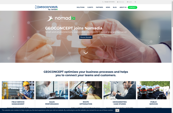
Geoconcept is a desktop geographic information system (GIS) software designed for working with geospatial data and making maps. It provides a wide range of features and tools for creating, editing, analyzing, visualizing, and publishing geographic information.With Geoconcept, users can import, manage, and analyze various types of spatial data including vector...