3d.city is a 3D modeling and visualization platform for architects, urban planners, and designers to model cities and buildings in 3D. It allows users to import maps and satellite imagery to create 3D models of existing or planned buildings and cities.
A platform for architects, urban planners, and designers to create 3D models of cities and buildings, importing maps and satellite imagery for accurate visualization.
What is 3d.city?
3d.city is a cloud-based 3D modeling and visualization platform designed specifically for architects, urban planners, civil engineers, and spatial design professionals to model cities, buildings, and infrastructure projects in rich 3D detail. The software allows users to import 2D CAD drawings, GIS maps, satellite/aerial imagery to create highly accurate 3D models of existing or planned buildings, districts, and even entire cities.
Key features of 3d.city include:
Intuitive 3D modeling tools to quickly create 3D buildings and environments from imported 2D drawings and maps
Massing wizard to easily create multiple variations of building designs
Detailed customization of buildings, landscapes, etc. with custom textures, materials, lighting
Interactive walkthroughs and flyovers to visually evaluate urban plans and designs
Photorealistic rendering to create lifelike visualizations, animations, VR experiences
Seamless collaboration allowing architects, planners, clients to annotate and review 3D models
Integration with popular design software like AutoCAD, Revit, Sketchup, etc.
Cloud-based platform that runs in desktop and mobile browsers
With its focus on urban planning and architecture, 3d.city provides a complete solution for AEC professionals to model and visualize cities and buildings in interactive 3D aligned to real-world coordinates and geography.
3d.city Features
Features
Import 2D maps and satellite imagery
Model buildings and infrastructure in 3D
Customize materials, textures and lighting
Annotate models with text, images and hyperlinks
Generate analytic data like shadows, sightlines and solar access
The SimCity series is one of the most well-known and successful city-building simulation game franchises. First released in 1989, the original SimCity tasked players with developing tracts of land into bustling metropolitan cities, balancing intricate combinations of zoning, infrastructure, taxation, transit, and public services.Gameplay in the SimCity series revolves around...
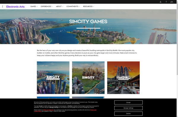
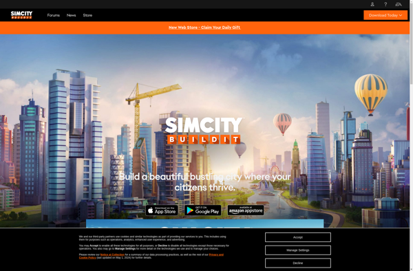
SimCity BuildIt is a mobile city-building game developed by TrackTwenty and published by Electronic Arts in 2014. As the mayor, players are tasked with designing, building, and managing their own custom metropolis.In SimCity BuildIt, players zone residential, commercial, and industrial areas to attract Sim citizens. As the population grows, players...
CityVille is an online social network game developed and published by Zynga in 2010. It is a city-building simulation in which the player takes on the role of mayor to develop a city from scratch. The core gameplay revolves around constructing buildings, producing goods, earning income, and keeping citizens happy.When...
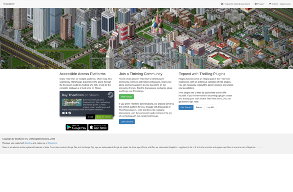
TheoTown is a popular city builder and urban planning simulation game available on Android, iOS, and Windows. In TheoTown, players act as city planners and mayors to design, build, and manage a virtual city of their own.In the open sandbox mode, players start with an empty plot of land to...
OpenCity is a free and open source software for modeling 3D city landscapes and buildings. It provides a user-friendly interface for constructing realistic urban environments suitable for urban planning, architecture, simulations, games, and visualizations.With OpenCity, users can quickly generate complex cityscapes containing buildings, roads, parks, street furniture, vehicles, and people....
Micropolis is an open source city-building and urban planning computer game, originally released in 2008. It is inspired by the popular SimCity game series, allowing players to design, build, and manage a simulated city.In Micropolis, the player takes on the role of a city mayor or planner and must make...
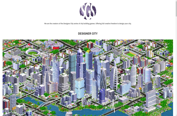
Designer City is a powerful yet easy-to-use 3D modeling and design application that runs directly in the browser. With an intuitive drag-and-drop interface, Designer City makes it simple for architects, urban planners, designers, and hobbyists to construct detailed 3D models of buildings, landscaping, cityscapes, and more.Some key features of Designer...
Bit City is a popular city-building game for mobile devices with retro pixel art graphics. In Bit City, players can build their own virtual city from the ground up. They start with an empty plot of land and slowly build upon it by constructing residential zones, commercial areas, industrial complexes...
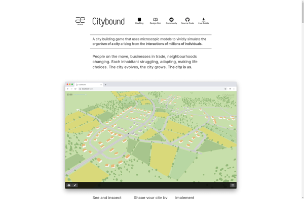
Citybound is an open-source city-building simulation game and city simulator developed by Anselm Eickhoff. The project aims to create an advanced city simulation that focuses on simulating the daily lives and activities of each individual citizen.Unlike traditional top-down city builders, Citybound uses a bottom-up approach where complex urban environments emerge...
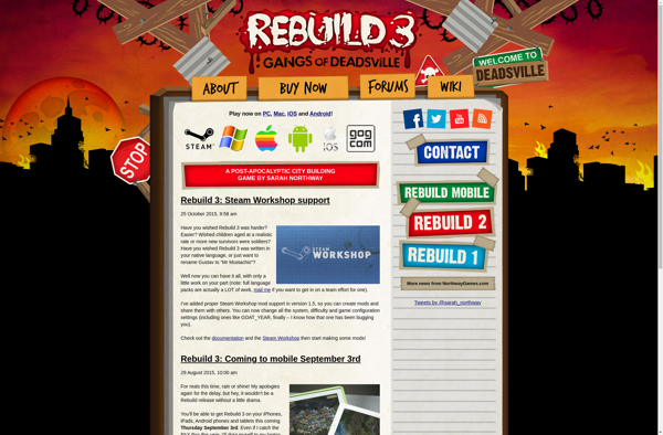
Rebuild is a popular city-building game series created by indie developers Northway Games. The first game in the series, simply titled Rebuild, was released in 2011. In Rebuild, players take on the role of mayor in a post-apocalyptic settlement struggling to recover. Using strategic resource management and urban planning, the...
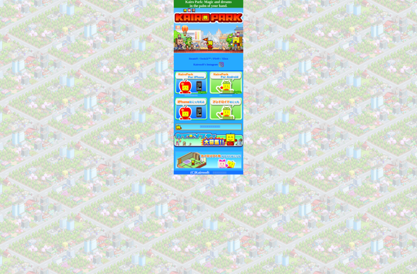
Epic Astro Story is a mobile simulation and management game developed and published by Kairosoft in 2013. In the game, players are tasked with building and managing a colony on an uninhabited alien planet.To start, players must choose which planet to colonize from a selection of planets with different environments...
IBM CityOne is a free-to-play business simulation game developed by IBM that focuses on creating more efficient, sustainable, and livable cities. The game allows players to take on the role of city manager and make decisions that impact areas like energy, water, banking, retail, and transit.In the game, players are...
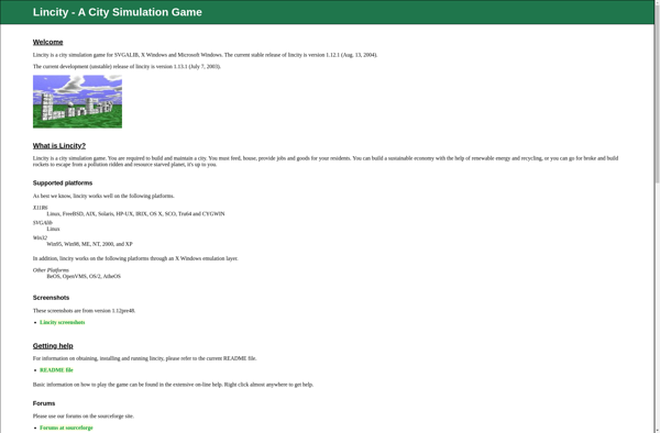
Lincity-NG is an updated version of the classic open source city building game Lincity. As the mayor of a virtual city, the player is responsible for managing essential infrastructure and utilities for the growing municipality.Key gameplay elements involve zoning land for residential, commercial and industrial development; building power plants, public...