KML viewer and converter

KML viewer and converter

KML viewer and converter is a free software that allows you to open, view, and convert KML and KMZ files. It supports previewing KML data on a map and converting to various formats like PDF, PNG, JPG, GeoJSON, CSV, and more.
KML viewer and converter image
kml kmz viewer converter gis mapping geodata

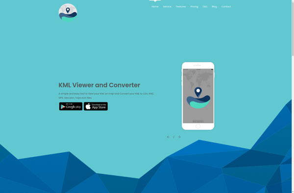
KML Viewer and Converter: Free Software

KML viewer and converter is a free software that allows you to open, view, and convert KML and KMZ files. It supports previewing KML data on a map and converting to various formats like PDF, PNG, JPG, GeoJSON, CSV, and more.

What is KML viewer and converter?

KML viewer and converter is a lightweight desktop application for working with geographic data in Keyhole Markup Language (KML) format. KML is an XML-based format used to display geographic data in applications such as Google Earth.

With the KML viewer and converter, you can easily open and view the contents of KML and compressed KMZ files. It renders KML placemarks, lines, polygons, images and textual descriptions on an interactive map. You can zoom and pan the map to explore the geographic data visually.

In addition to viewing, it also allows converting KML and KMZ files to various other formats. You can export the geographic data to PDF, PNG, JPG, SVG, GeoJSON, CSV, GPX formats while retaining important attributes. This makes it possible to use the data in other mapping and GIS applications that don't support KML.

The tool is completely free to use. It works on Windows, Mac and Linux operating systems. With its user-friendly and intuitive interface, the KML viewer and converter makes working with geographic KML data easy for both personal and professional use.

KML viewer and converter Features

Features

  1. View KML and KMZ files
  2. Preview KML data on integrated map
  3. Convert KML to PDF, PNG, JPG, GeoJSON, CSV
  4. Edit KML data and style
  5. Measure distances on map

Pricing

  • Free
  • Open Source

Pros

Free and open source

Simple and easy to use

Supports many file formats

Integrated map preview

Editing capabilities

Cons

Limited to viewing and converting KML/KMZ files

No advanced analysis or data management features

Basic editing only, no advanced KML authoring

Limited customization options


The Best KML viewer and converter Alternatives

Top File Management and Gis & Mapping and other similar apps like KML viewer and converter

Here are some alternatives to KML viewer and converter:

Suggest an alternative ❐

QGIS icon

QGIS

QGIS is a professional open-source Geographic Information System (GIS) software for working with maps and geospatial data. It is licensed under the GNU Public License. QGIS allows you to view, edit, analyze, process, and visualize spatial data in various formats including shapefiles, GeoTIFFs, PostGIS, SpatiaLite, GPX, and more. It supports...
QGIS image
ArcGIS icon

ArcGIS

ArcGIS is a robust and comprehensive geographic information system (GIS) software developed by Esri. It provides a range of capabilities for creating, managing, analyzing, and sharing geospatial data and maps across desktop, mobile, web, and enterprise systems.Key features of ArcGIS include:Advanced geospatial analysis tools for proximity analysis, geocoding, routing, terrain...
ArcGIS image
SuperGIS icon

SuperGIS

SuperGIS is a comprehensive geographic information system (GIS) software developed by SuperMap. It provides a wide range of capabilities for working with maps and geographic data including:Data Capture and Management - SuperGIS can import, manage and analyze spatial data from various sources. It supports vector, raster, CAD, databases, lidar, BIM...
SuperGIS image
MapWindow GIS icon

MapWindow GIS

MapWindow GIS is a free and open-source geographic information system (GIS) software developed by Idaho State University. It allows users to view, manage, edit, analyze, and visualize spatial data for a wide range of applications. Some key features of MapWindow GIS include:Support for common data formats like shapefiles, rasters, .Net...
MapWindow GIS image
Equator icon

Equator

Equator is a cloud-based digital asset management (DAM) and brand management platform used by global companies to easily manage their digital assets. It enables teams to efficiently organize, distribute, collaborate on, and track usage of brand assets from one central place.Key features of Equator include:Cloud-based storage for all digital assetsPowerful...
Equator image
PostGIS icon

PostGIS

PostGIS is an open source software program that adds support for geographic objects to the PostgreSQL object-relational database. PostGIS follows the Simple Features for SQL specification from the Open Geospatial Consortium (OGC). This enables PostgreSQL to store, query, and manipulate spatial data efficiently.Key capabilities and features of PostGIS include:Implements spatial...
PostGIS image
GeoSheets icon

GeoSheets

GeoSheets is a cloud-based geographic information system (GIS) software designed for creating interactive maps and analyzing spatial data. Some key features of GeoSheets include:Intuitive drag-and-drop interface to import, visualize and edit geospatial data from a variety of sources like Excel, CSVs, databases, APIs etc.Powerful yet easy-to-use tools for geocoding, spatial...
GeoSheets image
Mapline icon

Mapline

Mapline is an open-source, self-hosted web application that allows users to create custom maps for free. It is an alternative to proprietary services like Google My Maps.Some key features of Mapline include:Ability to add markers, lines, shapes, and text notes to your mapsSupport for multiple layers on a single mapOptions...
Mapline image
Geoconcept icon

Geoconcept

Geoconcept is a desktop geographic information system (GIS) software designed for working with geospatial data and making maps. It provides a wide range of features and tools for creating, editing, analyzing, visualizing, and publishing geographic information.With Geoconcept, users can import, manage, and analyze various types of spatial data including vector...
Geoconcept image
TdhGIS icon

TdhGIS

TdhGIS is an open-source geographic information system (GIS) software application developed by Terre des hommes (Tdh), an international NGO focused on humanitarian aid for children. It is designed specifically for public health professionals to map and analyze data to improve programs and policies.Key features of TdhGIS include:Interactive and dynamic mapping...
TdhGIS image
MapViewer icon

MapViewer

MapViewer is a free and open-source geographic information system (GIS) software application used for viewing, editing, and analyzing geospatial data. Developed by the Open Source Geospatial Foundation (OSGeo), MapViewer runs on Windows, macOS and Linux.Key features of MapViewer include:Support for major vector and raster spatial data formats including Shapefiles, GeoTIFF,...
MapViewer image
GeoMedia icon

GeoMedia

GeoMedia is a leading Geographic Information System (GIS) software application developed by Hexagon for working with maps and geographic information. First released in 1991, GeoMedia has over 30 years of development behind it and is used across industries including government, utilities, natural resources, transportation, and defense sectors.GeoMedia enables both GIS...
GeoMedia image