MotionX GPS is a navigation and GPS app for iPhone that provides turn-by-turn driving directions, voice guidance, traffic information, and offline maps. It has a simple interface and offers features like route planning, location sharing, and integration with other MotionX apps.
Turn-by-turn driving directions, voice guidance, traffic info, offline maps & more on your iPhone with MotionX GPS navigation app
What is MotionX GPS?
MotionX GPS is a popular GPS and navigation app developed specifically for the iPhone. It provides turn-by-turn voice guided navigation with rich 3D maps. Key features include:
Turn-by-turn driving and walking directions with voice guidance
Offline maps for navigation without an internet connection
Traffic information along your route and alternate routes to avoid delays
Detailed maps of the US, Canada, Europe, and Australia with business search and points of interest
Route planning with multiple stopovers
Location sharing to let friends and family follow your trip in real-time
Integration with other MotionX apps like MotionX 24/7 for fitness tracking and MotionX Pulse heart rate monitoring
The simple and elegant interface of MotionX GPS makes it easy to quickly get directions or plan a route. It offers both a full-screen map view focused on navigation as well as a small overlay compass view for navigating while using other apps. For iPhone users looking for an offline navigation app that works throughout North America and Europe, MotionX GPS is an excellent choice.
MotionX GPS Features
Features
Turn-by-turn voice guided GPS navigation
Offline maps
Route planning
Location sharing
Traffic information
Integration with other MotionX apps
Pricing
Freemium
Pros
Simple, easy to use interface
Accurate voice guided navigation
Can download maps for offline use
Good integration with other MotionX apps
Cons
Limited customization options
No public transit directions
Requires constant data connection for real-time traffic
May not be as full-featured as other paid navigation apps
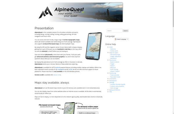
AlpineQuest is a feature-rich mobile app designed specifically for outdoor enthusiasts who enjoy activities like hiking, trail running, mountain biking, and backcountry skiing. It combines detailed topographic maps with GPS tracking and routing capabilities to help users safely plan and navigate routes in mountainous areas.Key features of AlpineQuest include:Detailed topographic...
OruxMaps is a feature-rich Android app designed specifically for outdoor activities like hiking, mountain biking, road cycling, trail running, geocaching, and more. Some key features include:Offline maps - Download detailed topographic, outdoor, cycling, and hiking maps for offline use.Route planning - Plan routes and courses on the map, including waypoints...
GPSies is a free online route planning and GPS track recording tool. It allows users to easily plan routes by entering locations or uploading GPS tracks, view interactive topographic maps and 3D satellite imagery of the route area, analyze elevation profiles of planned routes, measure distances of routes, and share...
TomTom GO Mobile is a free mobile navigation and mapping app developed by TomTom for iOS and Android smartphones. It allows users to navigate by car or on foot using 3D maps that provide detailed street information, landmarks, traffic data, and turn-by-turn directions.Key features of TomTom GO Mobile include:Turn-by-turn voice...
iGO My Way is a popular navigation and mapping application for Android and iOS devices. It provides turn-by-turn voice guided GPS navigation for driving, walking and public transit routes. Some of the key features of iGO My Way include:Offline maps - Maps can be downloaded to your device so navigation...
NAVIGON is a popular navigation and route planning app developed by Garmin for iOS and Android smartphones and tablets. It offers turn-by-turn GPS navigation with voice guidance to help users navigate to their destinations.Key features of NAVIGON include:Detailed maps of North America, Europe, Australia and New Zealand with free lifetime...
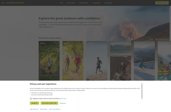
Outdooractive is an online platform and mobile app designed specifically for outdoor enthusiasts looking to discover and plan hiking, biking, ski touring, trail running, and other outdoor activities.Some key features of Outdooractive include:Detailed topographic maps covering popular outdoor destinations around the world, with trail and route overlaysThousands of expert-created route...
VZ Navigator is a GPS navigation software application developed by Verizon Wireless. It is designed to provide turn-by-turn voice guided navigation, real-time traffic information, lane assist prompts, junction view, and speed limit display on compatible Verizon devices.Some key features of VZ Navigator include:Turn-by-turn voice guided navigation for driving, walking and...
MotionX GPS Drive is a feature-rich GPS navigation and tracking app developed specifically for the iPhone. It provides turn-by-turn voice guided navigation to help users navigate to their destination. Some key features include:Real-time traffic alerts to avoid congestionAccurate voice guided navigation with street namesRoute planning with multiple stopoversTracking features to...
AutoMapa is an open source desktop application designed specifically for creating interactive and zoomable maps. It provides a user-friendly graphical interface that allows users to easily import a variety of spatial data sets including shapefiles, geoJSON files, KML files, and more.Once data sets are imported, AutoMapa provides extensive styling and...
GPS voice navigation software is designed to provide turn-by-turn voice guided directions while driving to help drivers navigate to their desired destinations. It works by accessing GPS satellite signals to accurately track the vehicle's location, then using embedded street-level mapping data to calculate optimal routes to the specified destination.As the...