Corgilytics is a data analytics and business intelligence platform designed specifically for corgi owners to understand corgi behavior and trends. It provides easy-to-use tools to track, analyze, and visualize various corgi data points like activity, diet, health, and more.
Corgi analytics platform to track behavior, trends, and data points like activity, diet, health, and more
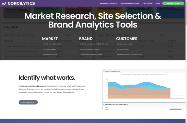
What is Corgilytics?
Corgilytics is a revolutionary data analytics and business intelligence platform built from the ground up to cater to the needs of corgi owners and enthusiasts. As a sophisticated yet easy-to-use tool, Corgilytics empowers corgi owners to better understand and optimize the health, happiness, and wellbeing of their favorite short-legged canine companions.
At the heart of Corgilytics lies a powerful data engine that ingests inputs from various sources - vet records, wearables, user-logged activities and diet details, and more. Advanced AI and machine learning algorithms then process these data points to detect crucial insights and patterns related to your corgi. The insights are then presented through interactive dashboards and visualizations that let you track key metrics over custom time periods.
Key features include:
Activity tracking and benchmarking against other corgis in your area
Automated anomaly and health issue detection
Customizable diet planning and calorie tracking
Comprehensive health profiling and vet visit summaries
Corgi community forums for advice and best practice sharing
With the power of data at your fingertips, Corgilytics provides unparalleled visibility into what makes your corgi tick. The actionable insights help you provide the best care to your furry pal. Sign up for a free trial today and unleash the power of data for your corgi!
QGIS is a professional open-source Geographic Information System (GIS) software for working with maps and geospatial data. It is licensed under the GNU Public License. QGIS allows you to view, edit, analyze, process, and visualize spatial data in various formats including shapefiles, GeoTIFFs, PostGIS, SpatiaLite, GPX, and more. It supports...
ArcGIS is a robust and comprehensive geographic information system (GIS) software developed by Esri. It provides a range of capabilities for creating, managing, analyzing, and sharing geospatial data and maps across desktop, mobile, web, and enterprise systems.Key features of ArcGIS include:Advanced geospatial analysis tools for proximity analysis, geocoding, routing, terrain...
Equator is a cloud-based digital asset management (DAM) and brand management platform used by global companies to easily manage their digital assets. It enables teams to efficiently organize, distribute, collaborate on, and track usage of brand assets from one central place.Key features of Equator include:Cloud-based storage for all digital assetsPowerful...
Magic Maps is an innovative mapping and route planning application designed specifically for outdoor adventurers like hikers, cyclists, and road trippers. It provides advanced features to enhance trip planning and navigation compared to traditional mapping software.One of the key benefits of Magic Maps is its seamless offline functionality. Users can...
GeoSheets is a cloud-based geographic information system (GIS) software designed for creating interactive maps and analyzing spatial data. Some key features of GeoSheets include:Intuitive drag-and-drop interface to import, visualize and edit geospatial data from a variety of sources like Excel, CSVs, databases, APIs etc.Powerful yet easy-to-use tools for geocoding, spatial...
Mapline is an open-source, self-hosted web application that allows users to create custom maps for free. It is an alternative to proprietary services like Google My Maps.Some key features of Mapline include:Ability to add markers, lines, shapes, and text notes to your mapsSupport for multiple layers on a single mapOptions...
Maptitude is a desktop Geographic Information System (GIS) software developed by Caliper Corporation. It provides tools for creating interactive maps, performing spatial analysis, managing geographic data, and generating reports.Key features of Maptitude include:Interactive mapping - Allows users to create professional-quality maps with layers, labels, scale bars, north arrows, etc.Data visualization...
Geoconcept is a desktop geographic information system (GIS) software designed for working with geospatial data and making maps. It provides a wide range of features and tools for creating, editing, analyzing, visualizing, and publishing geographic information.With Geoconcept, users can import, manage, and analyze various types of spatial data including vector...
TdhGIS is an open-source geographic information system (GIS) software application developed by Terre des hommes (Tdh), an international NGO focused on humanitarian aid for children. It is designed specifically for public health professionals to map and analyze data to improve programs and policies.Key features of TdhGIS include:Interactive and dynamic mapping...
Blue Spatial is a powerful geospatial data processing and analytics platform designed to handle large and complex geospatial datasets. It provides a complete suite of tools for working with spatial data including:Data ingestion from a variety of formats and sourcesTools for cleansing, transforming, and enriching geospatial dataInteractive dashboards and geospatial...
MapViewer is a free and open-source geographic information system (GIS) software application used for viewing, editing, and analyzing geospatial data. Developed by the Open Source Geospatial Foundation (OSGeo), MapViewer runs on Windows, macOS and Linux.Key features of MapViewer include:Support for major vector and raster spatial data formats including Shapefiles, GeoTIFF,...